Download
1 / 27
270 likes | 273 Views
This plan outlines strategies to preserve the quality of life in Jefferson County by preserving farmland, protecting valuable natural resources, and guiding growth to areas with available public services. It includes an inventory analysis, policy scenarios, and implementation recommendations.

E N D
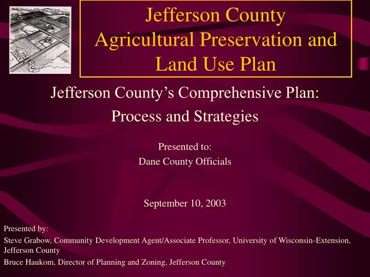
Jefferson County Agricultural Preservation and Land Use Plan Jefferson County’s Comprehensive Plan: Process and Strategies Presented to: Dane County Officials September 10, 2003 Presented by: Steve Grabow, Community Development Agent/Associate Professor, University of Wisconsin-Extension, Jefferson County Bruce Haukom, Director of Planning and Zoning, Jefferson County
Jefferson County Agricultural Preservation and Land Use Plan Framing Question: How can we present a County Plan that will help preserve the quality of life in Jefferson County and respond to the approved goals of: • Preserving farmland and rural character • Protecting areas that have high quality and valuable natural resource characteristics • Guiding higher density growth toward areas where public services will be available While recognizing the importance of fairness toward individual property owners and individual units of government.
Jefferson County Agricultural Preservation and Land Use Plan: Summary of Process and Components • Plan for planning - 11 months with Planning Core group • Steering Committee Work - 27 months with consultant; Approximately 120 meetings • Visioning-survey, Focus Group, Town Hall Workshops • 10 Newsletters • Plan Alternatives/Selection/ Recommendations
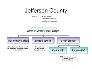
Jefferson County Agricultural Preservation and Land Use Plan Background Inventory & Profile Analysis, Trends & Projections Vision Statements & Alternative Policy Scenarios Jefferson County Agricultural Preservation & Land Use Plan • Adopted goals & objectives • Rural & urban land use policies • Agricultural preservation policies • Plan reconciliation process • Land use plan • Implementation recommendations • Demographics • Environmental resources • Transportation • Community facilities • Historic resources • Economic development • Existing land uses • Growth trends & projections • Issues identification & analysis • Consensus points • Rural policy alternatives • Urban policy alternatives • Environmental corridor policy alternatives • Graphic models
Jefferson County Agricultural Preservation and Land Use Plan: Summary of Process and Components (cont..) Plan Elements: • Agricultural Preservation • Rural Hamlet • Urban Service Area • Environmental Corridor System • Parks, Recreation and Open Space • Other: Transportation Overview, Community Facilities Overview, Site Review Design Guidelines • Implementation
Jefferson County Agricultural Preservation and Land Use Plan: Summary of Process and Components (cont..) County Planning and Zoning Committee/County Board Review • 5 County Board Meetings • Official Info/Public Hearings • Approved Modifications • Failed to Approve Plan as Amended (Plan failed on a 20-8 Vote: October 1998)
Jefferson County Agricultural Preservation and Land Use Plan: Summary of Process and Components (cont..) Plan Reconciliation Phase • Set Aside Less Controversial Plan Components • Focus on Agricultural Preservation Component • Planning and Zoning Committee led a refined process • Use a modified dispute resolution technique with representatives from key interest groups.
Jefferson County Agricultural Preservation and Land Use Plan: Summary of Process and Components (cont.) • Interest groups: • Committee of the Jefferson County Towns Association • Jefferson County Economic Development Corporation • Jefferson County Board of Realtors • Farm Bureau • Environmental Network • Interested County Board members • Plan Approved Unanimously: October 1999 • Revised Zoning Ordinance Approved: February 2000 • Zoning Ordinance in Effect: March 20, 2000
Jefferson County Agricultural Preservation and Land Use Plan: Framing Question: How can we present a County Plan that will help preserve the quality of life in Jefferson County and respond to the approved goals of: • Preserving farmland and rural character • Protecting areas that have high quality and valuable natural resource characteristics • Guiding higher density growth toward areas where public services will be available While recognizing the importance of fairness toward individual property owners and individual units of government.
Key Features in 1978 Agricultural Preservation Plan • Allowed 35 acre splits in the agricultural zone for dwelling • Allowed a rezoning out of the agricultural zone to a rural residential zone; up to 3 lots in non-prime soils
Key Features in 1999 Agricultural Preservation and Land Use Plan • Agricultural Preservation • Environmental Corridors • Urban Service Area • Rural Hamlets
Agricultural Preservation Component • Considered a variety of scenarios for each land use element, including 7 alternatives for agricultural preservation. • A “Right to Farm” statement to recognize changes in agricultural scale and practices • “The Jefferson County Board finds that development in rural areas and changes in agricultural technology, practices, and scale of operation have increasingly tended to create conflicts between agricultural and other uses of land. The County Board believes that to the extent possible, consistent with good land use planning and environmental protection, the County’s land use and zoning regulations should not hamper agricultural production or the use of modern agricultural technology.”
Agricultural Preservation Component cont. • Removes the provision to allow a dwelling on 35 acre parcels in the agricultural zone Impact: Prevents the consumption of large amounts of agricultural land for residential uses • Retains the policy of allowing up to three new rural residential lots in non-prime soils • One or two small rural lots in prime lands are allowed if non-prime lands are not available. Based on parcel size: • less than 50 acres: 1 prime lot • 50 acres or more: 2 prime lots • All rural residential lots would be limited to a 2 acre maximum and clustering is recommended
New Old
Affidavit map describing “parcel of record” that can no longer create rural residential lots
Environmental Corridor Component Environmental Corridors Delineation • Provides additional protection in environmental sensitive areas including: • wetlands • floodplain • upland woods greater than 10 acres • slopes exceeding 20% • Limits development in woodlands more than 10 acres by introducing a density limit of 1 unit per 10 acres, not to exceed the 3 lots maximum provision in the Agricultural Preservation policies.
Environmental Corridor Component Cont. Town of Farmington Land Use Map Impact: Provides additional protection to 18,000 acres out of the County’s 24,000 acres of upland woods
Urban Service Area Component • Encourages the majority of new development in the county to occur in areas that can be served by public sewers. Impact: Directs 70% of total projected growth to Urban Service Areas; agricultural preservation policies are in effect until community services become available
Rural Hamlet Component • Allows for the possibility of limited development potential within 10 designated rural hamlets • A town master plan for the hamlet area must be prepared for approval by the County Planning and Zoning Committee Impact: Enables limited residential growth in rural hamlets on private sewage systems.
New Plan Policies Impact on the Land • 1 to 2 acre maximum lot size for rural residential zoned lots with 3 lot maximum on a “parcel of record”. • Elimination of 35 acre A-1 zoned lots for dwellings. • Agricultural Preservation policies have reduced land consumption for rural dwellings from 1,000 acres/year to 225 acres/year. • Lots in prime ag soils average 50/year and have utilized only 60 acres of prime ag soils. • The small prime ag soil lots have provided fairness to farmers with good ag soils while preserving their land base. • Environmental Corridor density limitation of 1 per 10 acres coupled with a prime ag soil option has reduced pressure on our limited woodlands. • 13,000 acres have been protected from future home lots as a consequence of land owners exercising all their lot options.
Final Thoughts on the Planning Process • Provide adequate number and spacing of informational meetings • Involve representative stakeholders • The longest lasting solutions come from those most closely impacted by the regulations • The pendulum of public opinion most often swings to the middle • Major changes to land use policy might only occur when elected officials feel they need to respond to a majority of constituents who feel an immediate land use crisis
Jefferson County Agricultural Preservation and Land Use Plan