Download
1 / 16
160 likes | 465 Views
Seafloor Features. Unit 3. Common Features of the Seafloor and Coastline. You need to know the definition of each of these terms as well as what they look like…. Abyssal Plain. flat regions of the deep ocean floor among the Earth's flattest and smoothest regions the least explored

E N D
Seafloor Features Unit 3
Common Features of the Seafloor and Coastline You need to know the definition of each of these terms as well as what they look like…
Abyssal Plain • flat regions of the deep ocean floor • among the Earth's flattest and smoothest regions • the least explored • cover approximately 40% of the ocean floor • reach depths between 2,200 and 5,500 m (7,200 and 18,000 ft)
Alluvial Fan • A broad, sloping fan -shaped deposit of sediment at the mouth of a river or at the foot of a submarine canyon or a river canyon. • Often found at ground level where a mountain river meets a flat valley or plain.
Atoll • A ring-shaped coral reef surrounding a lagoon • have low sand islands • rest on submerged volcanic islands
Bank • A navigable shallow area of the ocean caused either by elevation of the seafloor or by submergence of a landmass.
Bay • An inlet of the sea • An indentation in the shoreline • An area of water mostly surrounded or otherwise demarcated by land • generally have calmer waters than the surrounding sea • due to the surrounding land blocking some waves and often reducing winds
Cape • A large point or extension of land jutting into a body of water • may be a peninsula or a hook of land
Channel • A deeper part of a river or harbor that is navigable • sometimes used to name a broad strait • English Channel
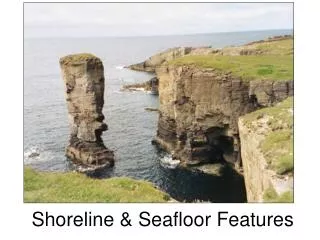
Cliff A very steep or overhanging land feature
Coast • Where land meets the sea • (A strip of land bordering the sea) • affected by marine waves and wind
Continental Shelf • The land forming the shallow seafloor extending outward from the edges of a continent • Submerged part of a continent extending outward 15 km to 50 km to the continental slope
Continental Slope • The sloping front of a continental shelf; the place where the continent ends • long slopes • often 20 to 40 km wide or more • The bottom of the continental slope is the continental rise
Continental Rise The area of the continental shelf between the continental slope and the deep seafloor where sediments from the continent accumulates
Delta • An alluvial deposit at the mouth of a river • A landform that is created at the mouth of a river where that river flows into an ocean, sea or lake • formed from the deposition of the sediment carried by the river as the flow leaves the mouth of the river • Over long periods of time, this deposition builds the characteristic geographic pattern of a river delta
Estuary • A river mouth or channel, or the drowned seaward end of a valley where fresh water from land mixes with seawater • River flow in some estuaries continues across the continental shelf, carving out a submarine canyon.