Download
1 / 18
190 likes | 199 Views
What is Geography?. KCCT Coach: Chapter 12 Amanda McGinnis Campbell Ridge Elementary. Please select a Team. Lucky Leprechauns Fighting Clowns Classy Clowns Perky Penguins Pie Throwers. Uses of Geography. a MAP is a representation on paper of some physical location

E N D
What is Geography? KCCT Coach: Chapter 12 Amanda McGinnis Campbell Ridge Elementary
Please select a Team. • Lucky Leprechauns • Fighting Clowns • Classy Clowns • Perky Penguins • Pie Throwers
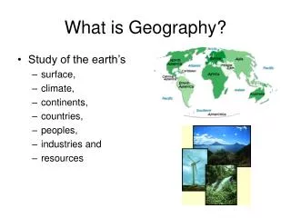
Uses of Geography • a MAP is a representation on paper of some physical location • Can you think locations that may have a map? • a GLOBE is a special kind of map of the world—it is a sphere…an accurate small scale model of Earth
Uses of Geography cont. • Maps and globes are used to identify a LOCATION…the place where something is • Maps and globes are designed to SCALE • To SCALE means that if you shrunk down the world to the exact size of a globe, the locations on the globe would exactly match the locations on Earth
Types of Maps • PHYSICAL MAPS focus on physical features such as rivers, mountains, plains, etc. It is used to identify land masses and waterways
Types of Maps • POLITICAL MAPS identify political borders (countries and states). They are used to identify countries, states, and cities
Types of Maps • THEMATIC MAPS identify locations based on a theme, like “oil producing nations” or They are used to identify locations based on traits.
Other items used to identify location: • CHARTS are a type of outline map. They are used to identify and track a particular characteristic, such as variations in climate (where the regions go over political borders)
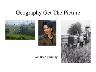
Other items used to identify location: • PHOTOGRAPHS and AERIAL PHOTOGRAPHS (photos from the sky) can also identify location. How would this be used?
Other items used to identify location: • GRAPHS can also give information about location, but they usually do not show what a location looks like. they can show change over time—maps and charts cannot.
Which type of map would you use to locate the Rocky Mountains? • political • physical • thematic • chart
What type of map would identify locations where oil reserves are located? • political • physical • thematic • chart
What is this? • chart • graph • political map • aerial photo
If you wanted to show how the amount of snowfall in your state varies from month to month, which of the following would you create? • chart • graph • physical map • thematic map