Download
1 / 34
340 likes | 348 Views
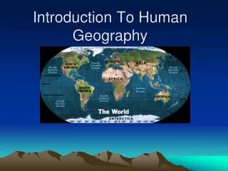
Intro to Human Geography. Evolution of Mapmaking. Babylonians – 2300 BC earliest surviving maps written on clay tablets. Aristotle – 384-322 BC demonstrated earth was spherical through maps.

E N D
Evolution of Mapmaking • Babylonians – 2300 BC earliest surviving maps written on clay tablets. • Aristotle – 384-322 BC demonstrated earth was spherical through maps. • Eratosthenes – 276-194 BC first person to use the word geography. Also the first person to correctly divide earth into 5 climatic regions. • Ptolemy – 100-170 AD Guide to Geography • Age of Exploration – by the 17th century, most continents and oceans were accurately displayed.
Human Geography: Five Themes • Location – the space that is occupied in the universe (absolute/relative). • Place – physical and human characteristics: space after humans. • Human/Environment Interactions – how humans depend, modify, and adapt to their environments. • Movement – how humans interact on earth, the diffusion of religion or trade patterns through connections of peoples. • Regions – an area with one or more shared characteristics.
How to Lie with maps • A map is a generalization or representation of the real world. • Cartography – the science of mapmaking. • Contemporary Mapping – • Remote Sensing Satellites • GIS (geographic information systems) • GPS (global positioning system) • All maps lie flat and all maps lie. They contain distortions. You cannot represent the three-dimensional earth on a flat surface without distorting reality. • Any useful map is selective in what is put in and left out. Example: road or subway map.
Three sources of map distortion • Map scale – most maps are smaller than the reality they represent. Map scales tell us how much smaller. • Map projection – this occurs because you must transform the curved surface of the earth on a flat plane. • Map type – you can display the same information on different types of maps.
All Maps should Have • Cartographer • Title • Scale • Key
Map scale – tells us relationship between distance on map and distance on earth’s surface • Ratio scale = ratio of map distance to earth distance. • 1:10,000 means that one inch on the map equals 10,000 inches earth’s surface; one centimeter represents 10,000 centimeters; or one foot equals 10,000 feet. • Recall a small fraction has a large denominator so that 1:100,000 is a smaller scale than 1:25,000. • A large-scale map depicts a small area with great detail. • A small-scale map depicts a larger area with little detail. Distortion is especially severe here.
Which is the large-scale map? A. B. C. D.
Map scale continued • Verbal scale – translates the representative fraction into words. • One inch represents one mile conveys more meaning than 1:63,630. • Used little in places where people use metric system. People familiar with centimeters and kilometers have little need for verbal scales to tell them that 1:100,000 means that one centimeter equals 1 kilometer or that 1:250,000 means that four centimeter represent one kilometer.
Map projection is the way we fit earth’s three-dimensional surface onto flat paper or a screen
Goode’s projection interrupts the oceans and tucks Australia and New Zealand farther west than in reality. Therefore, land masses appear relatively large compared to the oceans. • Minimized distortion in the shape of the various land masses and the size of one land mass compared to other land masses.
Mercator Projection • Stretches the poles from one length to the size of the equator. The north-south scale is constant, but east-west scale increases to twice the north-south scale at 60 degrees N and infinitely at the poles. • Shapes are correct for all areas, and map has correct directional relationships. • Look at the size of Greenland and Antarctica. • Map exaggerates the distance between Chicago and Stockholm, both in northern latitudes.
Equal Area Projection • Represents areas correctly, but distorts shapes. • If South America is 8 times larger than Greenland on the globe, it will be 8 times bigger on the map.
Robinson Projection • Frequently used. • Distorts both size and shape, but not too much. • The major benefit of the Robinson projection is that oceans are uninterrupted. This projection is useful in depicting patterns of global interaction.
Map Type – you can display the same information on different maps • Types of maps: • Isoline – connects points of equal value • Choropleth – puts features into classes and then maps classes for each region • Cartogram – adjusts the size of the country corresponds to the magnitude of the mapped feature • Proportional symbol – size of the symbol corresponds to the magnitude of the mapped feature • Dot – each dot represents some frequency
Choropleth – puts features into classes and then maps classes for each region
Proportional symbol – size of the symbol corresponds to the magnitude of the mapped feature
Cartogram – adjusts the size of the country corresponds to the magnitude of the mapped feature
Dot – each dot represents some frequency Chart Map
Other Thematic Maps- spatial distribution of one or more specific themes
Other types of visual images: • Mental map = map of an area in your mind
The acquisition of data about Earth’s surface from a satellite orbiting the planet is called remote sensing.
Space/Location • Distribution – the arrangement of a feature in space. Three properties • Density – the frequency with which something occurs. • Concentration – the extent of a feature’s spread over space. Used to describe changes in distribution. • Clustered • Dispersed • Pattern – geometric arrangement of objects in space.
Bottom line: hundreds of decisions are made in the making of a map, including scale, projection, and type. These decision ultimately determine the map’s message.