Download
1 / 24
260 likes | 405 Views
Weather Decision Technologies, Inc. Hydro-Meteorological Decision Support System Bill Conway, Vice President. Weather Decision Technologies.

E N D
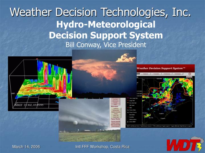
Weather Decision Technologies, Inc. Hydro-Meteorological Decision Support System Bill Conway, Vice President Intl FFF Workshop, Costa Rica
Weather Decision Technologies • Founded in 1999 by scientists from the National Severe Storms Laboratory, the University of Oklahoma, and the Oklahoma Climate Survey, currently have 25 employees • WDT has expertise in data integration, processing, and advanced algorithm design, and operational implementation • Operational Decision Support Systems implemented both in the US and internationally • Technology partners are the US National Severe Storms Lab, McGill University Canada, University of Oklahoma, National Center for Atmospheric Research, TOA Systems (US Precision Lightning Network), Enterprise Electronics Cooperation Intl FFF Workshop, Costa Rica
WDT Weather Decision Support Systems • Nowcast Decision Support System – for producing user-specific short-term warnings and predictions of severe and hazardous weather phenomena. • HydroMet Decision Support System – automated nowcasting (0-3 hrs) of severe weather and flash flooding • Aviation Weather Decision Support System - predictions and forecasts of weather potentially hazardous to aircraft and personnel in air and ground operations • Mesoscale Forecast Decision Support System– custom operational numerical weather prediction solutions Intl FFF Workshop, Costa Rica
Data Integration Radars Nowcasts of Many Weather Phenomena Satellite IR Precipitation Estimates and Predictions Surface Observations HydroMet Decision Support System Lightning Predictions Upper Air Obs HydroMet Products Lightning Intl FFF Workshop, Costa Rica
HDSS Overview • Integrates all available data – radar (single or dual-pol), satellite, model, surface stations, and rain gauges • Performs data quality control and builds 3D mosaics of the data • HDSS Algorithms: • QPE using Quantitative Precipitation Estimation Using Multiple Sensors • QPF using the McGill Algorithm for Precipitation Nowcasting Using Semi-Lagrangian Extrapolation (MAPLE) • Flash Flood Prediction Algorithm • Web browser based display • 3D display workstation Intl FFF Workshop, Costa Rica
Uses for HydroMet Decision Support System • QPE/QPF derived flood prediction on various time scales and domains • Automated flood warning decision support tools for operational forecasters • Customizable Web-based alert and warning dissemination • Initialization fields for hydrological modeling Intl FFF Workshop, Costa Rica
US HDSS Deployments Lower Colorado River Authority Texas NOAA Sea Grant North Carolina Texas/Oklahoma Weather Modification Project Salt River Project Arizona
International HDSS Deployments ARPAV Italy CWB Taiwan TMD Thailand Intl FFF Workshop, Costa Rica
WDT Central Processing Facility in the USA Intl FFF Workshop, Costa Rica
Data Integration Radars Nowcasts of Many Weather Phenomena Satellite Precipitation Estimates and Predictions Surface Observations HydroMet Decision Support System Lightning Predictions Upper Air Obs HydroMet Products Lightning Intl FFF Workshop, Costa Rica
HDSS Functionality • Data quality control and 3D mosaicing • QPE using Quantitative Precipitation Estimation Using Multiple Sensors • QPF using the McGill Algorithm for Precipitation Nowcasting Using Semi-Lagrangian Extrapolation (MAPLE) • Flash Flood Prediction Algorithm Intl FFF Workshop, Costa Rica
Data Quality and Mosaic • Clutter removal • Attenuation correction • Bright band/hail identification • Vertical Profile of Reflectivity correction • Hybrid scanning • Using dual-polarization radars, QC results can be significantly improved • Data from all available radars are mosaicked on a 1x1 (horizontal) km X 500 (vertical) m grid • QPE-SUMS and QPF-MAPLE are derived from the mosaic results Intl FFF Workshop, Costa Rica
Hybrid Scanning Intl FFF Workshop, Costa Rica
Multi-radar mosaic example Intl FFF Workshop, Costa Rica
QPE-SUMS Algorithm • Quantitative Precipitation Estimation and Segregation Using Multiple Sensors • Integrates radar, satellite, gauge, and numerical model data • Can use QPE from polarization derived results (Kdp, Zdr, etc) • Produces QPEs on high resolution grid • Convective/stratiform and frozen/liquid segregation using satellite and model data • Integrates satellite derived rainfall estimates • Differential Z-R equations • Utilizes real-time rain gauge data to remove biases in radar estimates • Produces QPE products for past 72 hrs Intl FFF Workshop, Costa Rica
Example of 3hr Total QPE Intl FFF Workshop, Costa Rica
QPF Based on the McGill Algorithm for Precipitation Forecasting Using Semi-Lagrangian Extrapolation (QPF-MAPLE) • Developed at McGill University, Montreal, Canada by Zawadski and Germann over a period of several years • Provides forecasts of reflectivity out to 8 hours depending on scale and domain Intl FFF Workshop, Costa Rica
Sample MAPLE Forecast Intl FFF Workshop, Costa Rica
HDSS in ItalyExample of a QPF-Maple 3 hr Rainfall Forecast Intl FFF Workshop, Costa Rica
Flash Flood Prediction Algorithm • Uses QPE-SUMs output to automatically identify basins that are approaching or exceeding Flash Flood Guidance (FFG), out to 72 hrs • Uses output from QPF-Maple, added to QPE-SUMS, to determine what basins will approach or exceed FFG in the next 3 hours Intl FFF Workshop, Costa Rica
Basin Delineation Example with Rainfall Amounts Intl FFF Workshop, Costa Rica
Italy: Basins with Warnings Intl FFF Workshop, Costa Rica
FFG View and Edit Pages Intl FFF Workshop, Costa Rica
Conclusions • HDSS is a robust system well suited to operational hydromet applications • HDSS is installed at several locations both in the US and internationally • HDSS integrates and processes radar, satellite, model, and surface data • HDSS includes data quality control, radar mosaics, QPE, QPF, and flash flood forecasting • HDSS can be adapted to any location worldwide • HDSS can be run with single or dual-pol radars • Future work includes: • Integration of numerical model data within QPF-MAPLE • Integrate inundation mapping capability • Ongoing performance verification studies in Italy and the US Intl FFF Workshop, Costa Rica