Download
1 / 41
440 likes | 599 Views
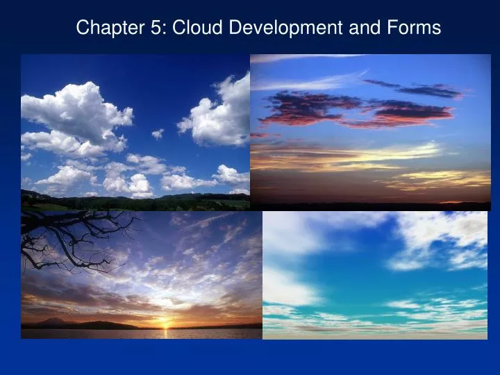
Chapter 5: Cloud Development and Forms. Introduction. Clouds are instrumental to the Earth’s energy and moisture balances Most clouds form as air parcels are lifted and cooled to saturation Lowering temperature to dew point cloud formation. Lifting Mechanisms (initial uplift push).

E N D
Introduction • Clouds are instrumental to the Earth’s energy and moisture balances • Most clouds form as air parcels are lifted and cooled to saturation • Lowering temperature to dew point cloud formation
Lifting Mechanisms (initial uplift push) • Orographic Lifting • Frontal Lifting • Convergence • Localized Convection
Orographic Uplift • results when air is displaced upward over topographic barriers • such as mountains • leads to adiabatic cooling (expansion)on windward slope, may • reach saturation • leeward slope – adiabatic warming (compression), rain shadow • e.g. Sierra Nevada and Death Valley
Frontal Lifting • occurs in transitional areas where large temperatures changes occur • over relatively short distances • when air masses of unlike temperatures (fronts) meet warmer • air is forced upward • results in adiabatic cooling and cloud formation • Cold fronts – warm air is displaced by cold air • Warm fronts – warm air rises over cold air Cold front Warm front
Convergence • atmospheric mass is not uniformly distributed over Earth • large-scale atmospheric circulation results from these • pressure differences (Aleutian Low, Hawaiian High) • air advects from areas of • HP to areas of LP • leads to convergence, air • rises adiabatic cooling
Localized Convection • localized surface heating may lead to free convection • heated air is less dense rises cools adiabatically • clouds form and precipitation may occur • limited in spatial extent
Cloud Types • liquid droplets, ice crystals or both • original scheme (1803): • cirrus – thin, wispy clouds of ice. • stratus – layered clouds. • cumulus – clouds having vertical development. • nimbus – rain-producing clouds. • create classification scheme based on height and form: • high clouds – cirrus, cirrostratus, cirrocumulus • middle clouds – altostratus, altocumulus • low clouds – stratus, stratocumulus, nimbostratus • extensive vertical development – cumulus, cumulonimbus
High Clouds • Bases above 6000 m, composed of ice • Cirrus - most common, wispy appearance due to low water content and • cold temperatures • Fall streaks – falling ice crystals • Cirrostratus – result from thickening cirrus and stretch across the sky • Cirrocumulus – puffy, billowy clouds associated with wind shear. Cirrus Cirrus with fall streaks
Middle Clouds • bases between 2000 and 6000 m • largely composed of liquid drops • carry the “alto” prefix • Altostratus – thick enough to obscure the sun/ moon, blanket the sky • Altocumulus – a series of puffy clouds arranged in rows. Altocumulus
Low Clouds • below 2000 m (6,000 ft), 500-1000 m thick, extensive coverage • normally composed of liquid water • stratus – result from lifting of extensive area of stable air • nimbostratus – produce light precipitation • Stratocumulus – low, layered clouds with some vertical development stratus stratocumulus
Clouds with Vertical Development • High vertical velocities in air that is unstable or conditionally unstable cumulus --- Cumulus humilis, or fair weather cumulus • develop primarily from localized convection • evaporate shortly after formation, vertically limited
Formation of fair weather cumulus Cumulus humilis
Clouds with Vertical Development --- Cumulus congestus • greater development, cloud towers appear • towers are indicative of uplift cells Cumulus congestus
Clouds with Vertical Development --- Cumulonimbus • Most violent of all clouds = thunderstorms • Indicate unstable conditions • may extend through the troposphere • Anvil tops develop Cumulonimbus
Unusual Clouds • Lenticular clouds - form downwind of mountain ranges, • Condensation on windward slope, evaporation on leeward slope • Nacreous clouds – found in stratosphere,super-cooled water or ice, mother of pearl clouds • Noctilucent clouds – found in mesosphere, typically illuminated after sunset
Cloud Coverage • When clouds comprise more than 9/10th of the sky = overcast • When coverage is between 6/10th and 9/10th = broken • When coverage is between 1/10th and 6/10th = scattered • Cloud coverage less than 1/10th = clear
Chapter 6: Precipitation Processes: Why does it rain on us???
Introduction • Not all clouds precipitate due to the small size and slow fall rates of average cloud drops • Rapid cloud drop growth rates are required for precipitation to form
Growth of Cloud Droplets • Gravity and frictional drag balance to achieve terminal velocity • terminal velocities for cloud drops, due to their small size, cannot • exceed even weak updrafts • volume of cloud drop must be 1,000,000 times greater than average drop to overcome updrafts
1. Growth by Condensation • Initially condensation occurs around condensation nuclei – forms most cloud drops. • Growth limited to a radii of ~ 20 μm due to limited amount of water vapor available for condensation. Also with so many droplets competing for a limited amount of water, none can grow very large. • Insufficient volume to overcome updraft and generate precipitation
2. Growth in Warm Clouds • Clouds with temperatures >0oC dominate tropics and • mid-latitudes during the warm season • Collision-coalescence generates precipitation • Process begins with large collector drops (i.e. the • largest droplet) which have high terminal velocities
Collision • Collector drops collide with smaller drops • compressed air beneath falling drop forces small drops aside • collector drops ‘capture’ fairly large cloud drops
Coalescence • When collisions occur, drops either bounce apart or coalesce into one larger drop • Coalescence efficiency is very high indicating that most collisions result in coalescence
3. Growth in Cool and Cold Clouds • Cool and cool clouds: T < 0oC • Clouds may be composed of: liquid water, super-cooled water, and/or ice • If ice nuclei are present, condensation leads to ice; if ice nuclei is absent, • condensation leads to liquid water, i.e., super-cooled water. • Coexistence of ice and super-cooled water is critical to the creation of cool • cloud precipitation - the Bergeron Process
Bergeron Process • The Bergeron process relies on the fact that the saturation vapor pressure with respect to ice is less than the saturation vapor pressure with respect to water. RH = vapor / saturated vapor differences in saturation vapor pressures of water
From the perspective of the supercooled droplets, the air is in equilibrium at saturation, but from the perspective of the ice crystals, the air is supersaturated. Therefore, water vapor will sublimate on the ice crystals. • Since the amount of water vapor in the air has decreased, and from the perspective of the supercooled water droplet, the air is subsaturated, the supercooled water will evaporate until the air once again reaches saturation.
Bergeron Process • When ice and water are present, water will be deposited directly onto ice • Ice crystals grow rapidly at the expense of super-cooled drops • Collisions between falling crystals and drops causes growth through riming and aggregation
Riming = liquid water freezes onto ice crystals producing rapid growth when ice crystals fall through a cloud and collide with super-cooled droplets. • Aggregation = the joining of two ice crystals to form a single, large one. • Collision combined with riming and aggregation allow formation of precipitation within 1/2 hour of initial formation
Forms of Precipitation • Snow results from the Bergeron process, riming, and aggregation • Snowflakes variable shapes/sizes Dendrite ice crystals Plate ice crystal
distribution related to north-south alignment of mountain ranges and • Great Lakes • convergence leads to uplift, adiabatic cooling and snowfall => Orographic uplift. • Lake effect snows develop on leeside of water bodies, e.g. Great Lakes
Lake effect snows develop on leeside of water bodies, e.g. Great Lakes • As cold air from the north or northwest flows over the lake, heat and water vapor are transferred upward and make air moist and unstable. As the air passes over the shore, the wind slow down due to large friction => convergence = > air rising => clouds = > heavy snows. (a) an initial mechanism for uplift (b) unstable air (c ) sufficient moisture.
Rain: always associated with warm clouds and sometimes cool clouds (T > 0oC) • Rain showers – episodic precipitation events associated with convective activity and cumulus clouds • Drops tend to be large and widely spaced to begin, then smaller drops become more prolific => larger raindrops have a faster terminal velocity.
Graupel – ice crystals that undergo extensive riming • Lose six sided shape and smooth out • Either falls to the ground or provides a nucleus for hail
Hail – consists of ice pellets formed in roughly concentric layers. - Initially, an updraft carries a graupel pellet or water droplet or water Droplet above the freezing level to form the core of a hailstone. - When the cores falls, it collides with water liquid droplet that coat it with a film of liquid water. - The updraft carries the pellet aloft, and the liquid water freezes to form a second layer of ice. - Process repeats, and finally hailstones are very heavy, and updraft can not resist it.
Hailstones are very heavy – high density • Capable of tremendous amounts of damage • Great Plains = highest frequency of hail events
Sleet begins as ice crystals which melt into rain through a mid-level inversion refreeze near surface . • Freezing Rain forms similarly to sleet, however, the drop does not completely solidify before striking the surface Sleet formation involves a mid-level inversion