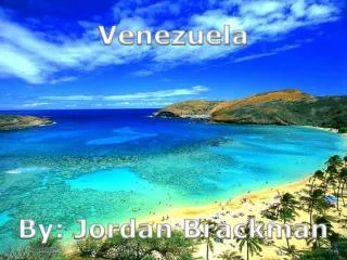
Download
1 / 18
190 likes | 323 Views
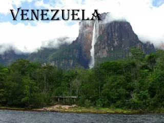
Venezuela . Amber Bishop. Location. Is located in the northern coast of South America. Latitude and Longitude: 8 degrees north and 66 degrees west. Climate. There is many variations in the climate.

E N D
Venezuela Amber Bishop
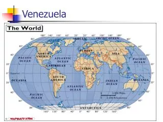
Location • Is located in the northern coast of South America. • Latitude and Longitude: 8 degrees north and 66 degrees west.
Climate • There is many variations in the climate. • The climate ranges from alpine to tropical humid even though the country is located completely within the tropical temperate zone. • The rainy season is from May to October. • The dry season is from December to April. • There is 4 different temperate zones.
Climate • Tropical Zone: the average temperature ranges from 26 and 28 degrees Celsius. (78.8 degrees - 82.4 degrees F.) • Climatic Zone: is also known as the temperate zone. The average temperatures range from 12-25 degrees Celsius ( 53.6 degrees - 77 degrees F). Most of the cities lie in this zone. • Altitudes: The climate is colder ranging from 9-11 degrees Celsius ( 48.2- 51.8 degrees F) • The high mountainous area- where snowfields and grasslands are found. The temperature here falls below 8 degrees Celsius. ( 46.4 degrees F)
Cultures • 70% of the population are Mestizo. • 20% of the population are unmixed whites, mostly of Spanish, Italian, Portuguese, and German descent. • 5% of the population is indigenous.
Transportation • The people in Venezuela travel just like most people do. • They travel by cars, trains, buses and taxi. • The most common transportation in Venezuela is by traveling by road. • You can also travel by air and by trains.
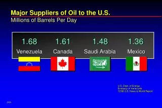
Movement of goods • Exports: aluminum, bauxite, steel, chemicals, agricultural products. • Main exporters: United States, The Netherlands, and China. • Imports: machinery equipment, construction materials, and other raw materials to support domestic industries and to increase exports. • Main importers: United States, Colombia, Brazil, China, and Mexico.
Environmental Problems • The most common problems are mining, water pollution, oil drilling, gas exploration, wood logging, and soil erosion. • The two common problems currently are water pollution and waste treatment. • The reason why there is water pollution is because they don’t save the clean water that they have and they use more than what they need per person on a daily basis. • The problem with the waste treatment is that there are only ten waste treatment plants in the whole country. • Waste is then being dumped on open land.
Environment affecting Humans • Just like many other countries in South America, Venezuela gets earthquakes. • Venezuela has other problems besides the earthquakes. • They have the problems of having periodic droughts, mudslides, floods, and rock slides.
Regions • A few regions of Venezuela are the Caracas region, the Andes and the Urban Belt. • The Andes: Runs through Venezuela from the Colombian border in a northeasterly direction through the states of Mérida, Táchira, and the Trujillo. This is a prime area for hiking, trekking, and wide range of adventure sports. • Caracas- is said to be a overcrowded, inhospitable, famously violent city. Is surrounded by high mountains and hillsides. Is one of the more cosmopolitan and architecturally cities in Latin America.
Regions • The Urban Belt: From Maracaibo in the west of Cumaná to Maturin in the east is a belt of urban development. Much of the development is based on major petroleum , mining, and agricultural centers.