Download
1 / 13
130 likes | 312 Views
Coast Guard Research & Development Center Multi-Sensor Performance Prediction (MSPP) Tool-Set. Kim Babcock U.S. Coast Guard R&D Center. What is MSPP ?. Coast Guard analyst software tool to estimate sensor performance Validated User-Friendly Well-Documented

E N D
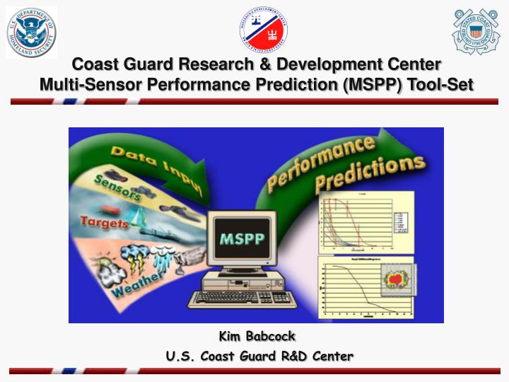
Coast Guard Research & Development Center Multi-Sensor Performance Prediction (MSPP) Tool-Set Kim Babcock U.S. Coast Guard R&D Center
What is MSPP? Coast Guard analyst software tool to estimate sensor performance • Validated • User-Friendly • Well-Documented Fills the shortfall for data that cannot be obtained from field tests
Sweep Widths • Lateral Range Curves • Instantaneous Probability of Detection Plots - Radial - Azimuthal • Target • Environment - Weather - Location - Date/Time • Platform • Sensor • Mode RADAR SENSORS AREPS Detection (Advanced Refractive Effects Prediction System - SPAWAR) NIGHT VISION & INFRARED SENSORS TAWS (Target Acquisition Weapons Software - AFRL) Detection Classification Evaluation What is MSPP? (Cont’d) Inputs Engine: DoD Models Outputs THE BETTER THE INPUT, THE BETTER THE OUTPUT!
MSPP User Input Options PLATFORMS Air– CG helicopters & fixed wing aircraft Surface – CG patrol boats, medium & high endurance cutters SENSORS (multiple modes per sensor are available) RADAR – SPS/73, APS-127, APS-137, APS-143, SINS 1933C INFRARED – Wescam DSi, Milcam XP+, CASPER-IR, MARFLIR-IR NIGHT VISION – PVS-5, 7, 7C, 14 PRE-DEFINED ENVIRONMENTS CG District 1 (good, average, poor) CG District 7 (good, average, poor) Cape Cod (7am or 7pm local in Feb, May, Aug, Nov) Key West (7am or 7pm local in Feb, May, Aug, Nov) ** users can create and/or edit platforms, sensors & environments **
Current MSPP Targets 35’ Sailboat with & without Radar Reflector PIW with & without Lifejacket 24’ Speedboat with & without Wake 6-Person Raft with & without Radar Reflector and with & without 2 People 71’ and 90’ Steel Hull Fishing Vessels Naval Gunboat 63’ Wood Hull Fishing Vessel
MSPP Targets in Development 31’ Cabin Cruiser 22’ Day Sailer Improved PIW with flotation device
Latest MSPP Version (3) • Analyst Plus (A+) Tool Set Features: • Editable Environments • Expanded CG Sensor Library • Expanded Target Set • New Classification and Evaluation Prediction Modes (in addition to Detection) • New Batch Processing Mode • Significantly Reduced Run Times
Platform: Air (altitude: 500ft) Sensor: OldIR and NewIR Target: 6-Person Raft with 2 People Environment: Cape Cod August, 11pm local time MSPP Sample Output Radial Plots of Instantaneous Probability of Detection These results indicate that in both NFOV and WFOV, OldIR provides moderately better detection results than NewIR.
MSPP Sample Output Platform: Air (altitude: 500ft) Sensor: OldIR and NewIR Target: 6-Person Raft with 2 People Environment: Cape Cod August, 11pm local time Azimuthal Plots of Instantaneous Probability of Detection (POD) NewIR OldIR Wide FOV Wide FOV These azimuthal plots use color to POD at increasing ranges from the center where the sensor is positioned. As in the previous slide, these results indicate that in both NFOV and WFOV, OldIR provides moderately better detection results than NewIR. 100 50 Narrow FOV Narrow FOV 0 POD Key
FY05 MSPP Tasks • Modify MSPP for unrestricted operation • implement the same approach used by TAWS • Incorporate radar wind-dependent sea clutter model (AREPS) • Investigate requirements to interface/integrate MSPP with mapping software such as ESRI’s Arc View • Add graphical output to batch mode (currently tabular)
MSPP Wish List • Validation of method used to estimate minimum detectable temperature (MDT) data for IR predictions • Expansion of MSPP Prediction Capabilities • Addition of CCD TV model (planned FY06) • Visibility impact on IR/NVG predictions (planned FY06) • Account for target height in IR/NVG max range predictions • Modeling of retro reflective effects for NVG • Modeling of unaided visual detection • Effects of radar scan-to-scan integration
Questions? Kim Babcock MSPP Project Manager USCG R&D Center (860) 441-2719 kbabcock@rdc.uscg.mil Gary Hover Sensor Program Manager USCG R&D Center (860) 441-2818 ghover@rdc.uscg.mil