Download
1 / 18
180 likes | 552 Views
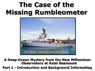
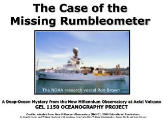
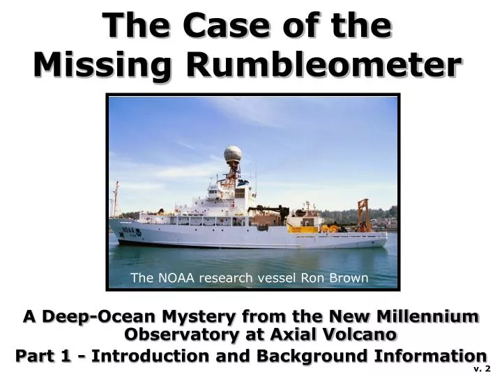
The Case of the Missing Rumbleometer. A Deep-Ocean Mystery from the New Millennium Observatory at Axial Volcano Part 1 - Introduction and Background Information. The NOAA research vessel Ron Brown. v. 2. A Mystery to Solve.

E N D
The Case of the Missing Rumbleometer A Deep-Ocean Mystery from the New Millennium Observatory at Axial Volcano Part 1 - Introduction and Background Information The NOAA research vessel Ron Brown v. 2
A Mystery to Solve Oblique view of the seafloor around Axial Volcano (white area near the center). In this computer generated image blue areas are deep and white are shallow. Several months ago, thousands of small earthquakes were detected at Axial Seamount, an active submarine volcano. This may mean that an eruption has occurred, but not necessarily. Your mission is to go to Axial Volcano and find out what happened there.
The Missing Rumbleometer Fortunately, a seafloor monitoring instrument, called a “rumbleometer” was already at Axial Volcano during the earthquakes and will provide important clues. But another ship was just out at the site and was not able to recover the rumbleometer. They could communicate with it on the bottom, so they know it is still on the seafloor, but they could not make it release and return to the surface. Why didn’t it return? Is it stuck on the bottom somehow? We really want to get the rumbleometer back because it likely recorded information on what the volcano was doing and will help us understand what happened during the earthquakes. We know where the rumbleometer is on the bottom, but you need to go out to Axial and find out why the rumbleometer did not come up. Then you need to recover it and look at the data it recorded to figure out what happened at Axial during the earthquakes. A research ship with a remotely operated vehicle are standing by ...
Glossary Acoustic: Pertaining to sound. Bathymetric map: A chart of ocean floor depths, similar to topographic maps on land. Caldera: A depression formed at the summit of a volcano caused by collapse when magma is removed from below. Chemosynthesis: The process by which microbes mediate chemical reactions to produce energy. This is in contrast to photosynthesis, because chemosynthesis does not require sunlight. Contour profile: A cross-section of topography along a given line. Degree: A unit of angular distance. There are 360 degrees in a circle (as on a compass). Deposit feeder: Animals that consume small pieces of plant and animal material that settle to the ocean floor from the water column. Epicenter: The point on the Earth's surface from which earthquake waves seem to radiate, located directly above the true center of the earthquake at depth. Earthquake swarm: A sequence of many small earthquakes (10’s to 1000’s), all of similar size (less than magnitude 4) and within a relatively short period of time (hours to weeks). Earthquake swarms are often recorded during volcanic activity. Hydrophone: An instrument used to record sound under water. Hydrothermal vent: A hot spring on the seafloor. Latitude: Angular distance on the Earth’s surface measured north or south of the equator. Lava: Molten rock after it has erupted from a volcano onto the Earth’s surface. Longitude: Angular distance on the surface of the Earth measured east or west from the prime meridian at Greenwich, England.
Magma: Molten rock that is underground, before it has erupted onto the Earth’s surface. Microbes: Single-celled living organisms, such as bacteria and archaea. Mid-ocean ridge: A type of tectonic plate boundary where two tectonic plates are moving apart (also called a “spreading center”). Volcanic activity creates a ridge along the boundary. Minute of latitude or longitude: A unit of angular distance that is 1/60 of a degree. Observatory: A site for long-term scientific observations. ROPOS: The name of the remotely operated vehicle usually used at NeMO. ROPOS stands for “Remotely Operated Platform for Ocean Science”. Rumbleometer: (pronounced rum-ble-om’-i-ter) A seafloor instrument that measures temperature and pressure (among other things) to help monitor submarine volcanoes. Seamount: An undersea mountain rising over 1000 meters above the surrounding seafloor. Seismometer: An instrument that detects ground movement from earthquakes. Sessile: Refers to marine animals that are permanently attached at the base; fixed in one place and unable to move around. Spreading center: See Mid-ocean ridge Subduction zone: A type of tectonic plate boundary where two tectonic plates are converging (moving toward each other) and one plate is forced under the other. Sulfide chimney: Formations made of sulfide minerals deposited directly from hydrothermal vent fluid at high-temperature seafloor hot springs. Symbiotic: The relationship of different organisms in a close association that is mutually beneficial. Many vent animals have symbiotic relationships with chemosynthetic microbes. Tectonic plates: Large intact pieces of the Earth’s outer rocky layer that move in relation to one another. Most of the Earth’s earthquakes and volcanoes are located near tectonic plate boundaries. Transform fault: A type of tectonic plate boundary where one plate slides past another. Triangulation: Method of finding a position with distances or angles from known points.
Before you go out to Axial Volcano to investigate what caused the earthquakes, you need a little background information. Fortunately, a multi-year seafloor observatory called NeMO was recently started at Axial Volcano. NeMO stands for “New Millennium Observatory”. Part 1Introduction and Background Information Cartoon of the NeMO Observatory at Axial Volcano with its summit caldera.
Axial Volcano Axial Volcano was chosen for the NeMO Project because it is very active. Axial Volcano rises 1000 meters above the surrounding seafloor and yet is still 1400 meters below sea level. A large volcanic crater or “caldera”, which is 3-km wide, 8-km long, and 100-meters deep marks its summit. Oblique view of the seafloor around Axial Volcano, showing the summit caldera (center). In this computer generated image purple is deep and orange is shallow.
Axial Volcano is located on the Juan de Fuca Ridge, a prominent feature on the seafloor of the northeast Pacific Ocean, about 300 miles offshore of Oregon and Washington. Juan de Fuca Ridge Map of the northeast Pacific Ocean.
Mid-ocean Ridges Cross-section of a mid-ocean ridge. The Juan de Fuca Ridge is an example of a mid-ocean ridge, a place where two of the Earth's tectonic plates are slowly moving apart from each other. Along the plate boundary, molten rock or “magma” rises up from deep in the earth and creates new ocean floor. This is why Axial is such an active volcano. The mid-ocean ridge system circles the entire Earth, somewhat like the seams of a baseball. Most of the volcanic eruptions on Earth occur on the mid-ocean ridge. Map of the world showing tectonic plate boundaries (yellow lines).
Plate Tectonics The outer part of the Earth is covered with rigid tectonic plates that slowly move around over the partially molten interior. There are three different ways that tectonic plates can interact. One way is spreading apart at the mid-ocean ridges. A second way is moving toward each other, which often forces one plate under the other, in a process called subduction. A third type of interaction occurs when one plate slides past another along a transform fault. Cross-section through the Earth showing two kinds of plate boundaries: a mid-ocean ridge and a subduction zone.
Hydrothermal Vents Cross-section of a mid-ocean ridge. A ship searching for hydrothermal plumes. Where submarine volcanoes bring magma near the seafloor or erupt lava, seafloor hot springs called hydrothermal vents are common. The hot spring water can be up to 350 degrees Celsius (660 degrees Fahrenheit) and is rich in dissolved chemicals. Hot spring water rises and forms a plume above the vent, somewhat like smoke rising from the chimney of a house into the air. These plumes can be detected by oceanographic instruments in order to help find hydrothermal vents on the bottom.
Black smokers At high-temperature hydrothermal vents, called black smokers, chimneys form which are made of sulfide minerals deposited directly from the vent fluid. The vent fluid looks like smoke because tiny mineral grains form when the hot vent fluid mixes with cold seawater. A seafloor hot spring called a black smoker. A movie of this vent is included in Part 3 of the NeMO Curriculum.
Chemosynthesis The chemicals in seafloor hot springs would be toxic to most forms of life familiar to us, but amazingly a unique ecosystem has evolved to live at hydrothermal vents. These organisms are not dependent on sunlight and photosynthesis, but instead rely on chemosynthesis, a process in which certain microbes use chemicals in the vent water to produce energy. They in turn form the base for an entire food chain of animals. Chemosynthetic microbes grow on and below the seafloor and even within other animals at the vents. Photosynthetic vs. Chemosynthetic food chains. Microscopic views of chemosynthetic microbes.
Tubeworms A tubeworm colony with a crab nearby. Close-up view of tubeworms at a vent. A movie of these tubeworms is included in Part 3 of the NeMO Curriculum. Tubeworms are one of the most common and distinctive animals found at hydrothermal vents. Tubeworms are attached to the bottom, but have no mouth or gut. Instead, they have symbiotic microbes living inside them. Tubeworms live in colonies consisting of hundreds to many thousands of individuals with many other smaller vent species living among them.
The ROPOS Vehicle You will be going on an expedition to Axial Volcano on the NOAA Ship Ron Brown, an oceanographic research vessel. To reach the seafloor nearly a mile below the surface, you must use an unmanned submersible called ROPOS which is lowered on a fiber-optic cable and controlled from the ship. ROPOS is capable of performing a variety of scientific tasks. The ROPOS remotely operated vehicle (ROV). ROPOS pilots at the control console.
What happened to the Rumbleometer? In the classroom activities in Part 2, your goal is to find out what happened at Axial during the recent earthquakes. Also, you need to figure out why the Rumbleometer instrument is stuck on the bottom. What happened to it? If you get it back, the data it recorded will help you interpret what happened at Axial volcano during these mysterious earthquakes. The Rumbleometer instrument on deck before it was lowered to the seafloor.
Get Ready to Set Sail Now you are ready to go to sea to try and discover what happened out at Axial Volcano. You are ready for Part 2. The Ron Brown is waiting at the dock…… The NOAA ship Ron Brown at the dock.
This is Part 1 of 4 of the NeMO Curriculum, which is available at http://www.pmel.noaa.gov/vents/nemo/education.html The NeMO Curriculum was funded byThe National Science Foundation Geoscience Education Program With additional support from the NOAA Vents Program and Oregon SeaGrant Written by Ronald Crouse and William Chadwick with assistance from Vicki Osis, William Hanshumaker, Teresa Atwill, and Jean Marcus