Download
1 / 33
330 likes | 471 Views
Call 1-408-792-6300 Enter access code: 576 562 592# Enter attendee id: 3#. For audio. Arc Hydro GroundWater. Data Model and Tools. Company Background. Software development Training Consulting. Arc Hydro GW Background.

E N D
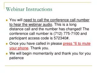
Call 1-408-792-6300Enter access code: 576 562 592#Enter attendee id: 3# For audio
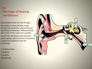
Arc Hydro GroundWater Data Model and Tools
Company Background • Software development • Training • Consulting
Arc Hydro GW Background Extension to Arc Hydro, originally published in 2002 by David Maidment and ESRI Press Data model and tools are developed by Aquaveo in partnership with ESRI
Upcoming Book Published by ESRI Press Due late summer or early fall 2010
Arc Hydro Groundwater Tools
Groundwater Analyst Wells Time Series Import Data
Subsurface Analyst Borehole management Borehole visualization Cross-sections GeoVolumes
MODFLOW Analyst • Import MODFLOW simulations • Visualization • Post-processing • Build models
Arc Hydro Groundwater Data model
Framework Surface water Groundwater Temporal
Aquifer features • An aquifer is defined by one or a set of polygon features • Aquifer features can be grouped by HGUID
The Well location is defined as a 2D point in the Well feature class In the Arc Hydro model we only predefine a set of basic attributes Wells Wells in the Edwards Aquifer
Time series views – create graph • FeatureID of the time series = HydroID of the spatial feature (e.g. Well) Well HydroID = 2791
Raster datasets indexed by time Each raster represents a continuous surface describing a variable for a given time over an area of interest Raster Series 1991 1992 1993
Wells and 3D data • 3D data is referenced along the well • From depth (top) – To depth (bottom) From To
Combining the well geometry (x, y) and the vertical measurements we can describe a set of 3D geometries (x, y, z) 750 Upper confining unit 146 Georgetown Fm. (GTOWN) 128 Cyclic + Marine member (CYMRN) 41 Leached + collapsed member (LCCLP) -60 Regional dense member (RGDNS) -81 Grainstone member (GRNSTN) -140 Kirschberg evaporite member (KSCH) -217 Dolomitic member (DOLO) -372 Lower confining unit, upper Glen Rose (UGLRS) -433 3D features (BorePoints and BoreLines)
2D Cross Section Editing Edit cross sections in ArcMap Outcrop Borehole data Salt water interface Panel divider Panel
For more information http://www.archydrogw.com (AHGW Wiki page) http://www.aquaveo.com/archydro (Info on tools) Norm Jones njones@aquaveo.com