Download
1 / 18
190 likes | 350 Views
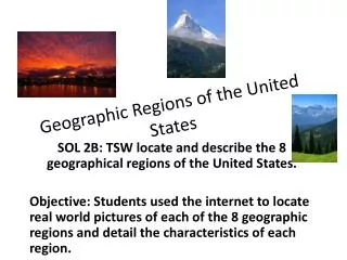
Geographic Characteristics of sub regions in the MDB. Sub Regions in the MDB. Key Skills and knowledge. Definition of a region Identification and classification of selected regions. The upper Darling. Majority of Australia's Cotton Industry

E N D
Key Skills and knowledge • Definition of a region • Identification and classification of selected regions
The upper Darling • Majority of Australia's Cotton Industry • 91% located along tributaries of the upper darling Upper Darling Balonne River
The Lower Darling • Arid • 6 million Hectares • Native Vegetation (Mallee, salt bush, red gum) • Mungo National Park, Walls of china, Willandra lakes World Heritage Area provide records of Indigenous life
The Lower Darling cont.. Wine grapes Mungo National Park Menindee lakes store water for irrigation and for Broken hill Pleistocene human footprints – Willandra Lakes
Lower Darling Cont… Produce Includes • Wheat • Cotton • Vegetables • Wool • Meat • Wine grapes • Stone fruits • Apples
The upper Murray • The Murray begins its 2375 km journey • three springs south of Mt Kosciusko
Upper Murray cont… • This sub region makes up less than 2% of the Murray Darling catchment • But contributes 37% of the rivers total flow • Hume and Dartmouth Dams control flow and generate hydro electricity The Hume Dam
The Riverine Plains • Flat • Sediment eroded from the Great dividing Range and deposited • Cadell tilt block changed the course of the rivers and helped produce Australia's largest red gum forest (Barmah)
Riverine plains cont… • Barmah forest occupies 60 000 hectares • Shepparton and Cobram orchards produce 80% of Australia's canning fruit • Rice is grown in Deniliquin and Wakool regions Barmah Forest
The Mallee zone and the Riverland / Sunraysia region • Murrumbidgee and Darling rivers join the Murray • Semi Arid region • Sandy soils, dunes, slat lakes, shrubs, sparse distribution of trees
The Mallee, Riverland, Sunraysiaregion cont……. • Ancient sea deposited large amounts of salt, present in soil and ground water • Extensive Irrigation allows: • Grapes • Citrus fruits • Stone fruit • Flowers • Vegetables Confluence of Murrumbidgee and darling rivers
The Murray Gorge • River has cut through Hard limestone • The Valley is 1.5 -2 km wide • 30 – 40 meters deep • Vertical cliffs and elongated wetlands border
The Murray Gorge cont… • The gorge is approximately 280 km long • The regional water table and river intersect • Salty water enters the river through aquifers exposed in the cliff face • The river turns sharply at Morgan
The lower Murray, the lower lakes and the Coorong • Wetlands have been drained and reclaimed for pasture and dairying • At Goolwa, barrages prevent salt water from extending upstream
The lower Murray, the lower lakes and the Coorong cont…. • The barrages also keep water levels high enough for irrigation • The river enters the lower lakes and finally the southern ocean Mouth of the Murray and the Coorong
The Coorong • Some water flows into the Coorong • The Coorong is a 140 km lagoon behind the coastal dunes