Download
1 / 34
340 likes | 384 Views
OCEAN/ESS 410. 14. Passive Margins and Sediment Transport William Wilcock (w/ some slides from Dan Nowacki). Lecture/Lab Learning Goals. Know the terminology of and be able to sketch passive continental margins Understand how passive margins are formed

E N D
OCEAN/ESS 410 14. Passive Margins and Sediment TransportWilliam Wilcock (w/ some slides from Dan Nowacki)
Lecture/Lab Learning Goals • Know the terminology of and be able to sketch passive continental margins • Understand how passive margins are formed • Understand differences in sedimentary processes between active and passive margins • Know how sediments are mobilized on the continental shelf • Understand how sediments are transported into deep water and be able to explain the difference between turbidites and debrites.
Passive Margins Transition from continental to oceanic crust with no plate boundary. Formerly sites of continental rifting
Shelf Break Abyssal Plain Terminology Continental Shelf - Average gradient 0.1° Shelf break at outer edge of shelf at 130-200 m depth (130 m depth = sea level at last glacial maximum) Continental slope - Average gradient 3-6° Continental rise (typically 1500-4000 m) - Average gradient 0.1-1° Abyssal Plain (typically > 4000 m) - Average slope <0.1°
Active Margins Plate boundary (usually convergent) Narrower continental shelf Plate boundary can move on geological time scales - accretion of terrains, accretionary prisms
Sediment transport differences Active margins - narrower shelf, typically have a higher sediment supply, earthquakes destabilize steep slopes.
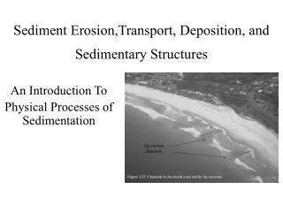
Sediment Supply to Continental Shelf Sediment Transport across the Shelf Rivers Glaciers Coastal Erosion • Once sediments settle on the seafloor, bottom currents are required to mobilize them. • Wave motions • Ocean currents
10 largest rivers in world supply 40% of freshwater and sediment to ocean 90% of carbon accumulating in ocean does so on continental shelves
Sediment Mobilization - 1. Waves The wave base or maximum depth of wave motions is about one half the wave length
Shallow water waves Wave particle orbits flatten out in shallow water Wave generated bottom motions strongest during major storms (big waves) extend deepest when the coast experiences long wavelength swell from local or distant storms
Sediment Mobilization - 2. Bottom Currents Wind driven ocean circulation often leads to strong ocean currents parallel to the coast. These interact with the seafloor along the continental shelf and upper slope. The currents on the continental shelf are often strongest near outer margins Aguihas current off east coast of southern Africa. The current flows south and the contours are in units of cm/s
Holocene deposits (<20,000 y)on passive continental shelves 70% of shelf surfaces have exposed relict deposits Boundary between modern inner-shelf sand and modern mid-shelf mud depends on waves
Sedimentation on active margins Washington continental shelf
Shelf Sedimentation • Coarse grained sands - require strong currents/waves to mobilize • Fine grained muds - require weaker currents to mobilize, transported to deeper water.
Sediment Transport from Shelf to Deep Waters Turbidity currents (and hyperpycnal flow) Fluidized sediment flows Debris Flows/Slides
Debrites and Turbidites • Debrites • Weakly Inversely graded (upward coarsening) • Thick, but pinch out quickly • Convoluted bedding • Turbidites • Normally graded (upward fining) • Laterally extensive • Thin • Horizontal bedding Lahars and pyroclastic flow deposits, Mt. St. Helens, WA.
Debrites and Turbidites • Debrites • Weakly Inversely graded (upward coarsening) • Thick, but pinch out quickly • Convoluted bedding • Turbidites • Normally graded (upward fining) • Laterally extensive • Thin • Horizontal bedding Turbidite in sandstone, unknown location (from http://uibk.ac.at)
Turbidity Current Experiments There is a good movie of a turbidity current available at http://learningobjects.wesleyan.edu/turbiditycurrents/
Missoula Floods Flow rates of up to 50 km3/hr Modern day Columbia River is ~0.02km3/hr