Download
1 / 56
1.03k likes | 1.75k Views
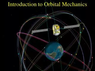
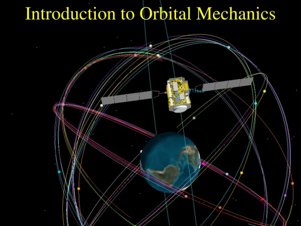
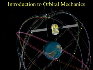
Introduction to Orbital Mechanics . What Is an Orbit?. A closed path around which a planet or satellite travels. Graphic obtained from Astronautics Primer by Jerry Sellers. Johannes Kepler discovered in 1600s that planet orbits form ellipses, not circles.

E N D
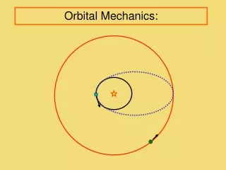
What Is an Orbit? A closed path around which a planet or satellite travels. Graphic obtained from Astronautics Primer by Jerry Sellers. • Johannes Kepler discovered in 1600s that planet orbits form ellipses, not circles. • Satellites (natural or human-made) orbit Earth as an ellipse. • Elliptical orbits remain fixed in space, and Earth spins under a fixed satellite orbit.
What Is an Ellipse? • An ellipse is the two-dimensional shape that is produced by a plane fully intersecting a cone. • Note that a plane intersecting the cone at a angle perpendicular to the cone’s center line will form a special ellipse called a circle.
A Circle is a set of points fixed (constant distance) from a center point (focus) A = constant Ellipse has two fociiinstead of a center Sum of distances from fociiis constant A+B = constant A B What Is an Ellipse? Circle is simply an ellipse with both focii located at the same spot. • Satellites orbit Earth with one focus at Earth’s center. • The other focus is an empty point, which may or may not be within Earth’s boundaries.
What Is an Ellipse? • a defines ½ the major axis length • b defines ½ the minor axis length • c is the distance from the center of the ellipse to either focal point • For a circle, a and b are equal to the radius, and both focal points are co-located at the center of the ellipse
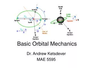
How Are Orbits Described? Orbits are described by a set of parameters called orbital elements (i.e., Keplerian elements). The Keplerian element set consists of 6 parameters (plus a time stamp): • Two of these describe the size and shape of an orbit • Three of these describe the orientation of the orbit in space • One of these describes the location of the satellite within the orbit
Eccentricity (e) Eccentricity describes the roundness of an orbit. It describes the shape of the ellipse in terms of how wide it is. Calculate the eccentricity of a circle. Eccentricity can vary from Semi-minor axis, b Semi-major axis, a
Eccentricity of 0 means the orbit is circular. Eccentricity This value is between 0 and 1 (for “closed” orbits). An eccentricity of 1 or greater means the orbit is not closed. Such would be used for interplanetary missions. Satellites in these types of orbits do not come back to their starting point.
Eccentricity Values between 0 and 1 mean the orbit is elliptical. e = .74 e = .60 e = .4 e = 0
Beyond Eccentricity Orbits may have the same eccentricity (e) but may be different sizes. There must be a Keplerian element which describes the size of an orbit.
Semi-Major Axis Major axis, 2a Semi-major axis a describes the size of the ellipse. It is half of the largest diameter (the major axis) of the orbit. Semi-major axis, a Center of ellipse The semi-major axis originates from the center of the orbit, but we are located on Earth. This makes semi-major axes difficult for us to visualize from our reference point.
Perigee altitude Apogee altitude Important Points on the Orbit “gee” suffix means Earth e.g. apoapsisand periapsis. Apogee Perigee Apogee defines the point in an orbit that is farthest from Earth. Perigee describes the point in an orbit that is closest to Earth. Apogee altitude is the distance between the surface of the Earth and apogee. Perigee altitude is the distance between the surface of the Earth and perigee.
Apogee, Perigee, and Circular Orbits For circular orbit Apogee Altitude = Perigee Altitude Apogee Apogee altitude Perigee altitude Perigee • In circular orbit, apogee altitude and perigee altitude are the same. • Perfectly circular orbit has neither an apogee nor perigee and is undefined. • Perfectly circular orbits cannot be achieved. • Generally circular orbits are described by their altitude. • Semi-major axis rarely used to describe circular orbits.
Semi-Major Axis(Altitude for circular orbits) Semi-major axis is the onlyorbital parameter that determines the orbital period. G = Universal Gravitation Constant (6.67x10⁻¹¹ m3/kg*s2) Translated as Kepler’s 3rdLaw: The square of the period of a planet is proportional to the cube of its mean distance from the Sun.
Semi-Major Axis • These orbits all have the same semi-major axis (a), but their eccentricities (e) and their orientations around Earth are different. • Observe the orbital periods.
Describing the Orientation of the Orbit in Space Orbits may have identical sizes and shapes (a and e), yet they can vary in their orientation in space. Three additional Keplerian elements define this orientation: • Inclination • Right ascension of the ascending node • Argument of perigee
Inclination (i) Inclination is the angle between the Earth’s equatorial plane and the plane of the orbit. It describes the tilt of the orbit. i = 5o i = 25o i = 45o i = 75o ??? Which satellite will complete one orbit first?
We interrupt our regularly scheduled presentation on inclination to bring you important information regarding ground traces! If a long string with a magic marker tied to the end of it were hung from a satellite, the path which the magic marker would trace over the ground is the ground trace. A ground trace is a projection of the satellite’s orbit onto the Earth. The satellite appears to move westward on (most) conventional orbits because the Earth is rotating eastward. (More on this later!) Click on map to start animation
Ground Traces After a full day, the ground trace of a satellite with an approximate 90 minute orbital period would look like this. Because the Earth is continually rotating below the orbit of the satellite, the ground trace eventually spans all longitudes. Click on map to start animation
Back to Inclination Inclination determines the northern and southern latitude limits over which the satellite orbits. For example, a satellite with a 45o inclination will have a ground trace ranging from 45o north to 45o south. You can determine the inclination of an orbit simply by examining its ground trace.
Inclination An orbit with an inclination of 0 degrees is called an equatorial orbit. An orbit with an inclination of 90 degrees is called a polar orbit.
Inclination A satellite in an equatorial orbit will pass directly over the equator. A satellite in polar orbit will pass over the entire Earth.
2nd pass, 25 degrees west longitude 1st pass, 0 degrees longitude What Do Ground Traces Reveal? Based on what we have already learned about orbital parameters, we can determine both inclination and orbital period from a ground trace. • Inclination is determined simply by noting the northern and southern latitude limits of the ground trace. • Orbital period can be determined using a simple calculation.
Determining a Satellite’s Orbital Period from its Ground Trace Recall that the orbit of a satellite remains fixed in space, and the Earth rotates underneath it. The westward regression of the ground trace is due to the rotation of the Earth. Determine how many minutes it takes for the Earth to rotate one degree: 1440 minutes/360 degrees = 4min/degree Determine how many degrees per pass the satellite’s orbit regresses on consecutive orbits (equatorial crossing is a common reference point). We’ll use 25 degrees as an example. How long did it take the Earth to rotate this many degrees? That’s the period of the satellite. 25degrees * 4min/degree = 100 minutes
Right Ascension of the Ascending Node (RAAN, W ) Satellites may have identical eccentricities, semi-major axes, and inclinations (e, a, and i) yet may still be oriented differently in space – they can be “rotated” or “twisted” about the Earth in various ways. Each satellite here starts out above a different longitude on the Earth. However, longitude can’t be used as a reference point because the Earth will rotate underneath the orbits, changing the reference longitude on each satellite pass.
RAAN Right ascension of the ascending node is the angle measured along the equatorial plane between a vector pointing to a fixed reference point in space (the first point of Aries, also known as the vernal equinox) and the point on the orbit where the orbital motion is from south to north across the equator (this point is called the ascending node). • = 0o • = 30o • = 60o • = 90o
Argument of Perigee (w) Orbits may have the same e, a, I, and W,yet may still have different orientations around the Earth. The location of their perigee point can vary within the orbital plane. Argument of perigee describes the orientation of the orbit within the orbital plane (where is apogee and where is perigee?). It is measured as the angle from the ascending node to the perigee point in the direction of the satellite’s motion. • = 0o • = 90o • = 180o • = 270o
True Anomaly (u) After an orbit and its orientation have been thoroughly described, there must be a way to describe the satellite’s position within an orbit at any instant. True anomaly is the angle between the perigee point and the satellite’s location (measured in the direction of the satellite’s motion). This value is constantly changing as the satellite moves in its orbit. True anomaly is 0 degrees at perigee, 180 degrees at apogee.
Eccentricity (e) • Semi-major axis (a) • Inclination (i) • Right ascension of the ascending node (W) • Argument of perigee (w) Keplerian Elements in Review The Keplerian element set consists of 6 parameters: Two of these describe the size and shape of an orbit: Three of these describe the orientation of the orbit in space: One of these describes the location of the satellite within the orbit: • True anomaly (u) A time stamp, referred to as an “epoch,”must also be included when providing a Keplerian element set. This is so that it is known WHEN this set of values was accurate for the satellite or when the “snapshot” of the orbit was taken.
Kepler’s Laws Kepler’s 2nd Law: A line drawn between Earth and a satellite will sweep out equal areas during equal time periods anywhere along the orbit. Time1 Time1 Kepler’s 3rd Law: The period of an orbit (T) is related to its semi-major axis (a) by: T2 = 4p2 * a3 m Kepler’s 1st Law: Satellites will travel around Earth in elliptical paths with the center of Earth at one of the foci. Translated, this means the speed of a satellite changes as the distance between it and Earth changes. At perigee a satellite is moving its fastest; at apogee, it is moving its slowest.
Special Orbit Types The Keplerian element set chosen for any given satellite is highly dependent on its mission. Certain orbits are better suited for certain missions.
LEO (Low Earth Orbit) • No specified minimum altitude • Relatively close to the Earth (several hundred km) • Short orbital periods ~90 minutes • Many revolutions per day • Limited swath areas • What can the satellite view on Earth’s surface? • All manned space missions (except lunar missions) were LEO • Many Earth-observing satellites • Weather and imagery • Why is this?
LEO (Low Earth Orbit) Image is to scale showing International Space Station height of orbit ~ 350 km
GEO (Geostationary) • What’s in a name? • Geostationary satellite remains over one location on Earth • Achieved by placing the satellite in a special orbit where period exactly equals one day • Altitude: roughly 36,000 km (22,200 miles) • Inclination is exactly zero degrees
GEO (Geostationary) • GEO satellite ONLY exists directly above equator AKA sub-satellite longitude • Geostationary satellite can see ~70 degrees north and south of the equator • Geostationary satellites mainly used for communications or “permanent relay station” in space
GEO • Only one altitude with a period of 24 hours • All geostationary orbits are in a “ring” around the Earth • The ring is called the geostationary belt • Geostationary belt is a limited resource • When a “Geobird” dies, it • Must be removed from its slot in the geobelt • Must make room for another satellite • Is usually boosted to a slightly higher orbit
GEO • Difficult to orbit exactly 24-hour period and zero inclination • Orbits typically have slight inclination • Satellites drift slightly north and south of equator • Slight east or west drift due to imperfect period • Small orbit-adjustment burns performed (called station-keeps) • Satellites with 24 hour period and non-zero inclination are called geosynchronous • Geostationary and geosynchronous often interchanged
Real Geobelt • Ground traces projected out to geostationary altitude • Large inclinations (figure 8) run out of station-keeping fuel • Sine wave orbits are being drifted to new location • Orbit color participation in data sharing program
How can you tell what direction is south if you’re lost in the middle of an urban area in the United States with no compass or GPS receiver? It is too cloudy to see the sun, and there is no moss growing anywhere! Think about what you have learned about orbits. Q. Just look for a building/house with a TV satellite dish. Since geostationary satellites can only “hover” above the equator, all dishes in the northern hemisphere that are communicating with geostationary satellites must be pointing toward the south. A. GEO A Short Lesson in Urban Navigation
Molniya (Moly) Using geostationary satellites for communications posed severe problems for Russia since so much of their land mass is near or north of 70 degrees in latitude. To overcome this problem, they created a type of orbit, a Molniya orbit, to allow for long-term communications over their northern land mass.
Molniya • Highly inclined and highly elliptical orbit • High inclination covers northern Russia • High eccentricity • -- Large apogee altitude • -- Very slow velocity at apogee • If apogee is over Russia, then satellite hangs over Russia (Kepler’s2ndLaw)
Molniya The Molniya ground trace looks quite different from most conventional ground traces. It clearly illustrates the “hang time” of the satellite over Russia. Click to begin animation
Polar Because the inclination of a polar orbit is 90 degrees, a satellite in polar orbit will eventually pass over every part of the world. This makes polar orbits well-suited for satellites gathering information about the Earth, such as weather satellites. A special type of polar orbit called a Sun-synchronousorbit passes over the same part of the Earth at roughly the same local time every day. Why might this be useful?
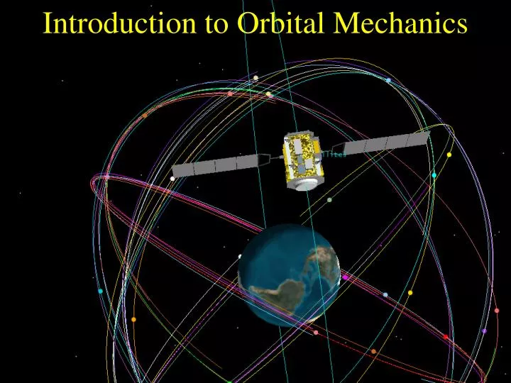
Constellations A single satellite is often insufficient to perform a particular mission. Groups of satellites in various orbits will work together to accomplish the mission. Such groupings of satellites are called constellations. GPS (Global Positioning System) is one such example.
Now That You Know the Basics Use your new understanding of orbital mechanics to answer the following questions. • If Norway wanted to obtain satellite imagery of all of its major urban areas, what type of orbit would be appropriate? • Could researchers at McMurdo Station in Antarctica use geostationary satellites for communications?