Download
1 / 29
510 likes | 898 Views
Geodetic Control Network Lecture 1. The purpose of Geodetic Control Networks, their application and the history of their establishment. Outline. Introduction Surveying vs. Geodesy Geodetic Control Networks The coordinate systems of GCNs Static vs Dynamic Networks

E N D
Geodetic Control Network Lecture 1. The purpose of Geodetic Control Networks, their application and the history of their establishment.
Outline Introduction Surveying vs. Geodesy GeodeticControlNetworks The coordinatesystems of GCNs StaticvsDynamicNetworks The hierarchy and establishment of GCNs The roles of the 1st ordernetwork
Introduction Lecturers: Lectures Dr. Szabolcs Rózsa Department of Geodesy and Surveying, K. building groundfloor 16. Practicals Dr. Szabolcs Rózsa Department of Geodesy and Surveying, K. building groundfloor 16.
Introduction Coursedetails: • one-semester course • 3 hours/week (2 lectures + 1 practical) • practicals will be held on every second week of the semester • the course is a foundation course for the Geodetic Control Networks Field Practice (6 days)
Introduction Attendance: • Please attend all scheduled lectures, seminars and practicals • Please note: attendance falling below 70% may lead to failing the course irrespective of the academic performance. Practicals: • Precise levelling (electronic and and tilting level); • Computations on the ellipsoid; • Computation of links to high points; • Fast-static GPS observations and their processing.
Introduction Classroom tests: • Altogether 3 classroom assessments: • Computation of observations in a tower – 20 points • Horizontal Control Networks – 40 points • Vertical and Gravimetric Control Networks – 40 points • 2 homeworks, which must be finished correctly Course Evaluation:
Introduction Learning resources: • Lecture notes as ppt files on the webpage. http://www.geod.bme.hu/index_e.html • However You shall write own notes during the lectures, too. • You’ll be supplied with computational sheets, field notes etc. during the course. • Textbook:Torge, W.: Geodesy (Third Edition, de Gruyter)
Outline Introduction Surveying vs. Geodesy Geodetic Control Networks The coordinate systems of GCNs Static vs Dynamic Networks The hierarchy and establishment of GCNs The roles of the 1st order network
Surveying - Science and Profession Surveying: The art of making measurements of the relative positions of natural and man-made features on the Earth’s surface, and the presentation of this information either graphically or numerically. Geodesy: Geodesy is the discipline that deals with the measurements and representation of the Earth, including its gravity field, in a three-dimensional time varying space. Geodesy focus on the Earth and neglect any man-made features on it (e.g. buildings, public utilities, etc.), while surveying use the results of geodesy for positioning and mapping of these features.
Classification of Surveying According to the space involved: Plane Surveying • relatively small areas • surface of earth can supposed to be flat • measurements plotted represent a horizontal projection of the actual field measurements Note: The two radii can supposed to be parallel, if the l(A,B) is small.
Classification of Surveying Geodetic Surveying • large areas • surface of earth can not supposed to be flat • the curvature of the Earth is taken into account • Mostly used for • establishing control networks, • determining the size and shape of the Earth • determining the gravity field of the Earth Planar approximation Spherical approximation
Outline Introduction Surveying vs. Geodesy GeodeticControlNetworks The coordinatesystems of GCNs StaticvsDynamicNetworks The hierarchy and establishment of GCNs The roles of the 1st ordernetwork
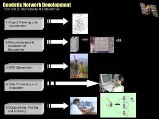
Geodetic Control Networks • Surveying and Geodesy relies on a set of permanently marked points, which is called the Geodetic Control Network. • The positions (co-ordinates) of these points are detemined using geodetic and gravimetric observations in an appropriate frame. • Geodesy relies on triangulations, trilaterations, levellings, satellite geodetic observations and gravimetric observations • The networks belong to the national/international infrastructure and serve as a basis for not only surveying, but geoinformation services, land registry and many other location based service.
Please recall: The control points are necessary for the definition of a coordinate system. Control Networks A set of control points covering a large region.
Outline Introduction Surveying vs. Geodesy GeodeticControlNetworks The coordinatesystems of GCNs StaticvsDynamicNetworks The hierarchy and establishment of GCNs The roles of the 1st ordernetwork
The coordinate systems of GCN • Geocentric coordinate system (satellite geodesy) • Surface coordinate systems (based on the geoid -> ellipsoid) • Surface coordinate systems • 3D = 2D + 1D • 2D is the coordinates on the surface (e.g. latitude, longitude) – horizontal coordinates • 1D is the distance between the point and the reference surface (e.g. ellipsoidal height) – vertical coordinates • The physical point is projected to a reference surface (Helmert or Pizetti – see it in the course on Geodesy)
The coordinate systems of GCN • The vertical coordinates • The height system should have a physical meaning, it should be linked to the potential of the point. • In reality the height above the sea level is used as a vertical coordinate. • Since the vertical coordinates have a different reference surface, and the observation techniques are significantly different: Traditionally the geographic distribution of the points of the horizontal control networks and the vertical control networks are different.
Control Networks The Control Network provide us with control points given in the same refence system (coordinate system). Thus measuring the relative positions of unknown points using these control points, the coordinates of the new points can be computed in the same reference system.
Outline Introduction Surveying vs. Geodesy GeodeticControlNetworks The coordinatesystems of GCNs StaticvsDynamicNetworks The hierarchy and establishment of GCNs The roles of the 1st ordernetwork
Static vs Dynamic Networks • Static view (up to the early 20th Century) • The Earth is a rigid body, the coordinates and the gravity field do not change. • The contradictions between remeasured GCNs were explained by the higher errors of previous observations. • Dynamic view • The Earth is not rigid, plate tectonics exist, therefore the control points may change their coordinates. • Repeated observation and computation of the networks enable us to split the coordinate error in two parts: • determined by the deformation of crust; • caused by observation error.
Dynamic Networks • In order to assess the deformations of the crust: • the location of points should be chosen using the results of other disciplines (geophysics, geology, etc.); • the points should be marked in a suitable manner; • displacement rates of approx. 1mm/yr should be exceeded. New Geodetic Control Networks should be planned and established so, that it provides a basis for surveying and geodesy as well as enables the determination of recent crust deformations.
Outline Introduction Surveying vs. Geodesy GeodeticControlNetworks The coordinatesystems of GCNs StaticvsDynamicNetworks The hierarchy and establishment of GCNs The roles of the 1st ordernetwork
The extent of geodetic control networks • Basically the extent is defined by national borders. • But: • National Geodetic Control Networks are connected to neighbouring countries; • continental networks are established, and • world wide networks are established. This course deals with the national geodetic control networks basically.
The hierarchy of geodetic control networks • Geodetic Controll Networks are established in many steps. • The sequence of steps defines the order of the geodetic control network. • The number of orders depends on: • the size of the area; • the type of the network. In Hungary: Horizontal networks: 1st-5th order (1-3: high-order control network; 4-5: low-order control network.) Vertical and Gravimetric: 1st – 3rd order networks.
The establishment and maintenance of GCN The establishment and maintenance of Geodetic Control Networks are of national interest. In Hungary: The horizontal geodetic control networks up to the 4th order and the vertical and gravimetric networks up to the 3rd order are established and maintained on a national basis. Thus these networks are called: National Geodetic Control Networks (NGCN). What about the 5th order horizontal control points? They are established on a „customer need” basis and they are not maintained on the national level.
Outline Introduction Surveying vs. Geodesy GeodeticControlNetworks The coordinatesystems of GCNs StaticvsDynamicNetworks The hierarchy and establishment of GCNs The roles of the 1st ordernetwork
The roles of the 1st order networks • The 1st order network: • provides a consistent frame for the detail surveys; • represents the country internationally (participate in regional, continental or world-wide geodetic control networks) to provide a constistent coordinate frame in a larger region; • must enable repeated observations on the points to: • monitor the deformation of Earth’s crust; • to assess the accuracy of previous geodetic control networks. • helps to determine the theoretical shape of the Earth (the geoid); • provides a basis for establishing the network of collocated points, where repeated observations of various geodetic techniques can be made (GNSS, gravimetry, levelling, etc.) to establish a European scale vertical control network for geokinematic applications.