Download
1 / 30
300 likes | 467 Views
COASTAL OBSERVING AND FORECASTING SYSTEMS IN GERMAN BIGHT AND WESTERN BLACK SEA: PRESENT STATUS AND PERSPECTIVES. E. V. Stanev, A. Palazov, J. Staneva, T. Badewien, R. Kandilarov, S. Grayek, G. Flöser. WORKSHOP ON THE STATUS OF EUROPEAN COASTAL OBSERVING AND FORECASTING SYSTEMS

E N D
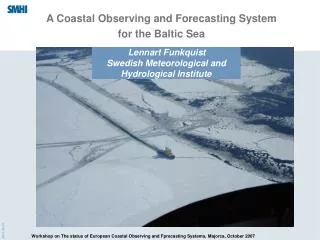
COASTAL OBSERVING AND FORECASTING SYSTEMS IN GERMAN BIGHT AND WESTERN BLACK SEA:PRESENT STATUS AND PERSPECTIVES E. V. Stanev, A. Palazov, J. Staneva, T. Badewien,R. Kandilarov,S. Grayek, G. Flöser WORKSHOP ON THE STATUS OF EUROPEAN COASTAL OBSERVING AND FORECASTING SYSTEMS 22nd to 24th October 2007, Hotel Formentor, Majorca
Outline • Introduction • Part I: German Bight • Part II: Western Black Sea • Part III: Perspectives
Integration of Coastal Observations and Forecasting Networks Is information from coastal stations used efficiently? Put individual „pieces“ together. Use modelling to optimise the integration.
Integrated Coastal Observation Network (ICON)
ICON, MARNET (BSH), Ocean Monitoring Systems (OMS) and Data station of University of Oldenburg
Stations in Wadden Sea GKSS • Now state of the art ICBM GKSS GKSS
ICBM station: http://las.physik.uni-oldenburg.de/wattstation/ tidally induced and (sometimes) human-controlled variability Actual data (17.10.07) Air (black line) and sea surface (green line) temperature (deg. C), (b) surface salinity (psu).
Real–time ADCP data
One-way nested models (GETM) Alternative: Operational model of the German Federal Maritime and Hydrographic Agency BSH 6 nm 3 nm GETM: flooding and drying 200 m 1 km Wadden Sea
GKSS-ADCP data versus simulated data Stanev et al. (2003a, OD)
Model validation Wadden Sea (U_Ol data) German Bight (BSH data)
MERIS TSM-300 m Data and numerical model simulations 19 Feb 2005 9 Sep 2004 Gemein et al. (2006)
Further perspectives COSYNA (Coastal Observation System for Northern and Arctic Seas ) enable a future long term observational network for the North Sea and Arctic coastal waters link to preoperational models for scientific and monitoring purposes Goals: consolidate existing systems, develop new ones, detect environmental and climate changes in coastal areas, produce forecasts, provide products and knowledge.
However, at the present • The existing systems are not harmonised. • Quality assessment is still a problem. • Real-time data transfer and exchange, as well as availability to modellers is not well solved. • Assimilation of various sources of near coastal data is still a complex scientific problem. • No enough coherence between physical, chemical, geological and biological data.
Western Black Sea DieCAST simulation What do we know about the Black Sea -huge estuary, -strong stratification and bad vertical ventilation, -combination of deep ocean and large shelf, -highly eutrophic basin, ...
Most of freely available models have been used. MOM DieCAST HOPS NLOM POP MICOM NCOM1 HIM OPYC HYCOM (z++) H POM GHER POLCOMS GETM, ROMS, TOMS, NCOM2, OPA, z+
... and now: NEMO Open Ocean Forcing: Black Sea NEMO Horizontal resolution: 1/12° Vertical grid: hyperbolic tangent stretching function, 31 levels Atmospheric forcing: Bulk formula parametrisation Assimilation: Altimeter data-Cooper and Heines Rich physical parameterizations
Bulgarian National Oceanographic Data Centre (BGODC) www.bgodc.io-bas.bg A local portal for national and international data exchange. Objectives: acquire the marine data sampled by Bulgarian Institutes and Agencies promote data exchange on national and international level Promote monitoring of the Black Sea.
Comparison between atmospheric analysis data and direct observations at data station
Comparison of Direct and Altimeter Data Direct and Model Data (effect of wind)
Further plans • Develop efficient nested models • Increase the representativeness of forecasts
Scientific background, state-of-the-art • Focus: the North Sea, and in particular the area of German Bight and Wadden Sea • already existing operational or near future operational systems and stations of GKSS and KDM partners • COSYNA will deliver the spatial representation through a chain of reference points (RP) with long term observations • mobile measuring techniques, such as autonomous underwater vehicles (AUVs, gliders) or ship surveys • offshore wind turbines (WEAs) as platforms for RPs • (FerryBox) will be continued and extended regarding the number of parameters
The facility is composed of the following elements. • Measuring platform inside the Wadden Sea • Measuring platform directly offshore Wadden Sea • Basic sensor units for stationary research stations or existing offshore platforms (WEAs) • FerryBox systems • Sensor systems for atmospheric-surface water gas exchange • Lander systems for sediment water exchange • Autonomous underwater vehicles, gliders • Hard- and software for data processing, data storage, modelling and visualisation • Feasibility study
The partners within this programme are: • AWI- Bremerhaven and Potsdam: Long term observation station Helgoland, joint use in North Sea and arctic waters • ICBM, University Oldenburg: Long term station Wadden Sea (Spiekeroog), joint effort in construction of offshore nearby coastal station; • Geosciences Department , University of Hamburg: benthic nutrient exchange, fluxes of matter in sediment-water and water –atmosphere exchange; • FTZ-Büsum: technical tests of components in Wadden Sea and German Bight, links to OMS project; potential user of sensor applications in pilot mariculture installation; • IfM-GEOMAR Kiel: Sensor applications for geochemical parameters; joint experiments with data quality and representative parameter values; • MARUM/RCOM, University Bremen: Planing, testing and application of under water stations and underwater vehicles; • IOW-Warnemünde: Measurements on water-sediment interface and water-atmosphere boundary layers with emphasis on CO2 exchange; • Raytheon GmbH, Kiel: data management systems, linkage to OMS project;