Download
1 / 11
110 likes | 242 Views
GEOL 108 - Crises of a Planet Lab 4 - Volcanic Hazards and Igneous Rocks. Sept. 23 - 28, 2012. Department of Earth Sciences. QUIZ 2 REVIEW.

E N D
GEOL 108 - Crises of a PlanetLab 4 - Volcanic Hazards and Igneous Rocks • Sept. 23- 28, 2012 Department of Earth Sciences
QUIZ 2 REVIEW Part 1: The January 2010 Haiti earthquake was one of the most destructive in recent history. It measured 7.0 in magnitude. Use the seismogram and travel-time graph to fill in the following chart. REVIEW | 2 Department of Earth Sciences
QUIZ 1 REVIEW • Part 3: What geologic condition in Oregon and Washington indicates the possibility of a Sumatra-like tsunami hitting this coast? How is this related to the mountains and volcanoes onshore called the Cascade Range? (2 points) http://www.tulane.edu/~sanelson/geol204/eqhazards&risks.htm REVIEW | 3 Department of Earth Sciences
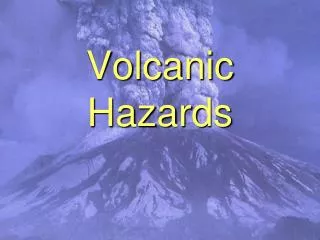
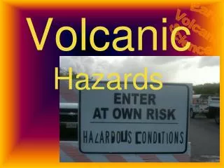
LAB 4 - VOLCANIC HAZARDS AND IGNEOUS ROCKS • Assess volcanic hazards in different settings • Read topographic maps • Recognize some igneous rocks and where they form VOLCANIC HAZARDS | 4 Department of Earth Sciences
TOPOGRAPHIC MAPS Scale: 1:250 000 Contour interval 200 ft Sandstone in Canyonlands, Utah • VOLCANIC HAZARDS | 5 Department of Earth Sciences
TOPOGRAPHIC MAPS Scale: 1:24 000 Contour interval 10 ft • VOLCANIC HAZARDS | 6 Department of Earth Sciences
TOPOGRAPHIC MAPS • Topographic contour lines are lines of constant elevation • Hachured lines indicate depressions • Pay attention to contour interval • Relief = elevation difference • VOLCANIC HAZARDS | 7 Department of Earth Sciences
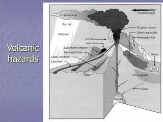
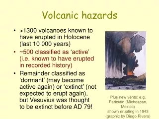
VOLCANIC HAZARDS • Lahars, lava flows, pyroclastic flows, earthquakes, tephra/ash, landslides Lahar after Pinatubo eruption http://pubs.usgs.gov/fs/1997/fs114-97/resources/BuriedHouse.jpg • VOLCANIC HAZARDS | 8 Department of Earth Sciences
VOLCANIC HAZARDS 2010 Iceland eruption www.boston.com http://www.marketoracle.co.uk/Article18692.html • VOLCANIC HAZARDS | 9 Department of Earth Sciences
VOLCANIC HAZARDS • VOLCANIC HAZARDS | 10 Department of Earth Sciences
VOLCANO TYPES AND ROCKS • Stratovolcano, shield volcano, plug dome, cinder cone Plug dome http://en.wikipedia.org/wiki/File:Volc%C3%A1n_Chait%C3%A9n-Sam_Beebe-Ecotrust.jpg • VOLCANIC HAZARDS | 11 Department of Earth Sciences