Download
1 / 12
120 likes | 216 Views
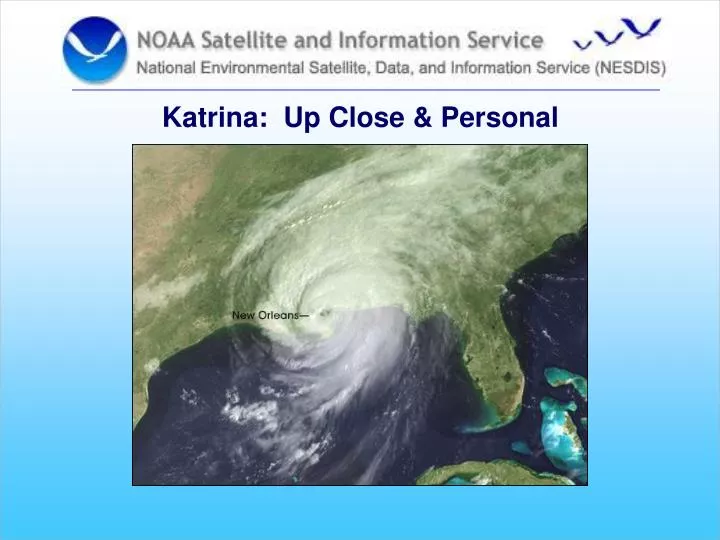
Katrina: Up Close & Personal. Stennis Space Center. Covington, LA. Bay St Louis, MS. Long Beach, MS. Ocean Springs, MS. NCDDC: Personal Impact Statements. Post-Katrina Support Activities. IT support to Mississippi Department of Marine Resources

E N D
Stennis Space Center Covington, LA Bay St Louis, MS Long Beach, MS Ocean Springs, MS NCDDC: Personal Impact Statements
Post-Katrina Support Activities • IT support to Mississippi Department of Marine Resources • Facilitate partnered Post-Katrina grant proposals • Environmental Assessment web site • Change detection • Imagery products • Grounded boat count • Storm surge analysis • Internet mapping
NESDIS – MDMR Partnership • Replace destroyed equipment • Desktop PCs; ruggedized laptops; printers; servers; network hardware • Data recovery underway • Oyster habitat, finfish & enforcement data
EGT/EOP Post-Katrina Grant Proposals • Tri-State coalition: monitoring, assessment, and integrated ecosystem data management (federal, state, and academia • USM/CenGOOS: bathymetry surveys; monitoring & assessment for environmental impact; data management • NRL: Response for environmental impact; in situ obs, remote sensing, & numerical modeling components • LSU Biogeochemistry Wetlands Institute: Katrina’s impact on Breton Sound, La marshes
Katrina Impact Assessment Website • Mapping Mississippi Coastal Counties • Infrastructure & facilities • Imagery • FEMA destruction zones • Change detection • Grounded boat count • www.ncddc.noaa.gov/Katrina * Also linked to Environmental Impact of Hurricane Katrina websitehttp://www.st.nmfs.noaa.gov/hurricane_katrina/
Change Detection:Gulf Islands National Seashore 306.2 acres lost
MODIS Aqua/Terra Turbidity Products:Lake Pontchartrain (NASA ESD) Aqua 7 Sept false color – light plumes TSM Terra Oct 24 post front – re-suspended sediment
Grounded Boat Count • Over 4000 boat counts with GPS coordinates • Provided to MDMR, FEMA, and USCG for assessment and removal • Briefed to Mississippi congressional delegations
Storm Surge Analysis • Demographics; reporting and infrastructure updates • Flood levels observable via mouse drag across screen • Tool developed through NESDIS grant to JSU
Katrina Impact Assessment Websitedemonstration www.ncddc.noaa.gov/Katrina