Download
1 / 29
290 likes | 473 Views
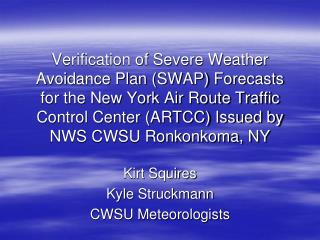
Verification of Severe Weather Avoidance Plan (SWAP) Forecasts for the New York Air Route Traffic Control Center (ARTCC) Issued by NWS CWSU Ronkonkoma, NY. Kirt Squires Kyle Struckmann CWSU Meteorologists. New York ARTCC (ZNY) Airspace. What is SWAP?.

E N D
Verification of Severe Weather Avoidance Plan (SWAP) Forecasts for the New York Air Route Traffic Control Center (ARTCC) Issued by NWS CWSU Ronkonkoma, NY Kirt Squires Kyle Struckmann CWSU Meteorologists
What is SWAP? • A program to ensure the safe flow of air traffic when a significant number of jet routes are impacted by weather or other phenomena. • Usually caused by convection. • Convection does not have to be “severe” by National Weather Service warning standards.
Isolated Convection • Aircraft can deviate around the cell without interfering with aircraft on nearby jet routes. • Aircraft may be able to fly over low-topped convection.
Clusters or Lines of Convection • Often impact more than one jet route simultaneously. • Jet routes are often closed. • Aircraft must be re-routed to different jet routes. • Arrival/departure delays increase.
Storms Close to NYC • May impact most jet routes and TRACON Gates. • Low-topped cells have as much impact as high-topped cells. • Very few ways in or out. • High impact on arrival/departure delays. • Example courtesy MITRE CAASD/FAA, June 16, 2008.
The SWAP Statement • Issued daily at 15z (11:00 a.m. EDT) – or earlier if requested. April 15 – September 30, 2008. • SWAP is: • “Not Expected” (0% chance of SWAP) • “Possible” (Greater than 0% but less than 50%) • “Probable” (50% or greater but less than 95%) • “Expected” (95% or greater) Followed by discussion SWAP start time, convective development and jet routes to be impacted.
SWAP Statement Users • Systems Command Center • TMU/Area Supervisors • Surrounding ATC Centers • Airlines
SWAP Forecast Process • Examine forecast models (GFS, NAM, RUC, etc.). • Consider dynamics, (instability, moisture advection, topography, etc.). • Monitor Storm Prediction Center products. • Participate in Aviation Weather Center convective collaboration online chats.
SWAP Forecasting Process (continued) • Determine when/where convection will start and how it will evolve. • Forecast location of convection in relation to jet routes. • Also watch neighboring regions (i.e. Cleveland ARTCC, Washington ARTCC, Boston ARTCC).
Example SWAP Statement (Possible) ZNY SWAP OUTLOOK FOR FRIDAY, JUNE 20TH, 2008 SWAP IS POSSIBLE ANY TIME AFTER 18Z. SCT TS MAY DEVELOP INITIALLY OVER SE OH AND WV…IMPACTING J80/J6. THESE STORMS WOULD MOVE INTO NRN VA AROUND 23Z AND AFFECT J48/J75. TOPS TO FL350. A SECOND AREA OF SCT TS MAY DEVELOP OVER NRN PA/CENTRAL NY AROUND 19Z WITH TOPS TO FL350. THESE STORMS WOULD IMPACT J95/J36. THESE STORMS MAY MOVE INTO OR REDEVELOP IN ERN ZNY AFTER 21Z…AND POSSIBLY IMPACT ANY/ALL JET ROUTES OUT OF NORTH AND WEST GATES. Verification: SWAP began at 1815z.
Example SWAP Statement(Probable) ZNY SWAP OUTLOOK FOR SUNDAY, JULY 6th, 2008 SWAP IS PROBABLE AFTER 1700Z FOR THE FOLLOWING REASONS: 1. SCATTERED TS ARE EXPECTED TO FORM THIS AFTN ACROSS ZNY AND INTO WRN PA DUE TO A COMBINATION OF A WEAK SURFACE FRONT AND AN UPPER LEVEL TROF APPROACHING FROM THE SSW. ROUTES FROM J60 – SOUTH ARE MOST LIKELY TO BE IMPACTED. 2. ADDITIONAL TS ARE EXPECTED TO FORM ACROSS WV AND WESTERN VA WITH IMPACTS LIKELY TO J6 AND J80. 3. SCATTERED TS ARE EXPECTED TO FORM ACROSS MD…ERN VA AND ERN NC WITH IMPACTS POSSIBLE TO ANY SRN ROUTE. Verification: SWAP began at 1745z.
Example SWAP Statement (Expected) ZNY SWAP OUTLOOK FOR SUNDAY, JULY 27TH, 2008 SWAP IS EXPECTED AFTER 15Z. MAIN AREA OF TS WITH TOPS TO FL370 IS EXPECTED TO DEVELOP BY 16Z OVER NEW ENGLAND, ERN PA, NJ, SE NY, AND SWD ALONG THE EAST COAST TO NC. BEFORE THAT, ISOLATED TS ARE PSBL OVER THE SAME AREA. TS WILL MOVE SLOWLY EWD THRU ZNY AIRSPACE AND NY/PHL TRACON AREAS THIS AFTERNOON AND EARLY EVENING BEFORE WEAKENING AROUND 02Z. DEVIATIONS ARE EXPECTED ON ALL NY TRACON GATES AND ALL JET ROUTES J95/J75 AND WHITE/WAVEY DEPARTURES. Verification: SWAP began at 1500z.
ZNY CWSU SWAP Forecast Results • SWAP is “Not Expected” • 65 Forecasts • 64 Times SWAP did not occur • Percent of SWAP Implementation (POSI) = 1.5%
ZNY CWSU SWAP Forecast Results • SWAP is “Possible” • 55 Forecasts • 19 Times SWAP Occurred • POSI = 34.5% • Well within range of 0% < POSI < 50%
ZNY CWSU SWAP Forecast Results • SWAP is “Probable” • 21 Forecasts • 18 Times SWAP Occurred • POSI = 85.7% • Also well within range of 50% <= POSI <95%
ZNY CWSU SWAP Forecast Results • SWAP is “Expected” • 20 Forecasts • 19 Times SWAP Occurred • POSI = 95% • Achieves goal of POSI >= 95% Only time SWAP did not occur was during Tropical Storm Hanna. Likely due to low air traffic volume.
Optimal POSI and Deviation From Optimal POSI • To produce a realistic verification scalar for the SWAP forecasts, we have chosen deterministic values of optimal forecast goals for each category, called the Optimal POSI (O-POSI). • “Not Expected”- 0% • “Possible”- 25% • “Probable”- 75% • “Expected”- 100%
Optimal POSI and Deviation From Optimal POSI • Deviation from Optimal POSI (DO-POSI) refers to the difference between the category’s O-POSI and its corresponding POSI. • DO-POSI = (O-POSI) – (POSI) • Positive(+); Over-forecasted • Negative(-); Under-forecasted
Summary • New York CWSU SWAP forecasts achieve goals for “Possible”, “Probable” and “Expected” events. • SWAP prediction is close to “optimal”. • SWAP forecasts give air traffic managers, airlines and other key customers quality decision-support information to support air travel.