Download
1 / 51
510 likes | 624 Views
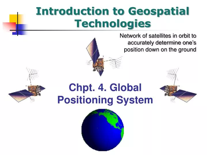
Introduction to Geospatial Technologies. Chpt. 4. Global Positioning System. Network of satellites in orbit to accurately determine one’s position down on the ground. Learning objectives. GPS origins Finding your location with GPS Position Measurements GPS Errors Differential GPS.

E N D
Introduction to Geospatial Technologies Chpt. 4. Global Positioning System Network of satellites in orbit to accurately determine one’s position down on the ground
Learning objectives • GPS origins • Finding your location with GPS • Position Measurements • GPS Errors • Differential GPS
The acronym “GPS” • GPS, Department of Defense • NAVSTAR GPS; United State System • Global Navigation Satellite System (GNSS)
GNSS Systems • NAVSTAR GPS • GLONASS (Russian Systtem) • Galileo (Consortium of European Governments and Industries) • Compass (Chinese version of GPS) • IRNSS (Indian satellite Navigation System)
Early Navigation: Measuring Latitude is Easy Ursa-major Sextant Pole star (North Star) at 41 degrees elevation ….Latitude is 41 degrees! • Navigation relied on position of the stars and sun • Navigators could determine their latitude by measuring the sun's angle at noon (i.e., when it reached its highest point in the sky). • North star, in Ursa-major constellation, can tell us Latitude directly by measuring elevation above the horizon. Measuring vertical angle to the NStar • Geographical Latitude is 0 deg at Equator, and 90 deg at the North Pole
MeasuringLongitude is Hard because there is no fixed point in the sky like the North Star or the Sun at Noon ! • A marine chronometer is a clock that is accurate enough to be used as a portable time standard; • Knowing GMT at local noon allows a navigator to use the time difference between the ship's position and the Greenwich Meridian to determine the ship's longitude. • As the Earth rotates at a regular rate, the time difference between the chronometer and the ship's local time can be used to calculate the longitude of the ship relative to the Greenwich Meridian (defined as 0°) using spherical trigonometry Compare time at Greenwich to local noon. One hour difference = 15 degrees of longitude. One second of error is 68 miles!
Satellites offered a much better solution • GPS isn't the First Satellite Navigation System!! • Transit by US Navy (1960) – location of seas-going vessels • Naval Research Laboratory Timation Program • Best accuracy 25 meters – up to 6 hours between measurements! • You have to wait to get a fix on your position rather than always knowing where you are
Global Positioning System • First GPS satellite in 1978 • 24th Satellite in 1993, completing an initial full capacity of satellites • >$12 billion spent • GPS is overseen and maintained by the 50th Space Wing, a division of US Air Force in Colorado • 24 satellites in 12 hour orbits • 12,000 mile (20,200 kilometer) high orbits • Two orbits around Earth every day • 4-8 satellites available above 15 degrees from horizon line • Positions available anywhere in the world, 24/7 Shows example of the number of satellites visible from a point on Earth over time
So how does it operate? Three segments of GPS satellite Relies on 3 separate components, all operating together • 1. Space • 2. Control • 3. User
1. Space segment 24 satellites in ~12 hour orbits about 12,500 miles above the Earth This is known as the GPS constellation At any given time, at least four of the satellites are above the local horizon at every location on earth 24 hours a day Ephemeris -- provides position in space at any specific time Shows example of the number of satellites visible from a point on Earth over time
Space segment: Distance from satellite • Radio waves = speed of light • Receivers have nanosecond accuracy (0.000000001 second) • All satellites transmit same signal “string” at same time • Difference in time from satellite to time received gives distance from satellite • The whole thing boils down to those "velocity times travel time" math problems we did in high school!! • "If a car goes 70 miles per hour for two hours, how far does it travel?" • Velocity (70 mph) x Time (2 hours) = Distance (140 miles)
Space segment : Accurate clocks • Satellites have very accurate clocks and very accurate ephemeris information • Light speed = 186,000 mi./second • Out of sync by 1/100th of second equals error of 1860 miles! • Atomic clocks (4) aboard each satellite
2. Control segment • US Air Force operates the satellite • They update ephemeris information for the satellite • They maintain information on the health of each satellite • They configure the hardware on the satellite • They check the clocks on the satellites
Monitoring stations Location of the four unmanned stations (circles) and one Master Station (triangle) of the GPS Control Segment
3. User segment-consists of the receivers we use • How many channels the receiver has (12 channel) • Single frequency receiver (can pick up L1) • Dual frequency receiver (L1 and L2) • Receiver can only receive satellite data, not transmit data back to satellite.
Triangulation and Trilateration • Triangulation • Based on angular measurement • Trilateration • Based on time • (or distance) • GPS is based on Trilateration
Travel time Signal leaves at 8:03:02.12 For example: 13,000 some miles Radio waves travel about 186,000 miles (300,000 km) per second. Signal arrives at 8:03:02.19
Whoa! 8:03:02.19 7 hundredths of a second difference for the 13,000 mile (i.e. 20,000 km) distance - 8:03:02.12 0:00:00.07 Takes some really good clocks (i.e. $50,000)!
Exactly Synchronized PRN Generator PRN Generator So how do you measure the time difference? Pseudo-random Noise Code (PRN Code) • If we wanted to see just how delayed the satellite's version was, we could start delaying the receiver's version until they fell into perfect sync. • The amount we have to shift back the receiver's version is equal to the travel time of the satellite's version.
Just compare the two codes! Measure the time offset to make the two codes align or “correlate” Now you have an idea of the distance between the two PN generators!
Measured Distance The satellite knows where it is. Earth (by definition) We know the distance from the satellite by the code correlation. So we know where we are on a big circle (sphere) around the satellite.
Add another satellite Earth (by definition) Two dimensional example: We’re in one of two spots.
Add another satellite Earth (by definition) Again: Two dimensions – 3 satellites – we know where we are!
Remember the pesky clock problem? Earth (by definition) Satellites have expensive clocks. Our receiver doesn’t! Our clock is “off”. So our distance is off – but by a constant amount!
Earth (by definition) Old trick: Add another satellite What number do we add or subtract from the time correlation to make everything come together?
Add or subtract the time offset number Earth (by definition) Now you got the time.
So what do the real signals look like? The information is sent either C/A (Course Acquisition Code) or P codes (Precision Code). The C/A code is broadcast on L1 Carrier Frequency. 1-5 meter accuracy. P Code – Precision Code is used by the military (L1 and L2).
What can go wrong - sources of Errors • Poor satellite geometry (angle of signal) • Multi-path errors • Signals bounce off objects before being received • Intended error (military: “Selective Availability”) • Switched off on May 2, 2000 • Earth’s atmosphere: signals slow or speed up
GPS Errors: 1. Earth’s atmosphere • You calculate distance to a satellite by multiplying a signal's travel time by the speed of light. • But the speed of light is only constant in a vacuum...
Ionospheric and Atmospheric Delays • Speed of light = 186,000 miles/second in a vacuum • Earth’s atmosphere is heterogeneous • Can cause signals to slow down or speed up • Eliminated by ‘dual frequency’ receivers • Low and high frequency • Low frequency affected more than high frequency • Receiver evaluates signal and corrects for error
GPS Erros: 2. Multipath Error • The signal may bounce off various local obstructions before it gets to your receiver. • Good receivers use sophisticated signal rejection techniques to minimize this problem.
GPS Errors: 3. Geometric Dilution of Precision • Basic geometry itself can magnify these other errors • A principle called Geometric Dilution of Precision or GDOP. • Good receivers determine which satellites will give the lowest GDOP
Satellite geometry Quantified by DOP: Dilution of Precision
10 km Sub meter accuracy Increased Accuracy using Differential GPS (DGPS)
DGPS/Reference Datum System • Raw GPS Data (no corrections) WGS84 • Coast Guard Beacons NAD83 • Omnistar (North America) NAD83 • Omnistar (Outside North America) ITRF2000 • WAAS (Wide Area Augmentation System)ITRF2000 • SBAS (Satellite Based Augmentation System)
A Caution on Datum • NAD27 (North American Datum 1927) • NAD83 (North American Datum 1983) • WGS84 (World Geodetic System 1984) • ITRF2000 (International Terrestrial Reference Frame 2000) • ITRF 1994, 1996, 1997
Coast Guard’s DGPS • US Coast Guard set up several reference stations along cost and waterways to aid ships in finding their location and navigation
WAAS (Wide Area Augmentation System • New system used by FAA (Federal Aviation Administration) to guide aircraft • 25 ground reference stations in US monitor GPS satellites • Low-level geo-synchronous satellites send correction messages to GPS receivers
WAAS receive GPS signals and determine if any errors exist • Correction message is prepared and uplinked to a geosynchronous satellite • The message is then broadcast from the satellite on the same frequency as GPS
The WAAS covers nearly all of the National Airspace System (NAS). • The WAAS provides augmentation information to GPS receivers to enhance the accuracy and reliability of position estimates. • The signals from GPS satellites are received across the NAS at many widely-spaced Wide Area Reference Stations (WRS) sites. • The WRS locations are precisely surveyed so that any errors in the received GPS signals can be detected. • WAAS Satellites calculate position correction information and broadcast the correction signal to Geostationary WAAS satellite • It can only function in US and nearby portions of North America How It Works
WAAS • WAAS corrections are valid in: • United States (including most of Alaska & Hawaii) • Virgin Islands & Puerto Rico • Southern Canada • Parts of Mexico • Not valid in all other areas • Base stations are too distant • Plans for future expansion
DGPS Accuracy • Under optimal conditions • User hand held 2-5 m • CALMIT units < 1 m • Survey grade units < .03 m • Very high precision units ~ .005 m