Download
1 / 30
300 likes | 414 Views
Spatial Distribution of Historical Arable Land Reconstructing in China’s Recent 300 Years. Xiaobin Jin Nanjing University. Background. Global environment’s change significantly global LUCC had led to 177Pg carbon emission during 1700 to 2000

E N D
Spatial Distribution of Historical Arable Land Reconstructing in China’s Recent 300 Years Xiaobin Jin Nanjing University
Background • Global environment’s change significantly • global LUCC had led to 177Pg carbon emission during 1700 to 2000 • Global LUCC have led temperature dropped 0.13 to 0.25℃ since the industrial resolution • In recent 300 years, more than 1.1million km² of forest have converted to farmland, the area of irrigation farmland have increased about 330 times • Population explosion quickly • Natural resource consumption rapidly
IGBP and IHDP (1995) LUCC and PAGES (2000) IGBP and IHDP (2005) LUCC BIOME 300 GLP 5 frame questions and 3 priority research fields reconstructing global historical land-cover data in recent 300 years LUCC model will be more focused on innovative and dynamic
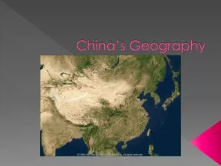
The characteristics of LUCC in China • Locates at east Asian monsoon region, undergoing a significant change in environment. • Land area ranks the third in the world, has a long history with agricultural civilization • Largest population, sustained growth • Detailed historical data , no stopped farming history
In recent 300 years, China’s LUCC changes rapidly • Since “the tan Ding Ru Mu” from Qing dynasty, China’s population has increased by 6 times LUCC • cultivated area increase:lots of land have been cultivated in the northeast China, Inner Mongolia and Xinjiang • forest and grassland decrease:transition zone between cropping area and nomadic area have moved 700 km toward north • water area decrease:the area of Lake Dongting has reduced by half • constructionland increase:construction land has increased by 50 times in traditional cultivated region
SAGEdataset • Center for sustainability and the global environment’s Ramankutty、Folyet al (1999)established SAGE dataset • HYDE dataset • Netherlands environment assessment agency’s Goldewijket al (2001/2011) established historical database of the global environment (HYDE dataset) Research review Global scale
Thecharacteristics and problems of data set • Low spatial resolution, Global dataset (0.5°×0.5°) • From the view of period, successive and discontinuous type • From the view of spatial expression,percentage or booleantype • Focused on cultivated land, lack of forest and construction land • From the view of “up to down” reconstruct method • Utilized common space allocation criteria and parameter setting,although considered the spatial homogeneity of geographical phenomena,ignore spatial heterogeneity and diversity
cropland forest water others The control of Geographic boundary Research approach Land-use spatial pattern reconstruction in the recent 300 years The reconstruction of spatial pattern Data collection and correction Assumption 1: the most suitable distribution of cultivated land Distribution model events Land records population Assumption2:the expansion control of the cultivated land The typical land- use pattern Land data correction Human-environment relationship Provincial correction Check system The pattern of historical land-use quantity control Land dataset
Correction of the administrative boundary Data collection in Qing dynasty events Cultivated land population Merge Area adjustment Jing-jin-ji Inner mongolia Discount Hide Exempt …… war Famine Food demand Supply of labor Hu-ning Jing-jin-ji Yue-qiong Data modification of historical record Chuan-yu Chuan-yu Gan-ning Others Northeast of china Data modification in Qing dynasty Data modification of cultivated land in modern administrative boundaries Data modification Analysis of data in provincial variation Analysis of pattern in food production Analysis of reconstructed result Analysis of growth stage Progress-Correction of historical cultivates land data
Correction of historical cultivates land data change stage of cultivated land quantity 136.8×10⁶ hm2 42.4×10⁶ hm2 the rapid growth stage in the early period of Qing Dynasty Low growth stage of the late Qing Dynasty Fluctuation stage in early of the Republic of China Early rapid growth stage the Republic of China The loss stage of cultivated land
Correction of historical cultivates land data cultivated land reclamation rate change Reclamation rate in the early of Qing dynasty by province • Average reclamation rate more than 25%
Correction of historical population data population and its growth rate trends
historical cropland reconstructing • Chinese traditional cultivated region • Mainland’s 17 provinces in 1820’s administrative division • Temporarily discontinue farming and restoration reclamation • historical data detailed, farming history has never been interrupted
Boundaries partition Arable dataset 耕地评价与演化分析 Historical traditional cultivated region populion Arable data Modern pattern of cultivated land modification Geographic boundary partition administrative boundary partition Data modification of historical record Exam Synchronization rule Modification by population land suitability Influence factors Evolution rules Events Reclamation ratio Chuan-yu Hu-ning …… Yue-qiong Arable data in Qing dynasty Filter Merge and split Arable dataset The republic of china Quantity control Rules control Boundaries control synchronization constraints CA N Confirmation Y The pattarn of cultivated in typical years • Construction of synchronization constraints CA Rule
Model simplification • Concept model
Comprehensive decision criterion • Influence of cellular neighborhood
μi,j represent j year i area’s Labor arable land index,μi,j>1 shows that the quantity of labor force can support the reconstruction’s cropland, otherwise, we must modify the factor α • Method B: By selecting China’ region at the corona satellite in 1967 black and white images data of typical area, point by point check the research area according to images selected about 5% . • Method A:
Begin Setting environment , variables and parameters Boundaries control Overlay cultivated map and boundaries Land suitability by subregion Transition probability by subregion Identification cellar of the min transition probability as transforming unit Binary logistic Yes Quantity control No Finish one iteration Update the dataset Yes Is total cellar less than external variable? No Generate the result End Transforming cellar<stepNum Synchronization imitation • Realizition of synchronization constraints CA
Result 1754 1820 1887 1930 1724 1685 1661 1873
Compared with the international data sets HYDE 3.1 SAGE 2000 1820
Further study Reconstruction of spatial distribution of historical cropland in traditional cultivated region based on synchronization constraints CA Combine with geographical boundaries and synchronization constraints CA, imitate the spatial distribution of historical cropland in expanded cultivated region Produce spatial distribution of historical cropland in whole nation Explore the accuracy attenuation of spatial up-scaling data