Download
1 / 25
260 likes | 402 Views
Meteorology (Weather) . Follow along in your notes packet…. http:// www.youtube.com/watch?v=FMagDRCpJ14 http:// www.youtube.com/watch?v=tkK4_F0VKhM. Our atmosphere has 3 states of water: 1. Ice 2. Water 3. Water Vapor. Changing Forms of Water.

E N D
Meteorology (Weather) Follow along in your notes packet…
http://www.youtube.com/watch?v=FMagDRCpJ14 • http://www.youtube.com/watch?v=tkK4_F0VKhM
Our atmosphere has 3 states of water: • 1. Ice • 2. Water • 3. Water Vapor Changing Forms of Water
Water changes from one phase to another as heat energyis either absorbed or released. • We call this heat energy latent heat • Most water enters our atmosphere through Evaporation • The process in which a solid changes directly into a gas is Sublimation Changing Forms of Water
Water Vapor in the atmosphere, known as humidity, is controlled by rates of evaporationand condensation • Temperature often controls the rate of evaporation, where as the rate of condensation is determined by vapor pressure • When the rate of evaporation and condensation are in equilibrium, the air is “saturated” Humidity
Absolute Humidity is the mass of water vapor contained in a given volume of air (the actual amount of water vapor in the air) • Relative Humidity is a ratio of actual water vapor content of the air to the amount of water vapor needed to reach saturation • We use a Psychrometer to measure humidity • Video Relative & Absolute Humidity
Air moves from areas of high pressure to low pressure • The Coriolis Effect occurs when winds are deflected by Earth’s rotation • Air masses are large bodies of air throughout which temperature and moisture content are similar How Air Moves
Air masses are classified according to their source regions, which are determined by the temperature and humidity of the air masses • Cold Air Masses: Polar areas • Warm Air Masses: Tropical areas • Masses formed over oceans: Maritime(moist) • Masses formed over land: Continental(dry) Types of Air Masses
A cool air mass is dense and won’t mix with a less dense and warm air mass- a boundary called a front forms between the masses • Video Types of Fronts
Cold Front: a cold air mass overtakes a warm air mass. Cold air lifts the warm air • Storms formed from a cold front are short-lived and sometimes violent • If it is a slow moving cold front, the storm may be weak with light precipitation Types of Fronts
Warm Front: a warm air mass overtakes a cold air mass • Generally produces precipitation over a large area and may sometimes cause violent weather Types of Fronts
Stationary Front: air masses move very slowly or not at all • Weather produced is similar to a warm front • Occluded Front : when a fast moving cold front overtakes a warm front and lifts the warm air off the ground completely Types of Fronts
Thunderstorms produce thunder and lightning. • Clouds discharge electricity in the form of lightning. • The upper part of the cloud carried a positive charge, the lower part carries the negative charge. • Lighting is the huge spark that travels within the cloud or between the cloud and ground to equalize the electrical charges Severe Weather: Thunderstorms
Thunderstorms have 3 stages: • 1. Cumulus Stage • 2. Mature Stage • 3. Dissipating Stage Severe Weather: Thunderstorms
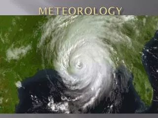
Hurricanes: severe storm that forms over tropical oceans and whose strong winds of more than 120 km/h spiral in toward the intensely low pressure storm center • Most destructive storms on Earth • Cause rising in the sea levels with large waves called storm surge Severe Weather: Hurricanes
To rate a hurricane we use the Saffir-Simpson Scale: 5 categories based on central pressure, wind speed, and storm surge. • Category 1: least damage • Category 5: most damage • Hurricanes begin over warm water….how would Global Climate Change affect this? Severe Weather: Hurricanes
Shortest lived severe storms, destructive, rotating column of air that has very high wind speeds and that may be visible as a funnel-shaped cloud • Forms when a thunderstorm meets high-altitude, horizontal winds which cause the rising air in the thunderstorm to rotate. A storm cloud may develop a narrow, funnel-shaped, rapidly spinning extension that reaches downward Severe Weather: Tornadoes
To measure and indicate temperature we use a Thermometer • For changes in air pressure affect air masses at certain locations or atmospheric pressure we use a Barometer • Wind speed is measured with an Anemometer • Wind directed is measure with a Wind Vane • Radar, weather satellites and computers are useful as well Weather Instruments
Meteorologists and weather stations collect data and transfer it onto weather maps. • So that everyone around the world can understand they use symbols and colors • A cluster of weather symbols are called a station model: pattern of symbols that represent the weather at a particular observing station and is transferred onto a weather map Forecasting the Weather
Isotherms: lines that connect points of equal temperature (think: thermometer) • Isobars: lines that connect points of equal atmospheric pressure (think: barometer) • Centers marked with an “H” represent high pressure; “L” is for low pressure • Areas with precipitation are marked with colors or symbols Plotting Temp & Pressure
Doppler Radar & Satellite Images can tell us about intensity and precipitationso that meteorologists can create weather models • Types: • Daily Forecasts: predict weather for 48 hrs • Extended Forecast: 3-5 days • Long-Range Forecast: more than 7 days • Watch: conditions are ideal for severe weather • Warning: severe weather has been spotted OR is predicted within 24 hours Weather Forecasts
Weather conditions for an area over a long period of time is Climate • Different latitudes receive different amounts of solar energy • The higher the latitude, the smaller the angle at which the Sun’s rays hit the Earth and the smaller the amount of solar energy received by the area • The tilt of Earth’s axis is also a factor Climate
Topography: surface features of the land can control the flow of air through a region • Rain Shadow: moving air mass encounters a mountain range, the air mass rises, cools and loses most of its moisture through precipitation. The air that flows down the other side is usually warm and dry. • Warm winds that flows down the eastern slopes of the Rocky Mountains are Chinooks Topography
Tropical Climates: high temperatures and heavy precipitation during at least part of the year • Middle- Latitude Climates: has an average maximum temperature below 18 degrees C in the coldest month and an average minimum temperature above 10 degrees C in the warmest month • Tropical Desert Climates: dry climates that receive less than 40 cm of precipitation a year Climate Zones
Mediterranean Climate: mild climate that has a small temperature range between summer and winter • Tundra Climate: smaller annual temperature range than subarctic but has a colder climate • Polar Icecap: much of the land and ocean covered in thick sheets of ice, average temp never rises above freezing • Large bodies of water, such as lakes, can influence local climates as well as precipitation Climate Zones