Download
1 / 7
70 likes | 224 Views
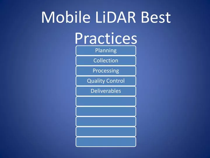
Mobile LiDAR Best Practices. Planning Panel and Validation Point Spacing and Placement (Dependent on road type, conditions & req’d accuracy) (Between 500 and 2500 feet) GPS Conditions (avoid outages & poor DOP) Traffic Volumes (avoid rush hours) Plan Travel/Collection Routes

E N D
Planning Panel and Validation Point Spacing and Placement (Dependent on road type, conditions & req’d accuracy) (Between 500 and 2500 feet) GPS Conditions (avoid outages & poor DOP) Traffic Volumes (avoid rush hours) Plan Travel/Collection Routes Plan GPS Base Location(s)
Collection Blocker Vehicle or Not Vehicle Calibration / IMU Wake-Up Follow Travel/Collection Routes in Google Earth Speed (panel sizes/end product) Avoid Stop and Go Limit Collection Routes to Manageable Lengths/File Sizes (within 10 to 20 miles) Use base station within 5 to 7 miles of project Survey Control VRS for Horizontal & Digital Level for Vertical
Processing Reduce/Localize Control PosPac – GPS Trajectory Register Trajectory, Point Clouds, Cameras to Final Panel Control May use some validation points for registration May use cloud to cloud registration in some areas
Quality Control LiDAR Processing Software Run Surface Confidence Check (Point Cloud to Validation Points) / RMSE Report May Constrain to Validation Points if Needed Client Software Geppak, AutoCad, TopoDOT, Geocue Run 0.10’ contours on surface Compare Original Point Cloud Contours to Point Grid Contours to Point Grid + 3D Breaklines Contours Compare to Aerial or Other Avail. Line Work
Detailed As-Built Information Basis for Design Topographic Mapping Pavement DTM GIS Feature Inventories Change Detection (Mesh to Point Cloud Comp) Volume Surveys 2D or 3D Mapping Deliverables - Uses for 3D Point Cloud Data…
Keys to a Successful Project • Determine the Level of Detail • Determine the Accuracy of the Primary Delivery • Collect once – use many • Fidelity of the data during collection • Archive Everything • Know the Client’s 3D aptitude • IT Infrastructure (can their computers handle it) • Personnel • End User (is it an engineer or a dozer operator)