Download
1 / 39
390 likes | 591 Views
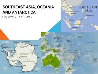
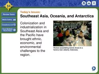
Southeast Asia and Oceania. That’s a lot of islands. Southeast Asia. Located on the equator: almost entire region falls within the humid tropics . Archipelago of about 25,000 islands Population: 610 million

E N D
Southeast Asia and Oceania That’s a lot of islands
Southeast Asia • Located on the equator: • almost entire region falls within the humid tropics. • Archipelago of about 25,000 islands • Population: 610 million • Southeast Asia is conventionally divided into two cultural, linguistic, and geographic regions: • Mainland Southeast Asia - the countries of Thailand, Laos, Burma, Cambodia and Vietnam; • Insular (Island) Southeast Asia - the island or peninsular countries of Malaysia, Singapore, Brunei, the Philippines, East Timor, and Indonesia
Mainland Southeast Asia • half of 11 countries are on mainland • Vietnam • Cambodia • Thailand • Laos • Myanmar • part of Malaysia • Laos only country without coastline • most on Indochina Peninsula • Malaysia shares Malay Peninsula with Thailand as well as occupying part of Borneo
Island Southeast Asia • insular-island • Brunei-almost surrounded by Malaysia • East Timor-1999 became independent of Indonesia • Indonesia-largest island country with 13,677 islands (only 6,000 are named and only 1,000 settled) • Singapore-just south of Malay Peninsula • Philippines-11 islands have 95% land area (900 of 7,000 islands named)
Indonesia • Regional setting • From the Greek Indos (India) and Nesos (Island), literally the “Indian Islands.” • 17,000 islands: • About 6,000 inhabited. • Longest coastline in the world . • Three time zones. • Coastal zones supports approximately 60% of the population. • Controls two strategic straits: • Sunda and Malacca. • Through which much of the world’s oil traffic must pass. • Volcanism • Intense volcanic and seismic activity. • 300 volcanoes of which 200 have been historically active
Indonesia: Core and Periphery More than 200 people per sqr km Periphery Core Inner islands (Java, Madura and Bali) Fertile land due to volcanic origin and monsoon (among the most fertile land in the world). 80% of the population on 7% of the land. Mostly Javanese. Outer islands (Sumatra, Kalimantan, Sulawesi, Irian Jaya) 20% of the population on 93% of the land. Most of the minorities. Sparsely populated but abundant in resources.
Mountains and Volcanoes • dominate landscape • most peaks below 10,000 feet • create geographical and political barriers • western and northern highlands separate region from India and China • three ranges run north to south • ArakanYoma Range in western Myanmar • BilauktaungRange between Myanmar and Thailand • Annam Cordillera separating Vietnam from Laos and Cambodia • island mountains form part of Ring of Fire • Indonesian and Philippine islands marked by craters • mineral-rich volcanic material breaks down and leaves rich, fertile soil, making Southeast Asia highly productive agricultural area
Volcanoes of Indonesia and the Philippines • 327 volcanoes stretch across Indonesia • Java, home to 17 of Indonesia's 100 active volcanoes, is one of Ring of Fire's most active areas • 1883 eruption of Krakatau destroyed everything • now monitor volcanic activity to be prepared • 1991 eruption of Mount Pinatubo 20th century's most powerful • 55 miles north of Philippine capital Manila • damaged town of Angeles • foot deep layer of ash over U.S. Clark Air Force Base
Tectonic Activity in Indonesia Eurasian Plate Philippines Plate Australian Plate Australian Plate
Mainland Southeast Asia • External influences • Have been stronger than internal influences. • China brought civilization and technology (early history). • India brought religion (Hinduism and Buddhism). • Middle Eastern countries brought Islam and trade. • Europe brought trade and colonialism. • USA and Japan brought imperialism (at different levels): • Recently brought trade and development. • Indochina • Often used to define the region. • Hint at the strong historical Chinese and Indian influence. • Notably refers to the former French colonies of Vietnam, Cambodia and Laos.
Rivers • waterways for transportation, communication, and food • silt and deposits of sediment create fertile agricultural regions • mainland rivers originate in northern highlands and flow south to Gulf of Thailand • Irrawaddy in Myanmar • Chao Phraya in Thailand • Red in Vietnam • Mekong between Thailand and Laos and through Cambodia and Vietnam before emptying into South China Sea, where it adds 50 feet/year to shoreline from sediment • island rivers shorter and flow in various directions • Indonesian rivers flow south to north • Borneo's rivers flow from center outward
Agriculture • Two main types in SEAsia • Slash and Burn • Located in upland areas • Slash forest and burn before rainy season • Rain washed nutrients into ground • Grows for 1-2 years then must abandon plot for 10-15 years • Wet Rice Agriculture • Must dramatically change land • Must build terraces and irrigation canals • Nutrients provided by algae in water • Very labor intensive, but can yield two crops a year
Mainland Southeast Asia: Thailand • Profile • The “Land of the free”: • Never colonized by European powers. • The core along the Chao Phrya Valley. • Access to the Indian (Gulf of Bengal) and Pacific (Gulf of Thailand) oceans. • 62 million population: • Thai 75%, Chinese 14%, other 11%. • Buddhist 94.4%, Islam 4%, Hindu 1.1%, Christian 0.5%. • Muslims minority in the south (along the Malaysia border). Chao Phrya Valley Bangkok Gulf of Thailand Indian Ocean
Mainland Southeast Asia: Vietnam • Geographical setting • Coastal plain along the South China Sea with a population of 78 million. • Stands for “People of the south”. • Two major deltas: the Red River (Song Koi) and Mekong. • Natural penetration corridor towards China. • Only 5% of the territory is mountainous. • The south is more fertile. • Most minerals resources in north. • Government still one-party communist-ish, but opened up to free markets Hanoi Red River Delta Annamite Chain Ho Chi Min City (Saigon) Mekong River Delta
Economies • Variety of political, economic and cultural landscapes • Least advanced economies of the region: • Laos, Cambodia and Burma. • Emerging nations: • Malaysia, Indonesia, the Philippines, Thailand. • The leader: Singapore. Phnom Phem and Singapore
Oceania Australia, New Zealand, and surrounding islands
Geography of Australia • World’s smallest continent/largest island; 6th largest country • Western half: plateau rising to mountains • Eastern half: Great Artesian Basin, rising to Great Dividing Range in East • Outback in the middle; covers 70% of Continent • Tasmania: large, mountainous island to southeast
The Outback • Any area outside of urban zones is known as “the bush” in Australia; more remote areas are called “outback” • REALLY remote areas are called the “Never Never” • Used for tourism, agriculture, and mining
Ayers Rock (Uluru) • Sacred spot to indigenous people • home to a plethora of springs, waterholes, rock caves and ancient paintings • Known for changing colors during the day/year
New Zealand • 900 miles East of Australia • Mostly forests, sharp mountain peaks (Southern Alps) due to convergence of plates • Queen of England is the head of state, she appoints a Governor-General to act for her in NZ at the recommendation of the Prime Minister • Wool is major export • Known for unusual birds
Physical Geography: Great Barrier Reef
Great Barrier Reef World’s largest reef system; over 2900 reefs What does it do? About $5.4 Billion in tourism for Australia coral reef structure buffers shorelines against waves, storms and floods, helping to prevent loss of life, property damage and erosion Huge biological diversity Supports people by providing fish Sacred space for Aboriginal People
Damage to the Reef • Threats: • Runoff • Most pollution comes from rivers running into the Reef • 30major rivers and hundreds of streams flow into the reef • Runoff from farms (fertilizer and pesticides)
Climate Change and Coral Bleaching • climate change accompanied by mass coral bleaching • Believed to be biggest threat • corals expel their algae (photosynthesizing zooxanthellae) which provide up to 90% of the coral’s energy requirements • turn colorless, revealing their white calcium carbonate skeletons, under the stress of waters that remain too warm for too long. • the coral is still alive, and if the water cools, the coral can regain algae • If the water does not cool within about a month, the coral will die of starvation. • Australia experienced its warmest year on record in 2005. Abnormally high sea temperatures during the summer of 2005-2006 have caused massive coral bleaching
More Threats to the GBR • The Crown-of-Thorns Starfish • a coral reef predator • preys on coral polyps by climbing onto them, extruding its stomach over them (eww…), and releasing digestive enzymes to absorb the liquefied tissue. • An individual Starfish can eat up to six square meters of living reef in a year • They have been in the GBR for thousands of years, but outbreaks are much more recent • Increases due to: • Reduction of water quality associated with agriculture can cause the crown-of-thorns starfish larvae to thrive. • Overfishing of its natural predators, such as the Giant Triton, is also considered to contribute to an increase in the number of crown-of-thorns starfish.
Humans in the GBR • Overfishing of key species, such as the Giant Triton and sharks, can cause disruption to food chains • Impact of Fishing • increased pollution from boats, • by-catch of unwanted species (such as dolphins and turtles) • habitat destruction from trawling, anchors and nets • Overfishing of herbivore populations can cause algal growths on reefs • According to a study published in 2012 by the Proceedings of the National Academy of Sciences, the reef has lost more than half its coral cover since 1985
Dailies: Day 8 What are the two regions that Southeast Asia is divided into? Describe the eruption of Krakatoa in 1883. How many islands make up SE Asia? What two types of agriculture is SE Asia known for? What is the “Bush”? The “Outback?”
Dailies: Day 8 Besides New Zealand, give three examples of Continental Islands. What causes the water to rise over an atoll and create a lagoon? Describe the cities in Tahiti. What is the major problem with resources in Kwajalein? Who is allowed to live on Kwajalein?