Download
1 / 3
30 likes | 109 Views
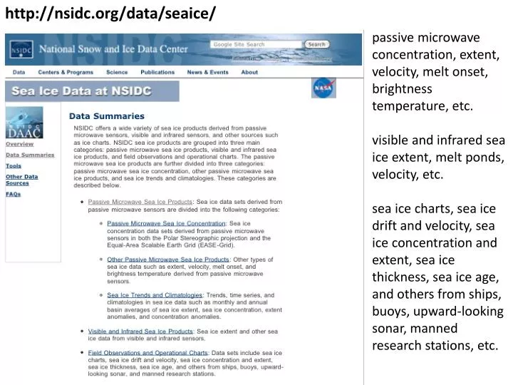
http:// nsidc.org/data/seaice /. passive microwave concentration, extent, velocity, melt onset, brightness temperature, etc. visible and infrared sea ice extent, melt ponds, velocity, etc.

E N D
http://nsidc.org/data/seaice/ passive microwave concentration, extent, velocity, melt onset, brightness temperature, etc. visible and infrared sea ice extent, melt ponds, velocity, etc. sea ice charts, sea ice drift and velocity, sea ice concentration and extent, sea ice thickness, sea ice age, and others from ships, buoys, upward-looking sonar, manned research stations, etc.
http://www-radar.jpl.nasa.gov/rgps/ high-resolution sea ice motion, deformation, age, and thickness
Sea ice temperature and albedo from AVHRR, MODIS, and TOVS: http://www-nsidc.colorado.edu/data/nsidc-0069.html http://modis-snow-ice.gsfc.nasa.gov/sea.html Twice-yearly (spring-fall) ice thickness and roughness from ICESat - http://nsidc.org/data/icesat/ Ice thickness is also available from ERS-1, ERS-2, and ENVISAT Upcoming satellite missions: Cryosat-2 ICESat-II SAR altimeter Laser altimeter planned launch in late 2009 launch in ~2015