Download
1 / 1
60 likes | 256 Views
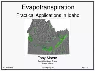
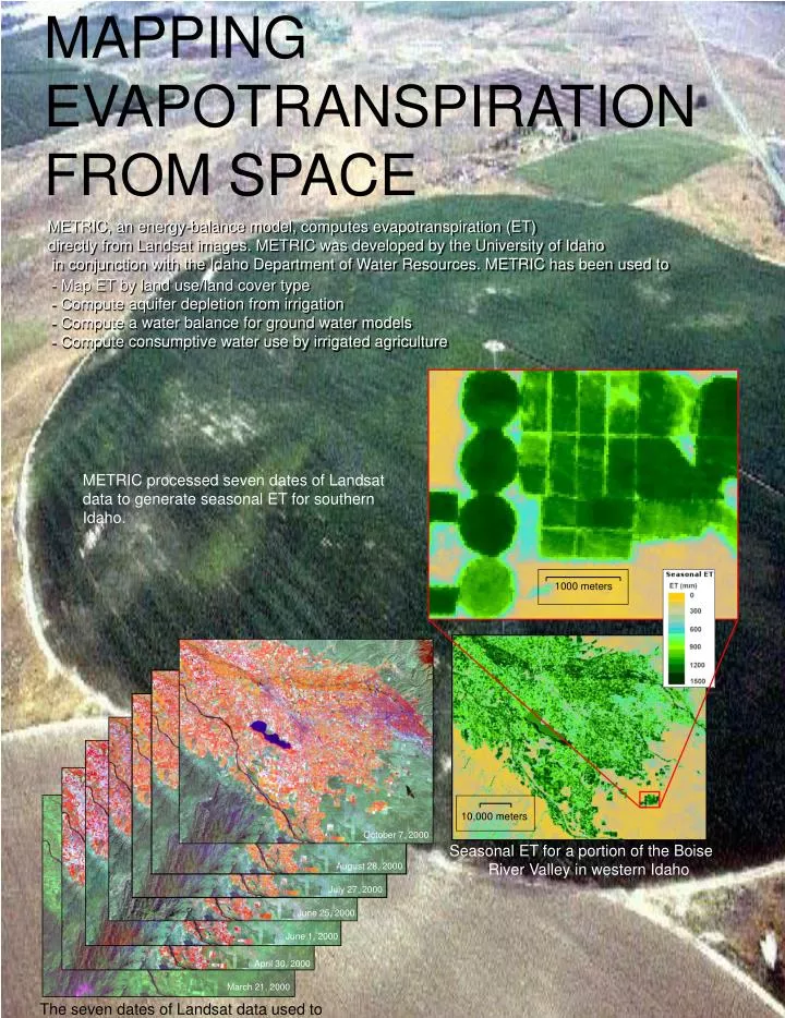
MAPPING EVAPOTRANSPIRATION FROM SPACE. METRIC, an energy-balance model, computes evapotranspiration (ET) directly from Landsat images. METRIC was developed by the University of Idaho in conjunction with the Idaho Department of Water Resources. METRIC has been used to.

E N D
MAPPING EVAPOTRANSPIRATION FROM SPACE METRIC, an energy-balance model, computes evapotranspiration (ET)directly from Landsat images. METRIC was developed by the University of Idaho in conjunction with the Idaho Department of Water Resources. METRIC has been used to - Map ET by land use/land cover type- Compute aquifer depletion from irrigation - Compute a water balance for ground water models- Compute consumptive water use by irrigated agriculture METRIC processed seven dates of Landsat data to generate seasonal ET for southern Idaho. 1000 meters 10,000 meters October 7, 2000 Seasonal ET for a portion of the Boise River Valley in western Idaho August 28, 2000 July 27, 2000 June 25, 2000 June 1, 2000 April 30, 2000 March 21, 2000 The seven dates of Landsat data used to compute seasonal ET by METRIC