Download
1 / 20
560 likes | 1.95k Views
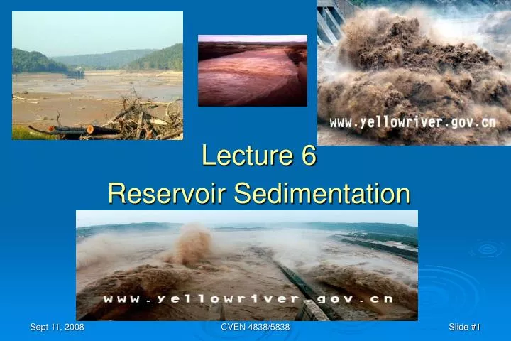
Lecture 6 Reservoir Sedimentation. Physical Processes in Watershed Weathering of rocks – chemical and physical process by which rocks break down into smaller particles. Erosion – detachment and transport of weathered material from one location to another.

E N D
Lecture 6 Reservoir Sedimentation CVEN 4838/5838
Physical Processes in Watershed • Weathering of rocks – chemical and physical process by which rocks break down into smaller particles. • Erosion – detachment and transport of weathered material from one location to another. • Landscape and fluvial transport systems can be divided into zones of erosion or zones of deposition, though both processes occur simultaneously in almost all environments. • Sediment Yield is the amount of eroded sediment discharged by a stream at any given point; it is the total amount of fluvial sediment exported by the watershed tributary to a measurement point and is the parameter of primary concern in reservoir studies. CVEN 4838/5838
Estimating Sediment Yield of a Watershed • Measure the sediment that is being transported in the river at the point of interest. • Use sediment transport models and sampling data • Estimate the erosion in the watershed (e.g. the universal soil loss equation) and then estimate the sediment-delivery ratio. • Empirical formulas for Sediment yield vs drainage area and sediment yield vs. mean annual runoff CVEN 4838/5838
Dynamic Adjustment of River System – Lane’s Relationship Where Qs is Sediment discharge Q is water discharge d is sediment particle diameter S is the slope of the channel CVEN 4838/5838
3 Forms of Sediment Transport in Rivers • Bed Load – Material that moves along the bottom of the channel (by saltation and rolling) as a result of shear stress created by vertical velocity gradients in the streamflow. • Suspended Bed Material Loadbed material that becomes suspended by action of turbulence. • Wash Load – fine material that is carried by the flow in suspension, but is not represented in the bed material. CVEN 4838/5838
Topset beds – bedload material or coarse suspended bedload (delta deposits) Foreset bed - the face of the delta deposits, steeper slope and decrease in grain size Bottomset beds – fine material deposited beyond the delta by turbidity currents or non-stratified flow. (also organic mat’l; floods can introduce layers of larger particles) Depositional Zones in Reservoir CVEN 4838/5838
Consequences of Reservoir Sedimentation • Loss of Storage (yield; reliability) • Upstream: loss of navigable depths • Downstream: degradation of channel; loss of land and habitats • Hydropower: downstream deposits can increase TW depths, decrease efficiency • Abrasion of turbines • Coastal areas: loss of coastlines when silt supply is interrupted CVEN 4838/5838
Loss of Storage due to sedimentation CVEN 4838/5838
Trap Efficiency: Ratio of trapped sediment to incoming sediment (%) (ability of the reservoir to entrap sediment) • a function of • ratio of reservoir volume to mean annual runoff volume (C/I) • sediment characteristics Design for Sediment Deposition: Trap Efficiency CVEN 4838/5838
Design Life of a Reservoir Design Life:the period required for the reservoir to fulfill its intended purpose (or the period over which the economic benefits are projected).Typically 50 to 100 years Design for sediment accumulation:traditionally this meant providing a reservoir storage capacity large enough to store all the accumulated sediment deposits without encroachment on the designed water-storage volume. Calculations of sediment-filling rates Compute for each of successive time intervals: - for storage at beginning of interval, find C/I ratio - determine trap efficiency - calculate accumulated sediments - determine new storage at end of interval CVEN 4838/5838
Sustainable Development • We should develop and use reservoirs for the benefits of present and future generations in a socially, environmentally and economically acceptable manner. • Along with the right to develop and use reservoirs comes the responsibility to meet the needs of present and future generations. • To achieve sustainable development and use of reservoirs and a higher quality of life for all people, we should gradually reduce and eliminate unsustainable patterns of development and use subject to social, environmental, and economic considerations. • Reservoir sedimentation shortens the useful life of reservoirs. Systematic and thorough consideration of technical, social, environmental, and economic factors should be made to prolong the useful life of reservoirs. “The worst enemy of sustainable use of reservoirs is sedimentation.” (Yang) CVEN 4838/5838
Elements of Sediment Management(from Morris and Fan, Reservoir Sedimentation Handbook, Sec 1.2) • Reduce sediment inflowsediment delivery to the reservoir can be reduced by techniqus such as erosion control and upstream sediment trapping. • Route sedimentsSome or all of the inflowing sediment load may be hydraulically routed beyond the storage pool by techniques such as drawdown during sediment-laden floods, off-stream reservoirs, sediment bypass, and venting of turbid density currents. • Sediment removalDeposited sediments may be periodically removed by hydraulic flushing, hydraulic dredging, or dry excavation. • Provide large storage volumeReservoir benefits may be considered sustainable if a storage volume is provided that exceeds the volume of the sediment supply in the u.s. watershed. The required sediment storage volume may be included within the reservoir pool or in one or more u.s. impoundments. • Sediment placementFocus sediment deposition in areas where its subsequent removal is facilitated, or where it minimizes interference with reservoir operation. Configure intakes and other facilities to minimize interference from transported or deposited sediments. CVEN 4838/5838
Sediment Routing • Sediment Pass-Through • Seasonal drawdown • Flood drawdown by hydrograph prediction • Flood drqwdown by rule curve • Venting turbid density currents • Sediment Bypass • On-channel storage • Off-channel storage • Subsurface storage CVEN 4838/5838
Sediment Routing at Three Gorges Dam In flood season, operating level is lowered to increase velocities to carry sediment out. Flood hydrograph is intended to mimic natural hydrograph in terms of both flow and sediment. Sediment passage through the dam will help offset bed degradation d.s. Initially the reservoir will trap bed material, causing channel degradation below the dam, until limited by the formation of a gravel armor layer. After approximately 60 years, the combination of armoring and increased bed material discharge through the dam is expected to halt and possbily reverse d.s. degradation. CVEN 4838/5838
Sediment Routing via Venting of Turbid Density Currents The turbid density current is the gravity-induced movement of a denser (sediment-ladened) fluid under clearer water. Sediment-ladened water enters the reservoir and plunges beneath the clear water, and travels d.s. along the submerged thalweg. It depostis coarser material along the bottom and the current may dissipate. The turbid density current can be vented from the dam through low-level sluices. CVEN 4838/5838
Sanmenxia Key Water Control Project The Sanmenxia dam is situated on the main stream of the Yellow River at the junction of Sanmenxia City in Henan Province and Pinglu County in Shanxi Province .It was the first major project built on the main river as recommended in the Comprehensive Planning of the Yellow River Basin in 1955. It controls 92% of the total drainage area of the river including two of the three major flood source areas and controls 89% of the runoff and 98%of the sediment carrying down the lower Yellow River. Dam construction started in April 1957 and the principal structures completed in September 1960. It consists of a dam, outlet structures and a power plaint. In the original design, the maximum water level in the reservoir was set at elevation 360m, a total storage capacity 64.7 billion m3 ,an installed capacity 1160MW and resettlement of 870,000 people. The reservoir area includes a part of the main river downstream Long men and the lower reaches of tributaries Weihe and Beiluohe River, located in Shanxi , Shanxi and Henan Province, Taking Tongguan as a demarcation, the reservoir area naturally falls into two different types of morphology, that is a lake-type reservoir for the upper stream part and channel-type reservoir in the downstream part. CVEN 4838/5838
After putting into operation, the reservoir was severely silted and the backwater opposites extended rapidly towards the upper stream, threatening the industrial and agricultural production of the lower reaches of the Weihe River. In addition, there were many difficulties to resettle a large number of people and to operate the reservoir according to the original design. In order to alleviate the serious reservoir sedimentation problem and to develop benefits, the late Premier Zhou Enlai presided over a meeting on harnessing the Yellow River in December 1964. During the meeting, a policy of ¡°Ensuring the safety of Xi¡¯an City in the upstream as well as that of the lower Yellow River¡± was set up and decision was made on the reconstruction of outlet Structures to increase the capacity of sluicing sediment and releasing flood, leading to a change of the operational mode of storing water and retaining sediment. The reconstruction work was carried out in two stages: In the first stage, two tunnels were built on the left bank for sluicing sediment and releasing flood and four penstocks were remolded into outlets. The first stage work was completed in August 1968, the discharge capacity had been increased from 3080 to 6100 m3/s at water level 315m. The second stage was to reopen 8 bottom outlets previously used for diversion for sluicing sediment, to lower the intake elevation of the penstocks No. 1~5 for power generation from 300m to 287m, and install five generation units with a total installed capacity of 250MW. The second stage reconstruction commenced in December 1969, 8 bottom outlets opened one after another until October 1971. The first generating unit started to operate at the end of 1973, and the rest were put into operation by the end of 1978. After reconstruction, releasing capacity of all the outlets increased to 10,000m3/s at elevation 315m. and the operational mode of the reservoir has been changed into ¡°storing the clear water and releasing the muddy¡±, i.e. the reservoir stores water and retains sediment in non-flood season (November to next June), managing the water for irrigation and ice flood prevention, while in the flood season (July-October), the water level lowers down for sluicing sediment. Hydropower will be generated all year round. By the operational practice since 1974, it has been proved that the reconstruction of the project and the new operational mode are successful. CVEN 4838/5838
At present, the effective storage capacity of the reservoir below elevation 335m amounts to 5.9 billion m3, in which an effective storage of 1.8 billion m3 below elevation 326m has been kept for long run, giving effective play to comprehensive benefits of summer flood and ice run flood prevention, irrigation, water supply and power generation. When a major flood occurs in the upstream basin of Sanmenxia, the outflow released from the dam would be limited to less than 15,000m3/s through reservoir regulation; when a major flood occurs in the downstream area of the project, the standard for flood prevention in the lower reaches could be increased from less than once in 100 years at present to once in 1,000 years through coordinating the operation of the Sanmenxia, Xiaolangdi Reservoir and Luhun Reservoir on the tributary of Yihe River and Guxian Reservoir now under construction on the tributary of Luohe River. In the past 15years, during ice run period, release from the reservoir was regulated by utilizing the effective storage capacity bellow elevation 326m of the Sanmenxia Reservoir. This has played an important role in reducing the threatening of ice run flood and guarantee the safety of the lower Yellow River, Besides, in coordination with the ice run control, in average, 1.4 billion m3 of water were stored annually in the spring, mitigating to certain extent the contradictions of water shortage for irrigation on both banks, and that for cities and industries such as the Zhongyuan and Shengli Oil Fields on the lower Yellow River in May and June. By 1988, the accumulated output of electricity amounted to 12.0 billion kw¡¤h, equivalent to 700 million yuan. With the mode of operation to store clear water and release the muddy in the reservoir, the rate of aggradation in the lower reaches of the Yellow River has been reduced because the river channel would be scoured in non-flood season due to the release of clear water and during flood season more sediment may be transported by a greater discharge. The modified flow regime is more suitable to sediment transport of the lower reaches. It is estimated that, in average, the annual amount of deposition in the lower reaches has been reduced by about 60 million tons. The practice of operation by water and sediment regulation in the Sanmenxia Reservoir has set an example and provided valuable experiences for solving sediment problems of large sized reservoirs built on sediment laden rivers. CVEN 4838/5838