Download
1 / 46
480 likes | 761 Views
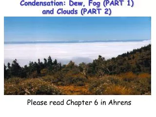
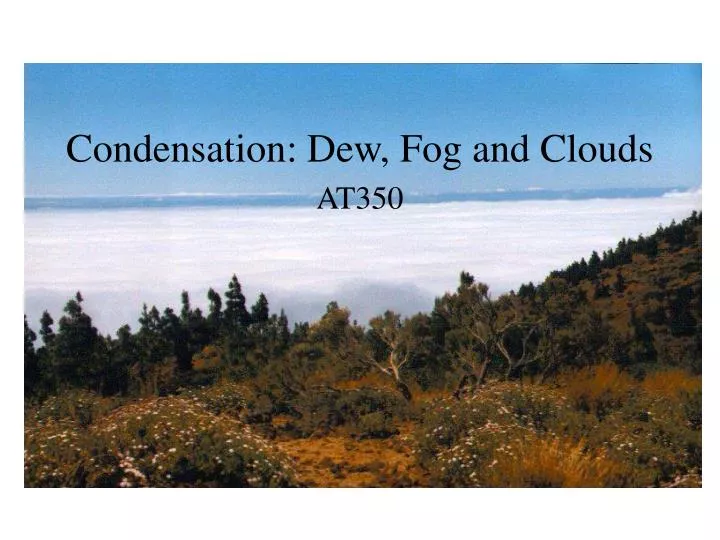
Condensation: Dew, Fog and Clouds. AT350. T=30 C Water vapor pressure=12mb What is Td? What is the sat. water vapor pressure? What is the relative humidity?. T=30 C Water vapor pressure=12mb What is Td? What is the sat. water vapor pressure? What is the relative humidity? ~12/42~29%.

E N D
T=30 C • Water vapor pressure=12mb • What is Td? • What is the sat. water vapor pressure? • What is the relative humidity?
T=30 C • Water vapor pressure=12mb • What is Td? • What is the sat. water vapor pressure? • What is the relative humidity? • ~12/42~29%
POLAR AIR • T=-2 C • Td=-2 C • What is water vapor pressure? • What is sat. water vapor pressure? • What is the relative humidity?
DESERT AIR • T=35 C • Td= 5 C • What is water vapor pressure? • What is sat. water vapor pressure? • What is the relative humidity?
DESERT AIR • T=35 C • Td= 5 C • What is water vapor pressure? • What is sat. water vapor pressure? • What is the relative humidity? • ~9/56~16%
If air is saturated at T=30 C and warms to 35 C, what is the relative humidity? • If air is saturated at T=20 C and warms to 35 C, what is the relative humidity? • If air is saturated at T=-20 C and warms to 35 C, what is the relative humidity?
If air is saturated at T=30 C and warms to 35 C, what is the relative humidity? ~75% • If air is saturated at T=20 C and warms to 35 C, what is the relative humidity? ~43% • If air is saturated at T=-20 C and warms to 35 C, what is the relative humidity? ~2%
Condensation • Condensation is the phase transformation of water vapor to liquid water • Water does not easily condense without a surface present • Vegetation, soil, buildings provide surface for dew and frost formation • Particles act as sites for cloud and fog drop formation
Dew • Surfaces cool strongly at night by radiative cooling • Strongest on clear, calm nights • The dew point is the temperature at which the air is saturated with water vapor • If a surface cools below the dew point, water condenses on the surface and dew drops are formed
Frost • If the temperature is below freezing, the dew point is called the frost point • If the surface temperature falls below the frost point water vapor is deposited directly as ice crystals • deposition • The resulting crystals are known as frost, hoarfrost, or white frost
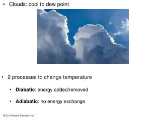
Cloud and fog drop formation • If the air temperature cools below the dew point (RH > 100%), water vapor will tend to condense and form cloud/fog drops • Drop formation occurs on particles known as cloud condensation nuclei (CCN) • The most effective CCN are water soluble. • Without particles clouds would not form in the atmosphere • RH of several hundred percent required for pure water drop formation
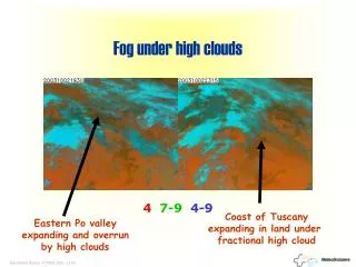
Fogs • Fogs are clouds in contact with the ground • Several types of fogs commonly form • Radiation fog • Advection fog • Upslope fog • Evaporation (mixing) fog
Radiation Fog • Surface radiation and conduction of heat away from the overlying air cool air temperatures near the ground • A layer of air near the ground becomes saturated and fog forms • Fog deepens as radiative cooling from the fog top continues overnight • Solar heating warms the ground and causes the fog to “burn off” from the ground up • What type of meteorological conditions would favor radiation fog?
Advection Fog • Warm air moves (is advected) over cold surface • Cold surface cools warm air • If saturation is reached, fog forms • Common on west coast of U.S. • Warm moist air from Pacific is advected over upwelling cold coastal waters • As foggy air moves ashore, solar heating warms the ground and overlying surface • Fog evaporates near ground • Coastal advection fogs are key moisture sources for California Redwoods
Upslope fog Moist air flows up along sloped plain, hill or mountain Expansion of rising air causes cooling and RH increases Evaporation (mixing) fog Mixing of warm, moist air with colder air produces saturated air parcel Examples Exhale on a cold day Evaporation of water from relatively warm, wet surface and mixing with colder air above. (Smokestack plume, contrails) Other Fog Types
Clouds result when air becomes saturated away from the ground They can be thick or thin, large or small contain water drops and/or ice crystals form high or low in the troposphere even form in the stratosphere (important for the ozone hole!) Clouds impact the environment in many ways Radiative balance, water cycle, pollutant processing, earth-atmosphere charge balance, etc…. Clouds
Cloud classification • Clouds are categorized by their height, appearance and vertical development • High Clouds - generally above 16,000 ft at middle latitudes • Main types - Cirrus, Cirrostratus, Cirrocumulus • Middle Clouds – 7,000-23,000 feet • Main types – Altostratus, Altocumulus • Low Clouds - below 7,000 ft • Main types – Stratus, stratocumulus, nimbostratus • Vertically developed clouds (via convection) • Main types – Cumulus, Cumulonimbus
High clouds White in day; red/orange/yellow at sunrise and sunset Made of ice crystals Cirrus Thin and wispy Move west to east Indicate fair weather Cirrocumulus Less common than cirrus Small, rounded white puffs individually or in long rows (fish scales; mackerel sky) Cirrostratus Thin and sheetlike Sun and moon clearly visible through them Halo common Often precede precipitation High Clouds
Cirrus Cirrus Display at Dawn
Cirrocumulus Cirrocumulus at Sunset
Cirrostratus Cirrostratus with Halo
Altocumulus <1 km thick mostly water drops Gray, puffy Differences from cirrocumulus Larger puffs More dark/light contrast Altostratus Gray, blue-gray Often covers entire sky Sun or moon may show through dimly Usually no shadows Middle Clouds
Altostratus Alto Stratus Castellanus
Altocumulus Alto Cumulus Radiatus
Alto Cumulus Alto Cumulus Undulatus
Stratus Uniform, gray Resembles fog that does not reach the ground Usually no precipitation, but light mist/drizzle possible Stratocumulus Low lumpy clouds Breaks (usually) between cloud elements Lower base and larger elements than altostratus Nimbostratus Dark gray Continuous light to moderate rain or snow Evaporating rain below can form stratus fractus Low Clouds
Stratocumulus cloud streets Stratus undulatus
Stratus A Layer of Stratocumulus Cloud viewed from above
Cumulus Puffy “cotton” Flat base, rounded top More space between cloud elements than stratocumulus Cumulonimbus Thunderstorm cloud Very tall, often reaching tropopause Individual or grouped Large energy release from water vapor condensation Vertically developed clouds
Satellite observations • Satellites can be • Geostationary • Monitors fixed spot on Earth’s surface • Polar orbiting • Orbit poles with Earth revolving below • Satellites observe • Clouds • Water vapor • Precipitation • Surface properties (temperature, snow cover, vegetation, etc…)
Visible and Infrared Satellite Photos IR Visible