Download
1 / 31
320 likes | 481 Views
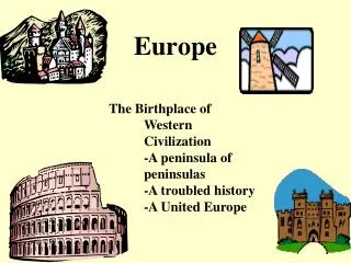
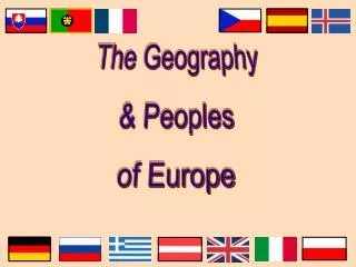
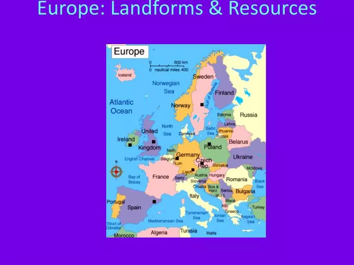
Europe: Landforms & Resources. Peninsulas & Islands. On a map, you can see that Europe is a large peninsula stretching to the west of Asia. Europe itself is made up of many smaller peninsulas. “Peninsula of peninsulas”-nickname

E N D
Peninsulas & Islands • On a map, you can see that Europe is a large peninsula stretching to the west of Asia. • Europe itself is made up of many smaller peninsulas. • “Peninsula of peninsulas”-nickname • Because of the peninsulas, most locations in Europe are no more than 300 miles from an ocean or sea.
Europeans way of life involves using these bodies of water for both business & pleasure.
Northern Peninsulas • In northern Europe, there is the Scandinavian Peninsula. • Occupied by Norway & Sweden • Bounded by the Norwegian Sea, the North Sea, & the Baltic Sea.
In Norway, glaciers carved out fjords-steep U-shaped valleys that connect to the sea & are filled with seawater after the glaciers melt. • Fjords provide great harbors for fishing.
Jutland Peninsula is directly across the North Sea from Scandinavia. • Jutland forms the largest part of Denmark & a small part of Germany.
Southern Peninsulas • Iberian Peninsula is home to Spain & Portugal & the Pyrenees Mountains block off this peninsula from the rest of Europe
Italian Peninsula is home to Italy • Shaped like a boot & extended into the Mediterranean Sea.
Balkan Peninsula is bordered by the Adriatic, Mediterranean, & Aegean Sea. • It is mountainous & transportation is difficult.
Islands • The larger islands are Great Britain, Ireland, Iceland, & Greenland. *all located in the North Atlantic
Smaller islands in the Mediterranean are Corsica, Sardinia, Sicily, & Crete. • All of Europe’s islands have depended upon trade.
Mountains & Uplands • Mountains & uplands of Europe may be viewed as walls because they separate groups of people. • They make it difficult for people, goods, & ideas move easily from one place to another. • These landforms also affect the climate. • For example, chilly north winds rarely blow over the Alps into Italy, which has a mild climate as a result.
Mountain Chains • The most famous chain in Europe is the Alps. • The Alps arc across France, Italy, Germany, Switzerland, Austria, & the northern Balkan Peninsula. • They cut off Italy from the rest of Europe.
The Pyrenees restrict movement from France to Spain & Portugal. • Both ranges provide opportunities to ski & hike.
The Apennine Mountains run down Italy & divide the Italian Peninsula between east & west.
The Balkan Mountains block off the Balkan Peninsula from the rest of Europe. • Historically, they have also isolated the peninsula’s various ethnic groups from each other.
Uplands • Mountains & uplands differ from each other in their elevation. • Uplands are hills or very low mountains that may contain mesas & high plateaus. • Some uplands of Europe are eroded remains of ancient mountain ranges.
Rivers: Europe’s Links • Europe has a network of rivers that bring people & goods together. • Rivers aid in economic growth. • Historically rivers have also aided in the movement of ideas.
Two major rivers are the Danube & the Rhine. • They have served as waterways for centuries. • Danube touches 9 countries & links Europeans to the Black Sea.
Rhine flows from the interior of Europe north to the North Sea.
Fertile Plains: Europe’s Bounty • One of the most fertile agriculture regions in the world is in the Northern European Plain. • Stretching in a huge curve across parts of France, Belgium, the Netherlands, Denmark, Germany, & Poland.
This plain is relatively flat & is very desirable farm land. • However, the plain’s flatness has allowed armies & groups of invaders to use it as an open route into Europe.
Resources Shape Europe’s Economy • Europe has abundant supplies of 2 natural resources—coal & iron ore—needed for an industrialized economy. • These resources make it possible to produce steel.
Areas where the minerals exist are heavily industrialized & good transportation exists. • As a result, these regions have suffered from industrial pollution.
Energy • Oil & Natural Gas were found beneath the North Sea floor in 1959. • In 1971, new technologies made it possible to construct offshore oil rigs in the North Sea despite its stormy waters. • Oil is pumped from rigs as far as 400 miles out to sea.
The North Sea oil fields are major sources of petroleum for the world.
Agricultural Land • About 33% of Europe’s land is suitable for agriculture. • The world average is 11-Europe is especially well off. • The land produces a variety of crops: grains, grapes, olives, and even cork. • Timber is cut from the forests in the Scandinavian Peninsula & the Alps
Resources Shape Life • Resources directly affect the foods people eat, the jobs they hold, the houses they live in, & even their culture.
Ireland lacks energy sources. • Solution: cut peat from large beds & burn it. • Peat: partially decayed plant matter found in bogs.