Download
1 / 23
230 likes | 367 Views
FOR557. Symbology 2. Outline. Symbology and mapping Classification examples Standard symbols Tricks Quiz 2. Symbology and Mapping. Making maps is the next module Mapping is Cartography Symbolization is basic to good maps What’s good map? One that communicates your message efficiently

E N D
FOR557 Symbology 2
Outline • Symbology and mapping • Classification examples • Standard symbols • Tricks • Quiz 2
Symbology and Mapping • Making maps is the next module • Mapping is Cartography • Symbolization is basic to good maps • What’s good map? • One that communicates your message efficiently • Sierra Club vs. Adirondack league club
For example If you were trying to make the case that you should be able to limit the publics use of your lake which map would you use?
Steps to Creating a Map • Define the Purpose of the map • Restate into a design problem • Design solution – • Symbolization • arrangement of map’s elements • Graphic design
Graphic design • Which elements of a map do you want the viewer to notice first? • The inset map? The main map? The legend? Features in the map? • Some parts will be like background • while others are foreground
Back to symbology • Through symbology you can • Draw reader’s attention from one detail and toward another • OR • You can distort the data so that the reader comes away with the wrong understanding of what is there.
Parts of a map • Main map • Smaller scale inset maps showing location • Larger scale inset maps showing detail • Title of the map (usually prominent) • Subtitles • Legend • Borders and neatlines • Scale (graphic) • North Arrow • Metadata
Mapped Area Title Border Legend Neatline Gradicule Purpose, metadata Unmapped Area Credits Scale
Classification • DEMO • See link below for an excellent discussion of classification • http://gis.washington.edu/esrm250/lessons/arcmap_basics/displaying_layers.html
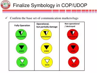
Standard symbols • The following standard symbols are drawn from the USDA Geospatial Symbology • The entire document is located at • http://www.itc.nrcs.usda.gov/scdm/docs/SPG-GeospatialSymbology.pdf
Tricks • Printing maps a getting them into word or other Microsoft stuff • Eye dropper • Graphics tools • Selecting stuff in the layout view
Printing • It is often difficult to print maps directly from ArcMap • So, since you have to turn in a word document anyway… • Save as a .png • Do file>Export • Select .png as “Save as type” • Save • In word select Insert>Picture>From file • In word you can format the insertion by right clicking the image and selecting Format picture • Click Layout and select how you want text wrapped (usually square) • If you insert the picture in to a text box you have more control over where the picture is placed. I usually un-check “move with text” and “allow overlap”
Eye Dropper • A tool you can add to your project interface that allows you to identify the parameters of the colors in your map • Particularly useful if you have two sets of data in the same map! • See help – use the search tool, enter in “eye dropper” and click on “using the eye dropper tool” to learn how to stick it into your project profile and create named colors
Selecting stuff • When you have a compete map layout and want to change something, say, the N arrow it can be hard to select • The trick is to start drawing the selection box OUTSIDE of the map and extend the box to include the thing you wanted to select • Booby Trap: Usually when you insert a thing like a text box it will appear as a little tiny thing in the middle of the map. Hard to see and hard to select