Download
1 / 39
390 likes | 513 Views
NOAA Hazardous Weather Testbed Experimental Forecast Program (EFP) Steven Weiss (SPC) and Jack Kain (NSSL). EFP. EWP. The NOAA Hazardous Weather Testbed.

E N D
NOAA Hazardous Weather Testbed Experimental Forecast Program (EFP) Steven Weiss (SPC) and Jack Kain (NSSL)
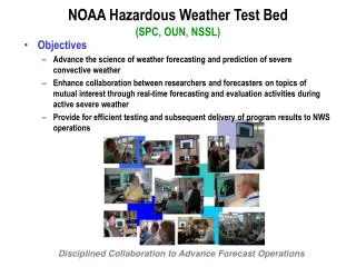
EFP EWP The NOAA Hazardous Weather Testbed • An organization that supports and promotes collaborative research activities between NSSL, SPC, OUN, and the broader national meteorological community of researcher scientists, academia, and forecasters. Two Main Program Areas… Experimental Forecast Program Experimental Warning Program Prediction of hazardous mesoscale and stormscale events from a few hours to a week in advance on spatial domains ranging from several counties to the CONUS. Detection and prediction of hazardous mesoscale and stormscale events up to several hours in advance on spatial domains of fractions of counties to counties.
EFP EWP The NOAA Hazardous Weather Testbed • An organization that supports and promotes collaborative research activities between NSSL, SPC, OUN, and the broader national meteorological community of researcher scientists, academia, and forecasters. Two Main Program Areas… Experimental Forecast Program Experimental Warning Program Prediction of hazardous mesoscale and stormscale events from a few hours to a week in advance on spatial domains ranging from several counties to the CONUS. Detection and prediction of hazardous mesoscale and stormscale events up to several hours in advance on spatial domains of fractions of counties to counties.
Focus of NOAA HAZARDOUS WEATHER TESTBEDEFP – SPC/NSSL Spring Experiments (Primary Collaborators) • FY-1996: Winter Weather Short Term Forecasts (WFO OUN) • ARPS Evaluation (CAPS, WFO OUN) • FY-1997: Winter Short Term Advisories (WFO OUN) • SPC Winter Weather Program Implemented • FY-1998: Fire Weather • SAMEX - ensemble forecasting (EMC, CAPS ...) • MEaPRS - MCS, Dual Polarity Radar, Electrification (NCAR, etc.) • SCAN Day 3 Outlook (NCAR, MDL, WFO LWX) • FY-1999: Fire Weather • SCAN Day 3 Outlook (NSSL, NCAR, MDL, WFO LWX) • Probabilistic Convective Outlook • STEP - cloud electrification in Kansas (OU, NCAR) • FY-2000: Convective Initiation, Hail Forecasting, Objective Analysis (FSL, EMC) • Impact of CPS on model soundings, RUC-based hourly mesoanalysis • FY-2001: Convective Initiation, Evolution related to Watch Lead Time (FSL, EMC) • PTAX - Precipitation type (HPC) • FY-2002: IHOP- impact of moisture, PBL, boundaries on convective initiation (NCAR, EMC, FSL) • Operational & Experimental NWP Evaluation • FY-2003: Operational development & test of SREF and initial convection-allowing WRF (EMC, FSL) • SREF implemented in SPC operations • BAMEX summer forecast support • FY-2004: Large domain convection-allowing and mesoscale WRF evaluation (NCAR, EMC, CAPS, FSL) • Experimental 4.5 km WRF-NMM “SPC Run” produced once daily and continuing today • FY-2005: Convection-allowing WRF sensitivity to resolution; WRF supercell detection (CAPS, EMC, NCAR) • MCS maintenance and motion summer forecast experiment • Operational high resolution WRFs placed in EMC HRW run slot • FY-2006: Pre-implementation test and evaluation of 12km NAM-WRF (EMC) • FY-2007: Convection-allowing 10 member WRF ensemble; higher resolution WRF tests (CAPS, EMC, NCAR)
Focus of NOAA HAZARDOUS WEATHER TESTBEDEFP – SPC/NSSL Spring Experiments (Primary Collaborators) • FY-1996: Winter Weather Short Term Forecasts (WFO OUN) • ARPS Evaluation (CAPS, WFO OUN) • FY-1997: Winter Short Term Advisories (WFO OUN) • SPC Winter Weather Program Implemented • FY-1998: Fire Weather • SAMEX - ensemble forecasting (EMC, CAPS ...) • MEaPRS - MCS, Dual Polarity Radar, Electrification (NCAR, etc.) • SCAN Day 3 Outlook (NCAR, MDL, WFO LWX) • FY-1999: Fire Weather • SCAN Day 3 Outlook (NSSL, NCAR, MDL, WFO LWX) • Probabilistic Convective Outlook • STEP - cloud electrification in Kansas (OU, NCAR) • FY-2000: Convective Initiation, Hail Forecasting, Objective Analysis (FSL, EMC) • Impact of CPS on model soundings, RUC-based hourly mesoanalysis • FY-2001: Convective Initiation, Evolution related to Watch Lead Time (FSL, EMC) • PTAX - Precipitation type (HPC) • FY-2002: IHOP- impact of moisture, PBL, boundaries on convective initiation (NCAR, EMC, FSL) • Operational & Experimental NWP Evaluation • FY-2003: Operational development & test of SREF and initial convection-allowing WRF (EMC, FSL) • SREF implemented in SPC operations • BAMEX summer forecast support • FY-2004: Large domain convection-allowing and mesoscale WRF evaluation (NCAR, EMC, CAPS, FSL) • Experimental 4.5 km WRF-NMM “SPC Run” produced once daily and continuing today • FY-2005: Convection-allowing WRF sensitivity to resolution; WRF supercell detection (CAPS, EMC, NCAR) • MCS maintenance and motion summer forecast experiment • Operational high resolution WRFs placed in EMC HRW run slot • FY-2006: Pre-implementation test and evaluation of 12km NAM-WRF (EMC) • FY-2007: Convection-allowing 10 member WRF ensemble; higher resolution WRF tests (CAPS, EMC, NCAR) Formal SPC/NSSL Spring Experiments began in 2000
Severe Weather Forecasting • Key premise - We must use knowledge of the environment and convective processes to determine the spectrum of storms that are possible, where and when they may occur, and how they may evolve over time
Severe Weather Forecasting • Observational data • Environment not sampled sufficiently to resolve key fields (especially 4D distribution of water vapor) • Uncertainty in current atmospheric state • Applies to pre-convective or near-storm environment • Inherent uncertainty in severe storm forecasting using environmental information alone • Different storm types can occur within similar environments • Similar storm types can occur in different environments
Relationship Between Environment and Storm Types Significant Tornadic and Non-Tornadic Supercells share similar parts of parameter space MLCAPE - ESRH Scatterplot (from Thompson et al 2005)
Severe Weather Forecasting • Mesoscale models • Increasingly important for convective forecasting beyond 6-12 hr for evolution of environment • Do not resolve phenomena such as thunderstorms • Mesoscale models provide limited guidance about convective mode (e.g., discrete cells, linear, multicell) • No information about likelihood of solution occurring • Model errors related to errors in initial condition specification and physics formulations
NOAA Hazardous Weather TestbedEFP - SPC/NSSL Spring Experiments • Recent Spring Experiments examined Short-Range Ensembles and convection-allowing WRF models • Can new NWP concepts provide useful guidance for severe weather forecasting? • Primary partnerships with EMC, NCAR, and OU-CAPS • Developed & tested many new SREF and high resolution WRF guidance tools that were subsequently transferred to operations SREF Spaghetti Chart 4.5 km WRF-NMM Reflectivity
Hazardous Weather Testbed Unique Benefits • The close working relationship between operational and research meteorologists has fostered • Increased appreciation by Research Meteorologists of forecaster insights, and operational constraints and requirements • Education of Operational Forecasters about NWP models, other research and diagnostic tools, and application of scientific knowledge to severe weather forecasting • Accelerated transfer of useful new technologies, products and diagnostic and prediction tools from research to operations
SREF Combined Probability (Prob CAPE >= 2000 J/kg) X (Prob Shear >= 40 kt) X (Prob Conv. Pcpn >= .01 in) Green solid= Percent Members; Shading >= 20% • Combined probabilities very useful • Quick way to determine juxtaposition of basic parameters • Overlap area where “sufficient” CAPE and Shear are forecast and convection is possible
Simulated Reflectivity in WRF • High res WRF reflectivity can provide mesoscale and near stormscale details not seen in traditional output 21 hour forecasts valid 21 UTC 15 Nov 2005 NAM 3 hr Pcpn 4.5 km WRF-NMM Reflectivity
4 km WRF-ARW 4.5 km WRF-NMM 24 hr Forecasts Valid 00 UTC 12 May 2005 2 km WRF-ARW RADAR VERIFICATION
WRF 24 hr Reflectivity ForecastsValid 00z 26 May 2005 ARW4 ARW2 NMM4 RADAR 4.5 km WRF-NMM 4 km WRF-ARW 24 hr Forecasts Valid 00 UTC 26 May 2005 2 km WRF-ARW RADAR VERIFICATION
Use of SREF and WRF in Severe Weather Forecasting • SREF and convection-allowing WRF models supplement traditional deterministic models in severe weather forecasting • SREF provides information about range of possibilities and can help quantify uncertainty • Ingredients-based approach using predicted environment • Improved by statistical post-processing (e.g., calibration)
Use of SREF and WRF in Severe Weather Forecasting • Convection-allowing WRF models offer insights into convective initiation, evolution, mode and intensity • Often credible mesoscale prediction of convective systems • 4 km grid length permits “approximation” of stormscale structures • Key forecaster challenge • WRF convective forecasts often appear plausible • When to believe mesoscale/stormscale details and when not to? • Uncertainty is inherent in convective forecasting • Suggests role for high resolution ensembles • HWT Spring Experiment 2007
Evaluating WRF Model Output forSevere Weather Forecasting: The 2007 NOAA HWT Spring ExperimentKey Contributors Steve Weiss, David Bright, Greg Carbin, Jason Levit NOAA/NWS/Storm Prediction Center Jack Kain, Mike Coniglio, Dave Stensrud NOAA/OAR/National Severe Storms Laboratory Ming Xue, Fanyou Kong, Dan Weber, Kevin Thomas University of Oklahoma/Center for Analysis and Prediction of Storms Morris Weisman, Greg Thompson National Center for Atmospheric Research Zavisa Janjic, Matthew Pyle, Jun Du NOAA/NCEP/Environmental Modeling Center David O’Neal Pittsburgh Supercomputing Center
2007 Spring Experimenthttp://hwt.nssl.noaa.gov/Spring_2007 Scientific Objectives (Primary): • Continue to explore convection-allowing WRF models - Five runs: x = 2 km (CAPS) x = 3 km (NCAR) x = 4 km (EMC, NSSL, CAPS) - Evaluate storm behavior, PBL structure, & impacts of physics, resolution • NEW FOCUS (2007-09): Explore convection-allowing WRF ensembleforecasts (SSEF) • Year 1: • 10 WRF-ARW members • x = 4 km over 3/4 CONUS • 6 members phys-only perts, 4 members with IC & phys perts • Use 21Z SREF for initial conds. - examine 21-33 h forecasts
2007 Spring Experimenthttp://hwt.nssl.noaa.gov/Spring_2007 When: • 8 am to 4 pm daily from 30 April to 8 June Where: • In new NWC HWT between OUN WFO and SPC Participation: • ~60 researchers and forecasters from government agencies, academia, and the private sector • 5-10 active participants at any time
HWT Spring Experiment 2007 Participating institutions: NOAA Agencies Universities Gov’t Agencies - NCEP/AWC (2) - NWS/OUN - Albany-SUNY (2) - NCAR (5) - NCEP/EMC (3) - NWS/RAP - Arizona - Env. Canada (6) - NCEP/HPC - NWS/SLC - Colorado St. - UK Met Office - NCEP/SPC (9) - NWS/SRH - Iowa State - NWS/BTV - OAR/NSSL (4) - NC State (4) Private Sector - NWS/LWX - OAR/GSD (3) - Oklahoma (2) - Merrill Lynch - NWS/MAF - OAR/PSD - Penn State - FirstEnergy - Purdue (2) - UNC-Charlotte - York (Ontario)
2007 Spring Experimenthttp://hwt.nssl.noaa.gov/Spring_2007 • Focus • Use of SSEF to quantify information about predicted storm location, timing, mode, intensity, and possible hazards • Some Key Challenges • Run 15 convection-allowing WRF models at 4 computing centers and transferring unprecedented volumes of data in a reliable and timely manner • Display output from five deterministic WRF models using operational N-AWIPS workstations • Devise ways to extract useful information for severe weather forecasting from a 10 member 4-km WRF ensemble • Produce SSEF product displays that are meaningful to forecasters
2007 Spring Experimenthttp://hwt.nssl.noaa.gov/Spring_2007 Daily Operations (morning): • Produce a preliminary SPC-like probabilistic forecast for severe weather for region of interest by 16Z • Forecast valid from 18-00Z, 21-03Z, or 00-06Z • Use information currently available to SPC operations; includes output from 2-4 km deterministic WRF model forecasts • Produce an updated graphical forecast by 17Z after interrogating storm-scale ensemble output
Some Types of SSEF Products • Reflectivity • Spaghetti, mean, median, probability matching, exceedance probability, maximum, postage stamps, linear mode • Microphysics dependent • Updraft Helicity (Supercell Indicator) • Exceedance probability, maximum • Resolution dependent • Maximum Updraft Vertical Velocity (Hail) • Resolution dependent • Lowest Level Maximum Wind (Wind Gust Potential) • Exceedance probability, maximum
Central Tendency Plots for Reflectivity “prob matched” mean mean median BREF
Probability of Reflectivity > 40 dBZ Within a Radius @ grid point + 10 miles + 25 miles BREF > 40 dBZ
Probability of Reflectivity > 40 dBZ Within a Radius @ grid point + 10 miles + 25 miles BREF > 40 dBZ
2007 Spring Experimenthttp://hwt.nssl.noaa.gov/Spring_2007 • Daily operations: Rate preliminary & final forecasts from previous day on 0-10 scale Final forecast: Preliminary forecast: 8 9
Prob refl > 40 dBZ: Obs refl > 40 dBZ: Preliminary forecast: Final forecast:
6 hr Probability of Linear Convective Mode (Refl > 35 dBZ; Aspect Ratio 5:1; Length > 200 mi) F027-F033: Valid 00-06 UTC 15 May 2007 + 25 miles F027: Valid 00 UTC 15 May 2007 Linear mode + 25 miles
6 hr Probability Linear Convective Mode Radar 02 UTC 15 May 2007
HWT EFP Spring Experiment SSEF Summary • SSEF proof-of-concept testing and initial product design successful • Unprecedented technological accomplishments • Fostered intensive collaboration between research and operations • Probabilistic forecast information shows promise • Spread-skill relationship more apparent in strongly forced situations • For detailed mode information need to see reflectivity from individual members • Postage stamps considered very important • Help assess impact of various physics and IC perturbations
HWT EFP Spring Experiment SSEF Summary • Key Challenges • Large sensitivity evident to initial conditions (21z versus 00z and impact of IC perturbations) • Cold start from NAM • Need to develop appropriate data assimilation methods for convection-allowing models (including radar, lightning, etc.) • What are appropriate perturbation strategies for SSEF systems? • Sensitivity of convective scale parameters (e.g., UH) to resolution makes establishment of meaningful thresholds difficult • Better ensemble systems result from better models • WRF model systems still under development • Linking SSEF to mesoscale environment analysis and predictions • If we don’t get environment better, improvements are problematic • High performance computing, networking, and workstation requirements needed for operational applications
HWT EFP Spring Experiment SSEF Summary • Tentative Future Plans • SSEF is multi-year project partially funded by CSTAR • 2008 • Build off 2007 results to construct better ensemble with improved statistical attributes and physical processes • Include WRF-NMM members for multi-model diversity • Incorporate 3DVAR cloud and radar data into 2 members • Launch On-Demand 2 km WRF runs over movable regional domain • 2009 • Increase resolution - SSEF at 2 km and On-Demand at 1 km • Replace 3DVAR with GSI – radar and satellite data assimilation • Continue to leverage new high performance computing and networking capabilities (NSF-LEAD, TeraGrid)
2007 Spring Experimenthttp://hwt.nssl.noaa.gov/Spring_2007 Did the addition of storm-scale ensemble output result in better forecasts?