Download
1 / 15
150 likes | 289 Views
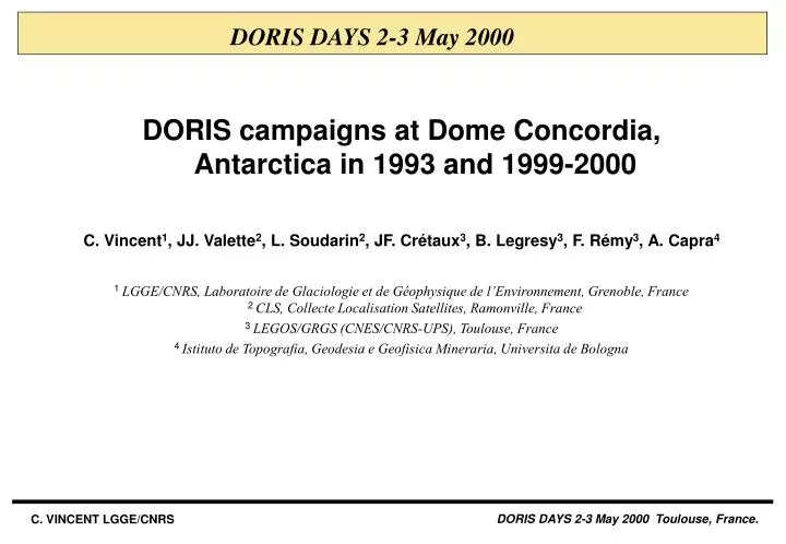
DORIS DAYS 2-3 May 2000. DORIS campaigns at Dome Concordia, Antarctica in 1993 and 1999-2000 C. Vincent 1 , JJ. Valette 2 , L. Soudarin 2 , JF. Crétaux 3 , B. Legresy 3 , F. Rémy 3 , A. Capra 4

E N D
DORIS DAYS 2-3 May 2000 DORIS campaigns at Dome Concordia, Antarctica in 1993 and 1999-2000 C. Vincent1, JJ. Valette2, L. Soudarin2, JF. Crétaux3, B. Legresy3, F. Rémy3, A. Capra4 1 LGGE/CNRS, Laboratoire de Glaciologie et de Géophysique de l’Environnement, Grenoble, France2 CLS,Collecte Localisation Satellites, Ramonville, France 3 LEGOS/GRGS (CNES/CNRS-UPS), Toulouse, France 4 Istituto de Topografia, Geodesia e Geofisica Mineraria, Universita de Bologna
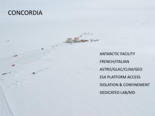
Dome Concordia Base on the Antarctic continent open from December to February since 1996, permanent by 2003 Management by IFRTP Concordia : French - Italian glaciological research project (LGGE/DISTART,...) topics : snow accumulation, ice thickness, ice flowing … EPICA : European project for deep ice coring topics : ice cap response to global climate changes, north-south hemisphere coupling...
Why a drilling location there? Interests of this continental dome : T < -25°C, no summer ice melting excellent location for a whole Antarctic record 3300 m thickness long and continuous climate record 400 Ka least disturbed ice sequence at the dome summit (minimal ice flow correction)
Main geodetic informations needed Questions Technique 1996 Position of the dome summit ? ERS-1 altimeter (Rémy) GPS (Ceffalo) Airbone VHF radar (Tabacco) for layering 2000 Absolute 3D ice surface velocity ? DORIS 1993 and 1999-2000 (C. Vincent) local deformation ? GPS 1995-1998 (A. Capra) ERS-1 Insar 1996 (B. Legrésy)
Charming but constraining place (1) Equipment suffering :beacon specification from -20° to +55°Cgradient < 10°/hr Generator failures USO drift of a few 10-11/jr (still under specification)
Charming but constraining place (2) Scientist suffering : Dry but freezing summertime(4 g/cm2 equivalent water a year) What geodetic « monumentation » ?How to prevent from stake subsidence? How to measure snow accumulation ?
CLS DORIS Data Processing Center, Toulouse Onboard instrument controlTelemetry acquisition and preprocessingOperational orbit and stations position (48 h delay) 2 days delay Dome C operational location (height) Spot 4 data validation
DORIS campaigns 10 km 5 m isolines Drilling site D1 Doris main site (IERS id. : 66009 in 93 - 66013 in 99)D2 Doris ancillary site (66014) DORIS observations at main point (D1)
Data processing At GRGS/CLS DORIS data analysis center for IERS and IDS with GINS/DYNAMO software and the most recent models : GRIM5 (Biancale et al.), atmospheric effects Geodetic parameters : satellites orbit, stations position and velocityEmpirical coefficients : air drag, solar pressure radiation, Hill residual forces, zenital tropospheric delayInstrumental parameters : USO frequency bias
Absolute velocity corrections Antarctic plate tectonic motion deduced from DORIS at Dome Concordia : in latitude : -9.4 mm/yrin longitude : 0.4 mm/yr (Crétaux et al. 1998) Post glacial rebound uplift : less than 1-3 mm/yr
Preliminary DORIS results 2 months global network solutions (Nov-Dec 93 and 99) Typical precision : 7 parameters Helmert transformation (versus solution 1993) 3D coordinates changes over 6 years (same réf. point, plate motion is removed)
Contribution to ice core analysis (1) DORIS 3D absolute velocity gives an input for numerical ice flow model in depth. Essential for cores dating. DORIS results in horizontal : 0.6 cm/yr in latitude -1.8 cm/yr in longitude agree with balance model between snow accumulation and ice flow induced by gravity (figure) (Legresy)
Contribution to ice core analysis (2) DORIS results in vertical : -9.6 cm/yr Probably the first absolute determination of the vertical velocity observed snow accumulation at the top of the stake (height level change) : 35 cm over the 6 years while 10 cm/yr is expected (Petit et al.) Error observation or snowfall anomaly ? Mass balance between snowfall and ice flow towards the ocean ? Sea level and climat changes implications
Contribution to radar remote sensing observations SAR Interferometry maps relative surface velocity in the line of sightERS SAR interferogram (69 days interval) shows maximum of 3 cm/yr DORIS gives the absolute ITRF tie of the velocity fieldsSpace Radar Altimetry maps ice topography within 10-20 cm but an in-situ calibration is needed, moreover the signal penetration depends on the snow structureDORIS gives the height reference and its variations in time
Conclusions DORIS (93-99) component of CONCORDIA project confirms that a very low absolute horizontal ice surface velocity affects the EPICA drilling (< 2 cm/yr). Also vertical flow determination as a first. DORIS absolute geodetic approach fully completes GPS survey and calibrates radar satellite remote sensing techniques (with future missions ERS2, ENVISAT, IceSat, CRYOSAT). Proposal to IDS for repeated DORIS campaigns at Dome Concordia