Download
1 / 49
500 likes | 647 Views
Alexandria Digital Earth Prototype (ADEPT). digital library services in support of learning. Outline. Introduction & overview a motivating example The Digital Earth metaphor Necessary basis: the Alexandria Digital Library ADEPT geo-information services Iscape creation & use

E N D
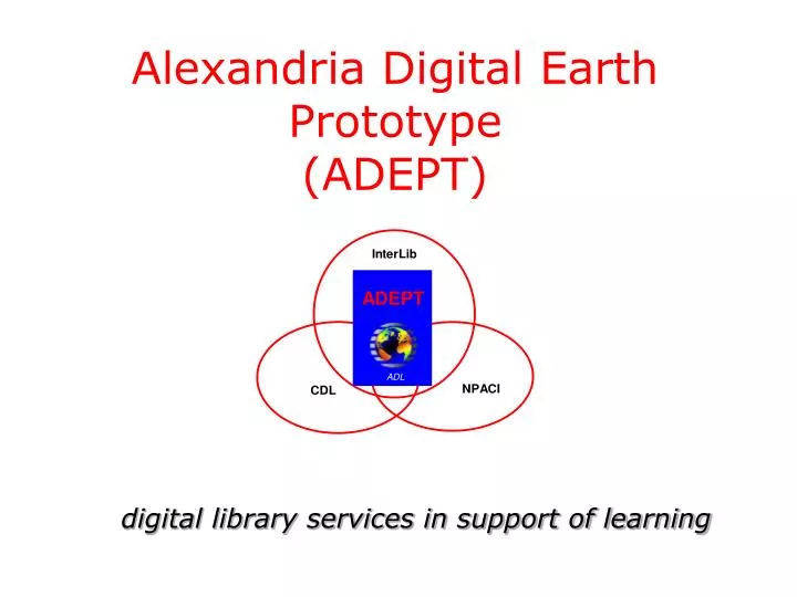
Alexandria Digital Earth Prototype(ADEPT) digital library services in support of learning
Outline • Introduction & overview • a motivating example • The Digital Earth metaphor • Necessary basis: the Alexandria Digital Library • ADEPT • geo-information services • Iscape creation & use • architecture & scalability • learning services & evaluation • Management & budget • Review issues & responses • Deliverables
Who we are • UCSB • Alexandria Digital Library • Davidson Library and Map & Imagery Laboratory • Computer Science, Electrical & Computer Engineering,Geography, and Psychology departments • Instructional Development • UCLA • University of Georgia • CDL & SDSC (NPACI partners) • InterLib and other university partners • Public sector (federal & state government) andprivate sector partners
Summary overview • Two phases in ADL’s development: • DLI-1: access to libraries of useful collections • DLI-2: integration & use of accessible information • beyond the library metaphor • Operational ADL: a necessary basis for information use • Initial applications of ADEPT services: • undergraduate learning in classrooms/studies/libraries • emergency response, virtual museums & stores, digital government • Internet-accessible information as models of the world • Digital Earth metaphor for access and presentation • Iscape concept for organization and use of information
3.141 2.718 ADEPT in a learning environment • Example: a class on flood management • Instructor prepares class material • discovers relevant information • constructs meta-information for joint resource use • compatibility of datasets and simulation models • integrates information into Iscapes (virtual DLs) • Instructor & students interact using Iscapes • request simulations with different datasets/parameters • Students use ADEPT in group & private study situations • group discovery, access, organization, use • support of information life cycle
Outline • Introduction & overview • a motivating example • The Digital Earth metaphor • Necessary basis: the Alexandria Digital Library • ADEPT • geo-information services • Iscape creation & use • architecture & scalability • learning services & evaluation • Management & budget • Review issues & responses • Deliverables
The Digital Earth metaphor • Learning about the Earth • information • processes • scenarios • The organizational metaphor • desktop, office, workbench • Earth itself • immersion • dynamics
Digital Earth background • The Gore speech • exploring the Earth’s environments • physical and social • NASA • the sunlit Earth • immersive environment • workshops • Organizing information by place • what do you have about there? • USGS Gateway to the Earth • NRC Distributed Geolibraries
ADEPT and simulation • Understanding Earth processes • social and physical • ADL data are static • boundary conditions for simulation • exploration of dynamic scenarios • GIS technology is static • links to the Utrecht group, Peter Burrough • two short demonstrations • diffusion • tectonic
Three probabilities for dispersion • Probability of individual reaching a given distance from the parent • Probability that habitat permits individual to establish • Probability that individual produces new offspring
Simple dispersion functions Probability of establishment
Example of diffusion modeling • Dispersion of individuals over a space in which the resistance to movement is variable • individuals need to work together to colonize new areas diffusion
Relativevertical displacement Faults Modeling uplift in Sabah, Malaysia (2/3) • Over a period of several million years, movement along the faults has created long, sediment-filled valleys Sediment
Modeling uplift in Sabah, Malaysia (3/3) • The demo illustrates: • a simplified model of normal faults and landform before uplift • reaction of landform to gradual vertical displacement along the parallel normal faults • erosion and deposition as a result of vertical movements (red is erosion, blue is deposition) • emergent behaviour of rivers leading to development of braided streams tectonics
Outline • Introduction & overview • a motivating example • The Digital Earth metaphor • Necessary basis: the Alexandria Digital Library • ADEPT • geo-information services • Iscape creation & use • architecture & scalability • learning services & evaluation • Management & budget • Review issues & responses • Deliverables
ADL overview • Operational digital library • located within UCSB’s Map and Imagery Laboratory • staff of “digital librarians” and systems personnel • three-tier architecture • Java client • Java middleware • heterogeneous databases • under continuous development • separately funded • interfaces, workspaces, collections, catalogs, gazetteers • planned incorporation into CDL • Research testbed • advanced interface, geospatial processing & database services
ADL: new and ongoing activities • CDL • NPACI • D-Lib Test Suite • GeoWorlds • NASA/ESDIS Prototyping Program • University of Aberdeen, Scotland • Digital Gazetteer Information Exchange (DGIE) • Nanyang Technological University, Singapore • Neural network analysis of user/use data • Utrecht University GIS group • New interactions being developed
Outline • Introduction & overview • a motivating example • The Digital Earth metaphor • Necessary basis: the Alexandria Digital Library • ADEPT • geo-information services • Iscape creation & use • architecture & scalability • learning services & evaluation • Management & budget • Review issues & responses • Deliverables
ADEPT services Iscape construction collection building discovery search geo-information information use and procedure application collaborative interaction
ADEPT geo-information services (1/2) • Symbolic & textual information • gazetteer (named places geographic coordinates) • mappings between representations • reasoning about relations between representations • geo-ontology (vocabularies) • domain-specific (e.g., geospatial) • domain-independent (e.g., syntax) • thesaurus (hierarchical vocabularies & synonyms) • geographic terms and feature types • visual synonyms (e.g., texture and color)
ADEPT geo-information services (2/2) • Visual information • indexing the surface of the Earth • smooth zoom from 10km to 1m • integration and conflation • merge, overlay, analyze multiple datasets • datum and projection • everything referenced to curved (not flat) Earth surface • level-of-detail • varies with focus and resolution of field-of-view • Integration of symbolic, textual & visual information
ADEPT Iscapes Visualization of Iscapes and resources Information landscapes (Iscapes) Distributed meta-information resources Distributed information resources
ADEPT Iscapes: construction & use (1/4) • Distributed, heterogeneous information resources 3.14159 2.71828 3.14159 2.71828 3.14159 2.71828
ADEPT Iscapes: construction & use (2/4) • Discovery of relevant information 3.14159 2.71828 3.14159 2.71828 search & collect 3.14159 2.71828
ADEPT Iscapes: construction & use (3/4) • Extraction of meta-information enabling joint use 3.14159 2.71828 3.14159 2.71828 extract & organize 3.14159 2.71828
ADEPT Iscapes: construction & use (4/4) • Visualization & use of information in Iscapes 3.14159 2.71828 visualize & use 3.14159 2.71828
ADEPT Iscapes: creation • Extraction of metadata from multi-modal information • segmentation and classification methods for search and retrieval • Models for describing heterogeneous repositories • semantic interoperability • procedures • Resource discovery using a multi-level approach • classification-based, multi-modal data • Distributed collaboration for building Iscapes • process coordination • cooperative workspaces
ADEPT Iscapes: use • Dynamic generation of query plans • supporting meta-information schema evolution • Incremental query support • non-traditional data types and investigating Iscape consistency • Supporting flexible method application • geographically distributed servers • framework for transparent distributed access to objects • Visualizing Iscapes using the Digital Earth metaphor • supporting collaborative interactions
ADEPT scalability • Active Disks: scalable architecture for large datasets • processor and memory integrated into disk unit • Coordinated server clusters • strategies to minimize response time and maximize reliability • Market mechanisms • controlling scheduling and load balancing with market-place model • Efficient access and index structures • scalable techniques for improved spatial, image and text indexing • Archiving and preservation • symmetric multi-level storage & caching in heterogeneous systems • Secure areas of computation • smart-card authentication to control user access and privileges
ADEPT application to learning • Initial application & evaluation of ADEPT • undergraduate settings • integrated with instructional development in science & humanities classrooms at UCSB & UCLA • extension to other environments (e.g., K–12) • Investigate: • mental models (longitudinal studies) • changes in users’ mental models of the system • do successful users develop different mental models from unsuccessful users? • performance with different interfaces (instructional studies) • effect of the Digital Earth metaphor on users’ mental models? • outcomes in entire, real classrooms
ADEPT evaluation approach • Assess: • before/after mental models • students will be asked to, e.g.: • solve benchmark problem tasks • predict results of sequence of user commands • student perceptions of how system functions • Identify: • common misconceptions of the system • systemic changes in users’ mental models while using ADEPT • design principles for improving interface metaphors • ADEPT features that do/do not work in real classrooms
Outline • Introduction & overview • a motivating example • The Digital Earth metaphor • Necessary basis: the Alexandria Digital Library • ADEPT • geo-information services • Iscape creation & use • architecture & scalability • learning services & evaluation • Management & budget • Review issues & responses • Deliverables
Executive Committee ADEPT Prototype Team Terry Smith - UCSB Mike Goodchild - UCSB A. Achrya - UCSB D. Agrawal - UCSB C. Borgman - UCLA L. Carver - UCSB J. Frew - UCSB R. Moore - UCSD R. Nideffer - UCI A. Sheth - U of Georgia Research and Implementation Team Greg Janée Qi Zheng Linda Hill Kevin Lovette Nathan Freitas Mike Freeston Advisory Board To be selected ADL Research Project Staff and Executive Committee ADL Funded Research & Development Team Leaders Larry Carver Core geo-services - M. Goodchild Iscape development - D. Agrawal Semantic interoperability & collaboration - A. Sheth Presentation services development - R. Nideffer Systems development - A. Agrawal Prototype development - J. Frew Collections development - L. Carver Evaluation & usability - C. Borgman InterLib coordination - G. Janée Mike Freeston Nathan Freitas Jim Frew CDL Mike Goodchild Linda Hill Greg Janee Kevin Lovette Melissa Mullen UCB Terry Smith Qi Zheng ADL Operational Library Stanford U.C. Funded Personnel SDSC Administration (2 FTE) Systems - Networking (2) Database Maintence (1) Data Prep & Loading (2) Cataloging (3) Patron Service (3) Project organization
Research plan (2/2) • Iterative development • sequence of prototypes • iterative incorporation of learning evaluation results • First year activity • initial prototype within 9 months • DL interface to Utrecht models • incorporation into UCSB Geography courses • virtual field course • designing for courses in other departments
Budget reduction scenarios • 10% • option 1: reduce activity in 5th year • option 2: scale back all aspects of project • 20% • option 1: delete 5th year & reschedule goals • option 2: curtail InterLib technology transfer component; reduce activity of university partners; scale back various aspects of project • 40% • reduce/eliminate major dimensions of the project • original project goals will be impossible to achieve
Outline • Introduction & overview • a motivating example • The Digital Earth metaphor • Necessary basis: the Alexandria Digital Library • ADEPT • geo-information services • Iscape creation & use • architecture & scalability • learning services & evaluation • Management & budget • Review issues & responses • Deliverables
Review issues & responses (1/2) • Project goal issues • overly ambitious? • ADL was ambitious, but achieved more than proposed • Iscapes too complex? • University of Georgia has developed basis • undergraduate education only? • extension to K–12 (SUNDIAL) • Conceptual issues • Digital Earth metaphor? • explained above • clientele’s geographic ignorance? • this is a continuing research area • separability from InterLib? • ADEPT is standalone, but stronger with InterLib
Review issues & responses (2/2) • Team and experience issues • GIS processing experience? • NCGIA, DLI-1, Dutch GIS group • archival experience? • SDSC, UCLA • interactions with Microsoft? • past successful partnership • System issues • collection building? • underway in DLI-1; will extend • single system? • set of integrable tools • construction strategy? • iterative development, as in DLI-1
Deliverables • Research results • papers & presentations • research testbed • available to other researchers as well • Sequence of prototype systems • tools for discovery, access, organization, visualization, use • integrated, running systems at UCSB, UCLA, CDL, SDSC,… • application & evaluation in classroom settings • extensive collections • Software • available for distribution (as is ADL under DLI-1) • Educational infrastructure