Download
1 / 27
310 likes | 567 Views
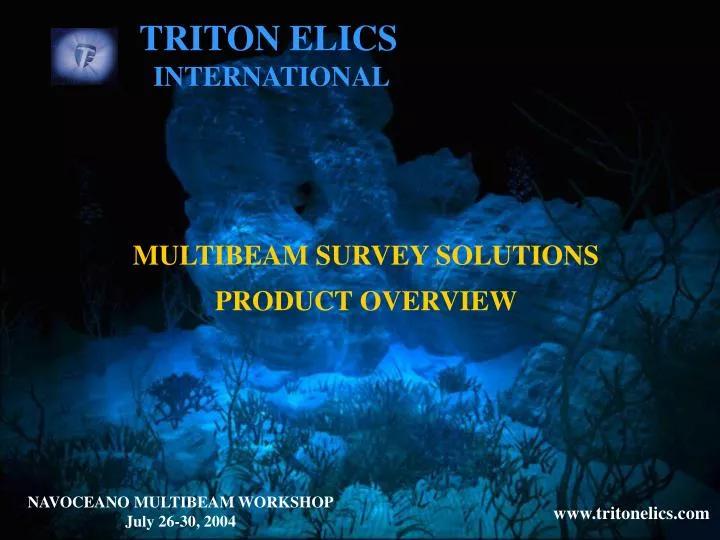
TRITON ELICS INTERNATIONAL. MULTIBEAM SURVEY SOLUTIONS PRODUCT OVERVIEW. NAVOCEANO MULTIBEAM WORKSHOP July 26-30, 2004. www.tritonelics.com. Briefly – The Company (1 of 3). Total Survey Solutions for:. SIDESCAN. MULTI BEAM. SEISMIC. Proven Software Products Custom Software Solutions

E N D
TRITON ELICS INTERNATIONAL MULTIBEAM SURVEY SOLUTIONS PRODUCT OVERVIEW NAVOCEANO MULTIBEAM WORKSHOP July 26-30, 2004 www.tritonelics.com
Briefly – The Company (1 of 3) Total Survey Solutions for: SIDESCAN MULTI BEAM SEISMIC • Proven Software Products • Custom Software Solutions • Expert Consulting • Design and Delivery of Integrated Systems • On site integration, installation, and training • World-Class Maintenance and Support • Constant improvement through innovation
Briefly – The Company (2 of 3) • Headquarted in California, U.S.A. • Research and Development in Oregon, U.S.A. • Technical Support in each TEI office • More than 20 years in business • Worldwide and Diverse Client Base • Federal, Commercial, and Institutional Customers • Global Sales Distribution (through agents)
Briefly – The Company (3 of 3) TEI Offices Distributors in 18 countries
Federal Clients (US) • Naval • CSS • NSWC • NAVO • USN SUPSALV • NUWC • USN EOD • NFESC • ONI • NRL • DSU • Others • NOAA • USGS • DOE • USACOE • Division of Fish and Wildlife
Domestic Benthos, Edgetech, Klein… Bluefin Robotics Boeing C&C Technologies CSC Earthworks ExxonMobil Geodynamics Geofix Harvey-Lynch Oceaneering Odom Parametrix Raytheon Shell International China Offshore Oil China National Zhenhua Corp China Sinopec Star Pet. Fugro/ Chance / Thales Hydronav Singapore J. Bornhoft Ind GmbH Ocean Engineering Japan Petrobras America Seatronics UK Seismic Asia Pacific Pty. Sodera of France Special Vessels LLC Brazil Stolt Offshore Norway Terra Surveys LLC Commercial Clients
Domestic Cal State Coastal Carolina University East Carolina University LSU Skidaway Institute State University of NY Syracuse University U of Maine UNC U of South Florida Texas A&M University International CEFAS Reino Unido CTI Italia Gepmare Sud di Napole Instituto Mar Báltico NITG Países Bajos Univ of Barcelona Univ of Cadiz Univ of Nice Univ of Tromso Noruega Univ of Gales Institutional Clients
Other International Clients • ARAMCO (Saudia Arabia) • Danish Navy • Danish Telecom • Dutch Navy • Finnish Navy • Gulf Dev Systems UAE • IFREMER (France) • NAVO United Kingdom • Hydrographic Institute of Portugal • NATO (Saclant) Italy • Turkish Hydrographic Department
Product Overview Acquisition Hardware • Versions: • Ruggedized – Industrial - Portable • Customizable configurations • Specialized boards for high resolution applications • Turnkey System Configurations - topside computers, software, sonar and bathymetry devices In the field Acquisition software • Servers for more than 25 types of sidescan, multibeam, • and subbottom profiler sonars (nearly any sonar on the market) • ROV and AUV capable • Co-registration with GPS, Gyro, Motion, Tide, Water Velocity data Sidescan • Real Time Processing and display of sonar and bathymetry data • Automated Field Patch Tests Multibeam • Analog or digital, single or multiple channels • Real Time processing • Georeferenced output Subottom / Seismic
Data Fusion Sidescan over 3D Bathy Sidescan Mosaic Bathymetry Mosaic 3D Bathy Product Overview In the Office The same products used for field acquisition can be used in an office environment for data playback, processing, analysis, interpretation, and visualization. • Fast playback, target capture and identification, pipeline tracking and analysis, seafloor classification, mosaicking • Auto launch of Mosaic tool. Sidescan Rapid Playback, 3D perspective view, processing capabilities, data confidence checks Multibeam • Playback and processing of raw data • Displayed as Georeferenced data Subottom / Seismic
IsisSonar Hardware Configuration Recording and Quality Control Displays Real Time 3D Bathymetry Display Using the Products for Multibeam Acquisition Delph Nav Navigation Planning Navigation Input (Launch modules to process Bathy data and Create Mosaic) BathyPro Process Bathy, Navigation DTM Creation Pass data in real time to DelphMap DelphMap Georeferenced Display (GIS) Data Fusion Real Time DTM display Real Time 3D display Update Navigation
HydroSuite- Complete Bathymetric System Integration Service from Design to Operation Design of the system with the client Equipment and software Installation and Integration Training and follow up visit
HydroSuite- Features • Single Source for all components and support • Integrate with User-Specified or Existing Sensors • Configuration of all Hardware • Sonar & Ancillary Sensors • Rugged PC Workstation • Brackets, Cables, etc. • Comprehensive Software Package • Planning: DelphNav, Mission Planner • Acquisition: IsisBathy, BathyRT (with SSS – Isis Sonar, MosaicRT). XTF format; industry standard • Analysis: BathyPro, DelphMap, Mission Monitor, Seaclass, TargetPro
Cross Section of HydroSuite Clients • NOAA – multiple systems (Elac, Reson) • NUWC – Simrad SM2000; onboard a 105’ vessel and interfaced with Qinsy • USACE-Buffalo – Reson 8101 with sidescan (SeaClass option purchased); interfaced with Innerspace SB and Hypack • USACE-St. Louis – Reson 8101; mounted on a barge • USACE-Seattle – Elac 1185; bow mount and interfaced with Hypack • Geodynamics – Simrad EM3000 • Qingdao University – Simrad SM2000 • Univ. of New Zealand – Simrad EM3000 Others have received parts of the HydroSuite – software, services, integration, etc… Every system is different, yet the software is all based on using Isis for data acquisition and other components of TEI to process / analyze the data
Real Time data display on two mon itors DelphMap and BathyPro TEI Multibeam Topside Computer Acquisition System DECK CABLE Motion Sensor Multibeam Transducers Single Beam Sound Velocity Probe Gyro GPS Typical Layout for HydroSuite System
How the software works with the data MB GPS mru Isis Bathy used for data acquisition combining all sensor data into the XTF file DelphMap BathyRT / BathyPro DelphNav Mission Monitor 3rd party software Caris, Hysweep, others SeaClass
Typical Screen layout for acquisition • Isis, BathyRT, DelphMap and DelphNav, Sonar server, sonar software…. • ! Dual Monitors Recommended !
Quality Control during Acquisition Additional tools to aid the operator in collecting GOOD quality data are: • Real Time 3D display in ISIS • Bathy Real Time • Mission Monitor • 3D Bathy Editor • Intellitrak • DelphMap Visualization
Real Time 3D display in ISIS Screen views are configured to operators preferences
Bathy RT (Real Time Bathy) Raw data is processed and displayed as DTM in real time.
Mission Monitor (1 of 3) Data spikes and errors may be difficult to see by operator, or missed altogether. The idea behind Mission Monitor is to let the computer analyze all the data
Mission Monitor (2 of 3) The Results of which are displayed in a highly visible window for the operator or helmsman to monitor. Colors indicate if data being recorded are within set tolerances. Physical values being recorded are posted within each window.
Mission Monitor (3 of 3) A coverage map is created with BathyRT, showing a Color-coded map of the survey Area. Data that have not met the minimum standard are highlighted in RED. Note that full coverage does not always mean good coverage.
3D Bathy Editor Bad data points like these are edited using an interactive 3D editor to picks points, areas, swaths for editing, or use an edit helper to build a model surface for editing. Now optional, soon to be incorporated into suite of products
Intellitrak Intellitrak automatically generates navigation lines based on current observed depths • Enhancements in progress: • Single line survey • Multi-segment lines • Contour-following lines
Visualization of Multibeam and Sidescan data DelphMap Layer Management Sidescan Mosaic without Bathymetry Multibeam Data 3D View Sidescan Overlay on Bathymetry AVI Click HERE
TRITON ELICS INTERNATIONAL www.tritonelics.com Product Demonstrations, Presentation on CD, and technical papers are available at the TEI table; vendor’s room GRACIAS THANK YOU Main Office 125 Westridge Drive Watsonville, CA 95076 Tel: (1) 831 722-7373 Fax: (1) 831 722-1405 Gulf Coast Office 1510 Eldridge Pkwy, Ste 110-123 Houston, TX 77077 Tel: (1) 281 589-1211 Fax: (1) 281 589-1231