Download
1 / 32
320 likes | 1.08k Views
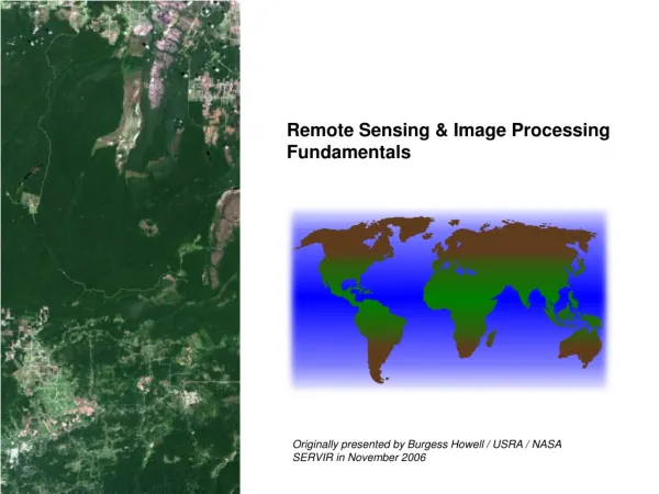
Remote Sensing & Image Processing Fundamentals. Originally presented by Burgess Howell / USRA / NASA SERVIR in November 2006. What is Remote Sensing. Acquisition of information about a target without physical contact with the object.

E N D
Remote Sensing & Image Processing Fundamentals Originally presented by Burgess Howell / USRA / NASA SERVIR in November 2006
What is Remote Sensing • Acquisition of information about a target without physical contact with the object. • Sensing and recording reflected or emitted electromagnetic radiation. • Storage, processing, analysis, and application of collected data.
Why Remote Sensing Remote sensing allows us to acquire information about a particular object without coming into direct contact with that object.
Why Remote Sensing Remote sensing also makes it possible to collect large quantities of data in a timely, efficient manner.
Uses • Update or supplant existing maps • Determine area of known categories • Create inventories of cover types • Document change over time • Measure conditions in an area • Quantitative measurement of property
Advantages of Remote Sensing • Data gathered can be transmitted over radio or microwave communications links • Many satellites orbit the earth, so the same area can be covered on a regular basis. • Once the satellite is launched, the cost for data acquisition is relatively low. • Satellites have very stable geometry, meaning that there is less chance for geometric distortion in the final image.
Principles Principles • Targets display discernible differences in emitted and reflected energy. • The appearance of a target changes with the wavelength in which it is observed. • Dissimilar targets have differing appearances in a single wavelength (or band of wavelengths). Radar Laser Camera Radiometer Sonar
Electromagnetic Radiation EMR consists of an electrical field and a magnetic field oriented 90° to each other and 90° to the direction of travel, moving in waves at the speed of light.
Electromagnetic Radiation Wavelength – the length of one full wave cycle, measured from the peak of one crest to the peak of the next. Frequency – the number of wave cycles passing a point in a given period of time. Wavelength and frequency are inversely related.
Energy Interactions with Atmosphere Scattering Refraction Absorption
Atmospheric Scattering Rayleigh (blue) • particle size < wavelength • affects shorter wavelengths more Mie (red) • particle size ≈ wavelength • affects longer wavelengths more Nonselective (white) • particle size much larger than wavelength • all wavelengths affected equally
Energy at the Target • Incident radiation can be… • Reflected • Transmitted • Absorbed (and reEmitted) I = R + T + A
(more) Spectral Responses Green Vegetation Dry Vegetation Soil
Differences in Spectral Response TM Band 3 (Red) TM Band 4 (NIR)
Passive: sensors use natural energy, either reflected sunlight or emitted thermal or microwave radiation. Active & Passive Sensors Active: sensors create their own energy transmitted toward Earth they interact with the atmosphere and/or target surfaces
Satellite Orbits Sun-synchronous(Landsat, SPOT) Geostationary (TIROS, GOES)
Sensors - Resolution Spatial Resolution is the separation distance required for a sensor to discriminate between two objects 30m 120m 120m 240m
Sensors - Bands Bands are regions of the electromagnetic spectrum to which an instrument is sensitive. Sensors are typically designed to be sensitive to several portions of the spectrum and to store data about each portion separately.
Satellite Imaging Systems A satellite’s geometry consists of its period, altitude, inclination, ground track, orbital track, and return time.
Multispectral Data Storage Metadata may be included with individual bands or entire files as headers (preceding) or footers (appended). It may also be included with individual lines of data as leaders or trailers. Many newer data storage formats deliver metadata in separate files.
ENVI ER Mapper ERDAS Imagine Grass IDRISI Kilimanjaro ILWIS Intergraph Image Analyst PCI Geomatica ArcGIS Software Packages