Download
1 / 37
370 likes | 500 Views
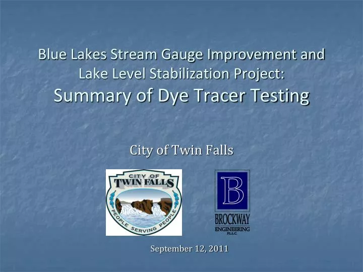
Blue Lakes Stream Gauge Improvement and Lake Level Stabilization Project: Summary of Dye Tracer Testing. City of Twin Falls. September 12, 2011. Brief Background. Blue Lakes pumps operational 1994 Lower lake weir installed 1997 in an effort to stabilize lake level fluctuations

E N D
Blue Lakes Stream Gauge Improvement and Lake Level Stabilization Project:Summary of Dye Tracer Testing City of Twin Falls September 12, 2011
Brief Background • Blue Lakes pumps operational 1994 • Lower lake weir installed 1997 in an effort to stabilize lake level fluctuations • Membrane liner placed upstream of weir, and later extended to about 50’ • Excessive seepage from bottom of lake prevents weir from operating effectively: • The “orifice” – large hole • Fissure(s) • Seepage around boulders upstream of weir
Brief Background • Extensive computer modeling: must have at least 130 to 140 cfs net inflow to lower lake. Below this flow, level control is compromised • Net inflow = Natural Spring Inflow – City Pumping • Lake control problem aggravated by continuing declines in natural spring flow
Where is it going? Statistically, the trend is still downward.
Brief Background • Current maximum day pumping: 25 cfs • Down from a peak of 31 cfs in 2003 • Maximum day typically occurs in July • Springs have a seasonal pattern, low point typically in May, and have not recovered by July • Natural spring inflow must be 155 to 165 cfs to achieve effective lower lake level control at current maximum day demand. • July natural flow, last 5 years: 120 to 140 cfs
Proposed Solution • Component 1: Replace USGS gauging station with measuring device • Rated section is highly inaccurate • +/-30 cfs is not adequate to properly manage the lake system • Trend in natural spring inflow (not the total Blue Lakes supply at the BL Trout weir) • Daily value of spring inflow guides how much can be pumped
Proposed Solution • Reduce seepage from Lower Lake • Attempt to find more cost effective ways other than controlling the orifice • Other flow paths • More flow passes over the lake control weir and sinks • Question: Will changing the seepage pattern… • Reduce the flow in Alpheus Creek? • Change the distribution of outflow from the various springs in the Alpheus Spring complex?
Dye Tracer Test: Objectives • Identify high seepage areas in lake bottom (other than orifice) • Define flow paths, travel times, and mass balance • Determine whether all water reaches Alpheus Springs, or if some bypasses the system • Determine effect of seepage reduction actions on distribution of flow from Alpheus Springs • BLCC allowed testing and permit applications
Preliminary Work • Initial reconnaissance • Three dives • Small amounts of dye used to identify seepage areas • Identified another major seepage location (fissure) • Measured outflow of fissure and the orifice using current meter • Orifice: 24 cfs • Fissure: 14 cfs • No appreciable seepage from upper lake • Video
Dye Tracer Test • Four injection locations, “slug” injections • Measured dye concentration curve at four locations: • Alpheus Springs, Alpheus Creek at BL Trout weir • Measured presence/absence of dye in Snake River • Dye: Rhodamine WT • Acknowledgements • IDWR and Idaho Power Co. – fluorometer equipment and expertise • IDEQ – discrete sampler • Ozark Underground Laboratories, Missouri
Breakthrough Curve Time to peak Concentration Arrival time Elapsed Time
Test 3: Boulder Field Test 5: Orifice Test 1: Orifice Test 2: Fissure Test 4: Pool below Weir
Overall Mass Balance at BL Trout Weir • Integrate Q x C under breakthrough curve • All tests - mass injected: 30 lb • Mass recovered: 25.7 lb (86%) • Some adsorption and other degradation of dye is expected • No dye detected in any charcoal packet in Snake River • Margin of error in mass balance may be +/- 10 to 15% • Conclude: no significant mass loss
Seepage Reduction Action Scenarios • Scenario 1: 15 cfs eliminated from fissure, infiltrates in pool below weir • Scenario 2: 20 cfs eliminated from boulder field, infiltrates in pool below weir • Scenario 3 (Preferred): 15 cfs eliminated from fissure, 20 cfs eliminated from boulder field, infiltrates in pool below weir • Scenario 4: 20 cfs eliminated from orifice, infiltrates in pool below weir • Scenario 5: 15 cfs eliminated from fissue, 20 cfs from boulder field, 20 cfs from orifice, infiltrates in pool below weir
Predicted Flow Changes • Flow change in absolute CFS:
Basic Findings and Conclusions • All water seeping from the Lower Lake emerges at one or more springs in the Alpheus complex • 81% of the flow emerges from the City Spring / Main Spring complex; 19% of the flow emerges from the Clubhouse Spring • Significantly different response curves depending on seepage location • Proposed seepage reduction actions will not decrease the flow in Alpheus Creek • Proposed seepage reduction actions will not significantly change spring flow distribution.
Proposed Plan • Install measuring device at USGS gauge • Reduce or eliminate seepage in fissure and boulder field • Natural gravel pack • Potential for membrane liner if needed • Target 35 cfs seepage reduction • Target minimum inflow to lower lake would be reduced from 130-140 cfs to about 95-105 cfs • Spring inflow would need to be: • 120-130 cfs to allow City to pump current 25 cfs max day • 147-157 cfs to allow City to pump full 52 cfs water right
Proposed Plan • Mitigate for roadside creek flow • Hydraulic fix • Options for pumping