Download
1 / 42
420 likes | 517 Views
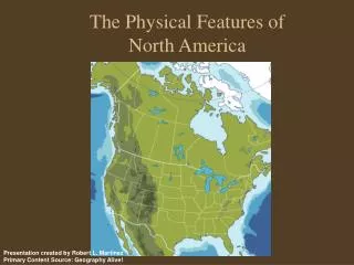
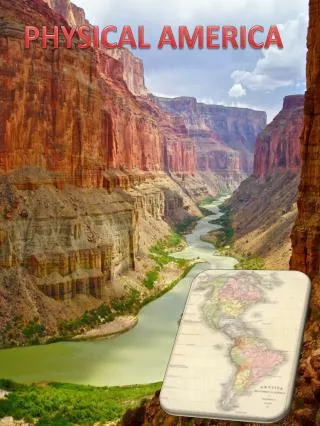
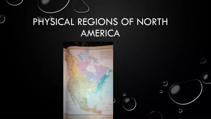
Physical regions of north America . Appalachian region. -made up of many mountain ranges. -mountains are over 300 000 000 years old. -the region has river valleys. -Appalachian region contains coal, oil, and gas that is inside the rocks. . Topography. Climate.

E N D
Appalachian region • -made up of many mountain ranges.-mountains are over 300 000 000 years old.-the region has river valleys.-Appalachian region contains coal, oil, and gas that is inside the rocks. Topography
Climate • -climate depends on 2 oceans currents. • Labrador current brings cold water from the artic, causes freezing in the northern side in winter months. • The gulf water brings warm water from the Caribbean
Vegetation Appalachian region was once was mostly forest Had many evergreen trees/shrubs and deciduous trees that shed their’ eaves a lot.
Economic activity • Mining coal ,oil, and gas from the rocks • Lumber from the trees.
Environmental concerns • Pollution in the streams • Due to economic issues a huge chunk of the land is in construction or has been constructed.Coal mining has effected the lands ,soils, etc.
The coastal plains • Less then 200 meters above sea level • Mostly flat land • The coastal planes are less then 30 meters above sea level • Has many swamps and marshes • Because some rivers can go on for many miles due to sinking like for example the Hudson river, it has made many transportation routes. • Swamps and marshes are also important because they provide a large amount of shellfish, and other life forms. Topography
Climate • On the north side of the coastal plains it has snowy cold winters . In the summer it is very hot and humid • Some what tropical climate on thru southern part and warm winters. • The south part of the coastal plains also proun to hurricanes
Vegetation • Soils are mostly sandy • Some areas like Mexico are full of jungles • The vegetation was originally full opine forest.
Economic activity • Fishingtourism • Forestry • Shipping • Paper making
Environmental concerns • Pollution in the water from mostly sewage ,runoffs, and industrial waste. • Development this is effecting natures natural habitat • coastal erosion which causes issues with ecosystems • Cutting down to many trees.
The great lakes St. Lawrence lowland Has a rolling landscape Mainly created by glaciation Flat areas are Brocken up by hills and deep river valleys. The St Lawrence area has flat plains on both sides of the river that begin to rise into the Canadian shield and the Appalachian. Topography
Climate • Very humid • Humid because of the great lakes. • Continental climate • The great lakes make the temperature cool during summer • It tends to be warmer in the winter because the heat is stored • The winter is sometimes cold or just cool • The summers are sometimes warm or very hot.
Vegetation • It is full of very fertile soils and was full of trees. • It used to have Canada largest broad leafed forest. • Because of its climate and soil conditions it allows maple,beech,hickory,and black walnut trees to thrive. • On other parts ox region it has many more of a verity of trees.
Economic activity • Agriculture • Transportation routes • Development of cities • manufacturing industries
Environmental concerns • Due to having over half the population living in this area there is a lot of pollution, in the water, air soil, etc. • A lot of hot mettle seep in the ground. • And a lot of coal.
The interior plains • Divided into central lowland and the great plains • The north side of Central lowland is formed by the Canadian shield, great lakes, and St Lawrence. • The great plains are High elevation. • 600 meters to 1500 metes above sea level, in the west. Topography
Climate • Continental climate in the interior plains Hass extreme climate very long hot summers, and very cold Winters. Very little precipitation. Farther north winters are colder and longer and the summers are short and cool. The north side has artic climate
Vegetation • Originally central low land east of Mississippi was full of different kinds of trees. • The great plains also has a lot of trees but also had grass that would grow as tall as a person • Tress only grew by the river vallys. • On the northern side of the interior plains forest grew all over going towards the arctic ocean.
Economic activity • Agriculture • Mining • Agriculture splits in two vegetables and livestock • In the interior plains cattle pigs poultry live. • Vegetables grown in the Interior Plains are; wheat, barley, oats, flax, canola, mustard, potatoes, corn and sugar beets
Environmental concerns • Farm pollution seeping into the ground • Having peoples transportation chemicals in the air
The Canadian shield • During ice age glaciers got rid of most soils • In many places there are barren rock surfaces. • Glaciers effected the drainage to a high degree. • Many damned up rivers , or caused them to flow in different directions. • There for the shield has a chaotic pattern on rivers ,lakes , swamps, and bog • Elevation of the shield is 100,above sea level. • On the south side 500 metes above sea level. • In the middle of the shield it has low elevation compared to the outer parts. Places like Hudson bay and James bay are low land so due to that it has a lot of clay. Most rivers flow in 2 bays. Topography
Climate • The climate is different through out the Canadian shield. • If you go north winters are incredibly long , and cold. • With summers shorter and cooler.
Vegetation • The northern artic forest covers most of the shield. • Sandy soil • Not very much precipitation • Very hard to grow tress due to having very short growing season.
Economic activity • the Canadian Shield is home to large copper, iron, zinc, silver and gold deposits. Lead, uranium, nickel, cobalt and tungsten have also been discovered in the expansive region. • Defrosting Mining for diamonds.
Environmental concerns • Its melting the tundra. • Pollution in the great lakes • De foresting
The western cordillera • Topography • Has many new mountains because of erosion. • More the twice as high as the Appalachian region. • Many different mountain ranges • The rocky mountains to the east • All rivers to the east of the Rockies • The river flow either goes to the gulf of Mexico or the artic ocean. • The rivers dian is located near the pacific ocean.
Climate • The west coast has maritime climate which means it strongly influenced by the closeness of water. • West side is very wet and moist and parts are considered to be the wettest parts in the world. • Winters are usually freezing cold. • Summers are cooler. • Valleys are warmer then mountain slopes.
Vegetation • Depending on where you are in the western cordillera the vegetation varies. • Many different kinds of trees, that grow very high and very old. • Has the biggest tree in the world • At the top of the mountains the vegetation is similar tundra which is climate way to cold for trees. • Farther south cactus grow and evergreen don‘t grow due to less rain fall.
Economic activity • Fishing • Mining • Lumber • Tourism
Environmental concerns • Mining most of the coal mines are taken place here. • Defrosting • Economic development
The intermountain region • Usually river water and mountains never go near the sea. Instead they go to lakes. • But in some Ares river water and trees do make it to the ocean. • Parts of the land are used for having a place for water source for plants and what not. • Other parts are good for cattle ranching. Topography
Climate • Climate is affected by its location and elevation. • Winters are usually cool and wet or hot and dry. • On the south side winters are short and warm • Very little precipitation
Vegetation • Grass land • Plants can survive in semi desert temperature • Higher up on the region it starts to get covered with a lot pine forest.
Economic activity • Lumber • Development • Tourism
Environmental concerns • •Many bird habitats are being destroyed by human actions. • •Up to 11 bird species in the intermountain region is endangered • •Because of the dry air forest fires can be a problem too
The arctic • Very flat • Most of the land is near ocean • Farther up north mostly covered in glaciers. Topography
Climate • Since the artic is far from the equator the climate is harsh. • Winter lasts for 10 months • Summer very short • Summer is cold not really warm • Has very little precipitation • Artic is a desert
Vegetation • Few life forms • Trees cannot grow in parts due to harsh coldness and dryness • Very small amount of thawing occurs during summer • Small shrubs, fungi like organisms, and mosses are the only things that can grow. • Shrubs mosses and fungi like organisms can grow because they cling to the ground sucking in all the moisture and warmth on summer.
Economic activity • Oils • gas • Minerals • In 2008 90 billion barrels of undiscovered oil was found , and 44 billion barrels of natural gas liquids in . This represents 13% of the undiscovered oil in the world is in the artic.
Environmental concerns • Sea ice can damage boats and cause pollution in the water • Global warming
"judge:bill wont shield coal from water quality suits." appalachian mountain adavocates. charesto gazette, 2011. Web. "intermountain region." regional geography of north America. wikispaces, 05 2011. Web. 15 Feb. 2014. <http://ss9geography.wikispaces.com/page/history/Intermountain Region>. "yahoo answers." What are some environmental concerns in the canadian shield?. N.p., n. d. Web. 17 Feb. 2014. cranny, Michael. "regional geography of north America." Trans. Array. Toronto Canada: Anita borovilos, 1998. 160-179. Print. "enviormental issues of minning." wikedia. N.p., 14 02 2014. Web. 17 Feb. 2014. brittany, hitt. "what are the economic activity in the coastal plains." ask. leenos, 2012. Web. yasmine, zhing. "enviormental probloms." ehow. N.p., n. d. Web. 17 Feb. 2014. yasmine, zhing. "what sre the econooc activities of the great lakes of st lawrance and low land." wikianswers. N.p., n. d. Web. 17 Feb. 2014. "the interior plains." assighnmemt 6.5. N.p., n. d. Web. 17 Feb. 2014. "tripod." help save the montanen coreddle . N.p., n. d. Web. 17 Feb. 2014.