Download
1 / 13
150 likes | 294 Views
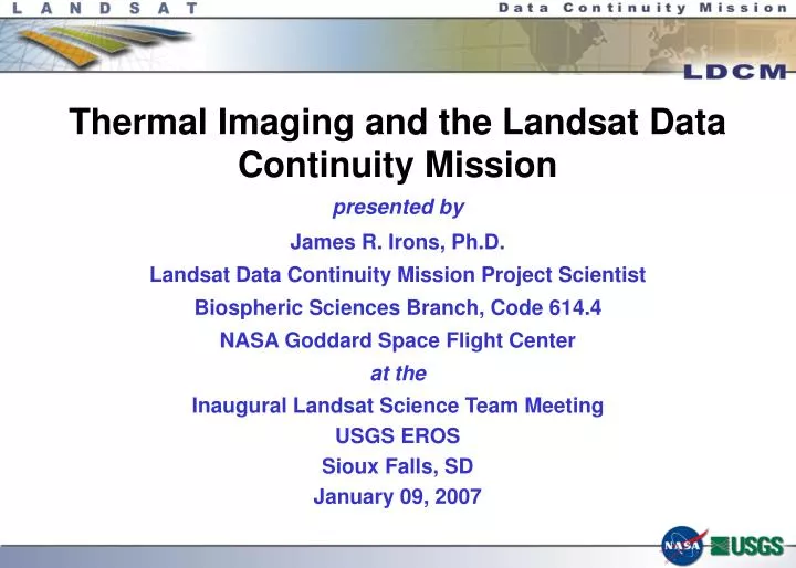
Thermal Imaging and the Landsat Data Continuity Mission. presented by James R. Irons, Ph.D. Landsat Data Continuity Mission Project Scientist Biospheric Sciences Branch, Code 614.4 NASA Goddard Space Flight Center at the Inaugural Landsat Science Team Meeting USGS EROS Sioux Falls, SD

E N D
Thermal Imaging and the Landsat Data Continuity Mission presented by James R. Irons, Ph.D. Landsat Data Continuity Mission Project Scientist Biospheric Sciences Branch, Code 614.4 NASA Goddard Space Flight Center at the Inaugural Landsat Science Team Meeting USGS EROS Sioux Falls, SD January 09, 2007
Revised Implementation Strategy • OSTP Director Marburger signed a Dec. 23, 2005 memorandum with subject line, “Landsat Data Continuity Strategy Adjustment” • supercedes previous direction to fly Landsat sensors aboard NPOESS satellites (Aug. 04, 2004 memorandum) • Directs NASA to acquire free-flyer spacecraft • Assigns DOI / USGS the responsibility for operating the spacecraft Landsat Science Team, USGS EROS, Sioux Falls, SD
Initial Free-Flyer Acquisition Approach • NASA placed a synopsis of intent to release an LDCM RFP on the NASA Acquisition Information System (NAIS) web site on Feb. 22, 2006 • “NASA is considering issuing a solicitation for a Firm Fixed Price (FFP) contract for a free-flyer spacecraft mission” • “NASA is planning a single award for the development and delivery of a spacecraft, instrument, observatory integration and test, and operational systems/sustaining engineering support” • “NASA plans to issue the solicitation with an optional requirement for the instrument to observe a portion of the thermal spectrum” Landsat Science Team, USGS EROS, Sioux Falls, SD
Thermal Advocacy • The Western States Water Council sent two letters to the Director of OSTP, Dr. Marburger (most recently on July 31, 2006) • “I am writing to reiterate our strong support for maintaining a thermal band as part of the Landsat Data Continuity Program. This information is increasingly critical for the management of western water resources, particularly agricultural water use.” • “Landsat thermal information has gained wide-spread use in the West.” • “We strongly support spending to provide for the continued availability of Landsat-comparable thermal data, and oppose any move to omit or delete the thermal band from future satellites.” • The Western Govenors’ Association sent a letter to the Director of OSTP (Sept. 12, 2006) • “Including a thermal imaging instrument on the next Landsat vehicle is critical to the continued use of this information in western states for monitoring and measuring agricultural and other outdoor water uses, related evapotranspiration, and administrating states water rights, interstate compacts, and surface and ground water budgets.” Landsat Science Team, USGS EROS, Sioux Falls, SD
Thermal Advocacy (cont.) • The National Research Council’s Decadal Survey Panel received a letter (Sept. 14, 2006) signed by 117 managers and scientists: • “The accuracy of Landsat-scale TIR evapotranspiration (ET) estimates has improved to the point that consumptive use and water rights can be reliably monitored from space at the scale of a single irrigation system.” • “In particular, a statement acknowledging the societal benefits of the proposed LDCM TIR imager will be important in encouraging NASA and Congress to ensure continuity of high-resolution satellite TIR imaging.” Landsat Science Team, USGS EROS, Sioux Falls, SD
Landsat thermal data are now used operationally to monitor water consumption on a field-by-field basis in the U.S. West and internationally Development of operational energy-balanced-based evapotranspiration models SEBAL METRIC Basis of Thermal Advocacy Using 120 m Landsat 5 Thermal Data Courtesy of Richard Allen, Kimberly Research and Extension Center, University of Idaho • Water rights regulation and administration are critically tied to identification and quantification of water consumption on a field-by-field basis - Allen, R.G. “The Need to Continue High Resolution Thermal Imagery …” • Typical irrigated field sizes in the U.S. range from 180 m to 750 m on a side • Quantification of water use from Landsat using thermal data is the only way to independently and consistently measure water use on a field-by-field basis - Morse, A., and R.G. Allen. “Water and the Critical Need for a Thermal Band on Landsat Landsat Science Team, USGS EROS, Sioux Falls, SD
Additional Thermal Data Applications Landsat thermal data are used for : • Mapping urban heat fluxes for air quality modeling (urban heat island) • Volcanic hazard assessment, monitoring, and recovery • Cloud detection and screening • Mapping lake thermal plumes from power plants • Burnt area mapping / Wildfire risk assessment • Tracking material transport in lakes and coastal regions • Identifying mosquito breeding areas and vector-borne illness potential Atlanta, GA NASA ATLAS TIR IMAGE LANDSAT TIR IMAGE urban LAND CLASSIFICATION (Images from D. Quattrochi) Landsat Science Team, USGS EROS, Sioux Falls, SD
Draft LDCM Thermal Requirements • 120 m spatial requirement derived from trade between irrigated field size and the maturity of detector technology • Sufficient to resolve most center-pivot irrigation fields in U.S. West - typically 400 to 800 m in diameter (see poster by Ryan et al.,) • Thermal data user survey by Rick Allen, U. of Idaho, supports 120 m requirement • Landsat 4 & 5 TM’s provided 120 m thermal images for single thermal band • Landsat 7 ETM+ provided 60 m thermal images for single thermal band • The two bands enable atmospheric correction for accurate surface temperatures Landsat Science Team, USGS EROS, Sioux Falls, SD
60 m (~ETM+) 5 km 120 m (~TM) 10 x 30 km LE (Wm-2) Kustas et al., 2004 1 July 2002 – Central Iowa (corn & soybean production) These data show that differences in water consumption rates between individual corn (yellow/red) and soybean (blue/green) fields can be discerned at both 60 m and 120 m spatial resolutions From Kustas et al., 2004. Effects of Remote Sensing Pixel Resolution on Modeled Energy Flux Variability of Croplands in Iowa. Remote Sens. Environ. 92:535-547 Landsat Science Team, USGS EROS, Sioux Falls, SD
Revised LDCM Acquisition Approach • NASA released revised synopsis for the Landsat Data Continuity Mission (LDCM) acquisition approach on Oct. 24, 2006 • “…NASA is now revising the acquisition approach for LDCM to includeseparate procurements for the instrument, spacecraft, and mission operations elements. NASA Goddard Space Flight Center (GSFC) will serve as the system integrator for the mission…” • “NASA plans to issue an openly competed Request for Proposal (RFP) for the instrument element before the end of CY 2006 that will result in a cost reimbursable contract award in CY 2007.NASA continues to assess alternatives for the inclusion of a thermal spectrum sensing capability…” Landsat Science Team, USGS EROS, Sioux Falls, SD
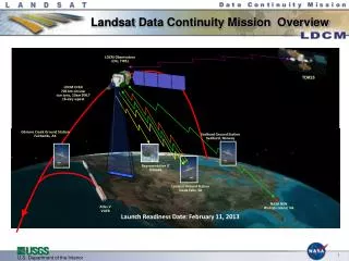
LDCM Schedule • Dec. 07 - draft RFP released for LDCM instrument element, the Operational Land Imager (OLI) • Comments requested within 7 days • The draft RFP contains NO thermal image options • Dec. 11 - Industry day at University of Maryland University College Conference Center, College Park, MD • Jan. 03 - RFP release date • Proposals due in 30 days, Feb. 02 • June, 2007 - OLI proposal selection • July, 2011 - LDCM target launch date Landsat Science Team, USGS EROS, Sioux Falls, SD
Status • NASA continues to assess alternatives for the inclusion of a thermal spectrum sensing capability in to the LDCM Landsat Science Team, USGS EROS, Sioux Falls, SD
!! Thermal Data Continuity Land Surface Temperature and Emissivity Earth System Data Record (LSTE-ESDR) Table from S. Hook Landsat Science Team, USGS EROS, Sioux Falls, SD