Download
1 / 26
260 likes | 363 Views
Scoping the North Carolina Cooperating Technical State Project. Ed Curtis, P.E., CFM, North Carolina Division of Emergency Management Jerry Sparks, P.E., CFM Dewberry & Davis LLC. Background. North Carolina CTS Flood Mapping Program.

E N D
Scoping theNorth Carolina Cooperating Technical State Project Ed Curtis, P.E., CFM, North Carolina Division of Emergency Management Jerry Sparks, P.E., CFMDewberry & Davis LLC
North Carolina CTS Flood Mapping Program • Hurricane Floyd in 1999 revealed limitations of outdated FIRMs in NC • NC General Assembly committed$25 million to flood mapping • CTS partnership between FEMA, State, and 16 other Federal Agencies • State ownership and responsibilityfor FIRMs
Project Components • High-resolution topographic data and accurate DEMs • Engineering studies of flood hazards • Countywide digital FIRMs • Online Information Management System
Project Benefits • Current, accurate data for sound siting and design decisions • Use of updated data for floodplain management will reduce long-term flood losses • Updated data will alert at-risk property owners of the need for flood insurance • Faster, cheaper FIRM updates
Project Benefits (Continued) • Digital format allows for more efficient, precise flood risk determinations • Digital format allows for use with GIS for analysis and planning • Digital Information System allows for online access 24 hours a day • DEMs will be useful for almost any engineering or planning applications
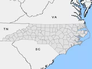
Eastern Six River Basins • NC General Assembly directed the State to first address the eastern six basins(Phase I) • Basins most affected by Hurricane Floyd • Approximately half of the State • > 50 counties and >330 municipalities(in whole or in part) • Encompass ~ 21,200 linear milesof streams and rivers
North Carolina River Basins—by Phase Phase I—bluePhase II—goldPhase III—green
Map Production Scoping The Flood Mapping Process
What Is Scoping? • Researching/inventorying available elevation, flood hazard, and digital base map data • Assessing adequacy existing flood hazard data • Outreach to, and input from, counties and communities • Identifying data to be developed or acquired • Determining proposed scales, paneling scheme, and format for DFIRM production • Developing schedule
Scoping the Six Eastern River Basins • Comprehensive scoping process • Tailored FEMA’s scoping process to meet the needs of North Carolina’s basin-wide approach and accelerated production schedule • NCDEM worked closely with FEMAand FEMA’s Map CoordinationContractor, Dewberry & Davis LLC (D&D) • Process involved 5 steps
SCOPING PRODUCTION Step 1 Step 2 Step 3 Step 4 Step 5 Initial Research and Community Coordination Initial Scoping Meeting Draft Basin Plans Final Scoping Meeting Final Basin Plans State KickoffMeeting with County/Local Floodplain Administrators Questionnaire State Prepare Delivery Orders& CTC Mapping Activity Agreements & Update CTS Mapping Agreement Develop Draft Basin Plans MappingNeeds Assessment Generate Initial Scoping Package NCScoping Database InitialScoping Meetings Final Scoping Meetings Finalize BasinPlans Analysis and Mapping FEMA EffectiveFIS & FIRM Research FEMA Process for Scoping Six River Basinsin Eastern North Carolina EvaluatePost-FloydData
Step 1: Initial Research and Community Coordination • Kick-off meeting with county and local floodplain administrators — August 31, 2000 • Objectives: • Overview State’s CTS Agreement with FEMA and the Statewide Flood Mapping Program • Inform about process that will be followed • Encourage active participation • Community questionnaire distributed
Step 1: Initial Research and Community Coordination (Continued) • State completed research of community mapping needs • September 1999, CTP “Assessment of Community Mapping Needs” agreementwith FEMA • FEMA and D&D researched FEMA Flood Mapping Archives and FEMA’s Mapping Needs Update Support System (MNUSS) database
Step 1: Initial Research and Community Coordination (Continued) • State and FEMA evaluatedpost-Hurricane Floyd data • Identified areas where flooding elevations and inundation limits did not match effective flood hazard data
Step 1: Initial Research and Community Coordination (Continued) • State and FEMA conducted detailed review of effective flood data for counties along the open coast and inland coastal areas • State met with county and community GIS staff to inventory local GIS data to identify potential base map data resources
Step 1: Initial Research and Community Coordination (Continued) • Results of initial research and community questionnaire responses entered into a GIS-enabled scoping database created especially for North Carolina project • Database used to generate “Initial Scoping Packages” for each community • Initial Scoping Packages used to conduct Initial Scoping Meetings (Step 2)
Step 2: Initial Scoping Meetings • Meetings in each county • Presented results of initial 1 research • Reviewed Initial Scoping Package with each community’s representatives • Asked for community input on proposed study priorities andanalysis methods • Identified available local data
Step 3: Draft Basin Plans • Synthesized research and community input • Draft basin plans include: • Comprehensive lists of flooding sources to be updated and methods to be used • Counties for which DFIRMs will be produced • Overall schedule
Step 4: Final Scoping Meeting • Draft Basin Plan sent to affected counties and communities • Meetings held in each county • Present Draft Basin Plans • Provide final opportunity for input • Individual meetings scheduled with community representatives
Step 5: Final Basin Plans • Draft Basin Plans revised to produce Final Basin Plans • Final Basin Plans state how the Draft Basin Plan was revisedand why
Step 5: Final Basin Plans (Continued) • Final basin plans used to: • Complete CTS Task Agreementwith FEMA • Develop Delivery Orders for State’s mapping contractor • Develop CTP Mapping Activity Agreements with any countiesor local communities
Scoping theNorth Carolina Cooperating Technical State Project QUESTIONS? ? ? ? ?