Download
1 / 48
530 likes | 648 Views
GPS BASICS. Fire Suppression Repair March, 2010. GPS – What It Does. GPS receivers detect, decode, and process GPS satellite signals into position, velocity, and time estimates.

E N D
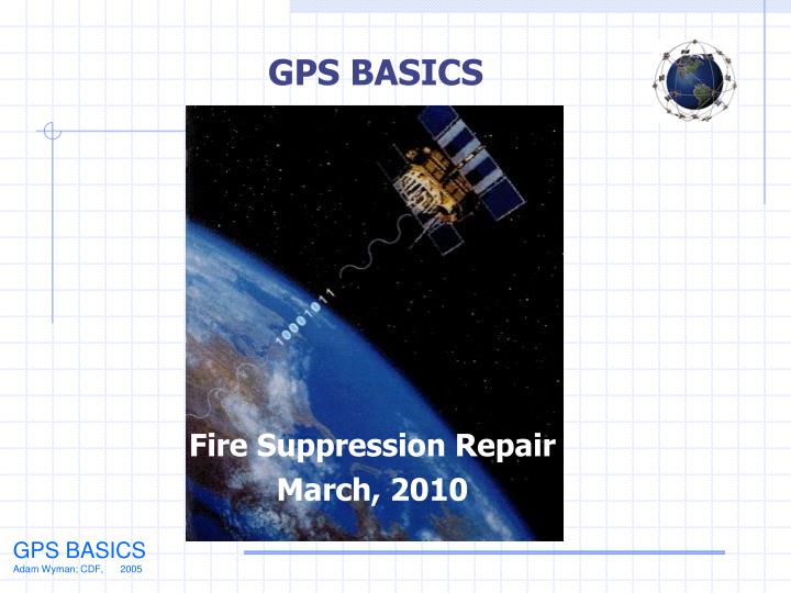
GPS BASICS Fire Suppression Repair March, 2010
GPS – What It Does • GPS receivers detect, decode, and process GPS satellite signals into position, velocity, and time estimates. • GPS receivers must be locked onto 4 satellites to get a 3D reading: Latitude, Longitude & Altitude or X,Y,Z coordinates. • GPS receivers must be locked onto 3 satellites to get a 2D reading: Latitude & Longitude or X, Y Coordinates. • GPS compares the time a signal was sent by a satellite to the time it was received.
GPS Accuracy Earth’s Atmosphere SIGNAL INTERFERENCE Airplanes Solid Structures Electro-magnetic Fields
GPS Accuracy Sources of Error or Signal Problems Along Your Path: - Canopy Cover - Large Rocks - Terrain/Topography
GPS Accuracy Multipath – Satellite signals are reflected off large nearby objects (buildings, cars, trees, rocks/boulders, canyons) causing an erroneous signal to be received by the GPS antenna
GPS Accuracy Sources of Errors You Cannot Control • Satellite geometry. • Reflections from objects – multipath errors • Antenna quality of your GPS model • Atmospheric interference • System errors (time and orbit)
GPS Accuracy • Our GARMIN receivers are accurate to +/-30’ Average. WAAS enabled GPS can improve accuracy to +/-9’ • Accessory antennas plug into the GPS receiver, increasing accuracy
GPS Units: Recommendations Know Your Limits! E-Trex Vista 60CSx 76CS Garmin V
GPS Set-up Set up your GPS prior to going out on the fireline!
GPS Set-up - Format LATITUDE / LONGITUDE • DMS – Degree, Minutes, Seconds • Garmin Set-up Menu: hdddmm’ss.s’’ • Example Readout: 3947’59.9’’ -12134’59.8’’ • DDM – Degree, Decimal, Minutes • Garmin Set-up Menu: hdddmm.mmm’ • Example Readout: 3947.999’ -12134.997’ • DD – Decimal Degrees • Garmin Set-up Menu: hddd.ddddd • Example Readout: 39.79998 -121.58325
GPS Set-up - Format LATITUDE / LONGITUDE Degrees, Decimal, Minutes is the Format all aircraft use DDM – Degree, Decimal, Minutes Garmin Set-Up Menu: hdddmm.mmm’ Example Readout: 3947.999’ - 12134.997’
GPS Set-up Map Datums • Datums -A datum is the set of equations used to plot the latitude and longitude on the surface of the earth. Datums are based on a particular spheroid. NAD 27 CONUS, WGS 84, etc. • In Set-up, choose the map datum you want to use. WGS 84 is suggested. • Our GPS receivers can collect lat and long coordinates in any map datum you set-up in your GPS. If you change the map datum in the Set-up menu (example: from NAD 27 CONUS to WGS 84), the lat and long coordinate in question will be plotted in a different location on the ground because the difference between the NAD 27 and WGS 84 map datums is approximately 300 feet on the ground.
Map Datums NAD 27 CONUS (Mapped on-the-ground) This shows the difference how NAD 27 CONUS and WGS 84 would plot on a map without any correction by computer software program WGS 84 (Helicopter Mapped)
GPS Concepts To Understand The data you collect will be either points or lines (Waypoints or Tracks) Waypoints will always be a single location. Tracks are Track Logs, the Active Log & Routes (What’s the diff?)
GPS Concepts To Understand The Active Log is the trail of breadcrumbs you see automatically on the GPS (provided tracking is “ON”). A Track Log is set-up and saved by you to record specific data. You can set-up a Track Log, or save an Active Log as a Track Log file. You’ll get specific data: I.e. Distance, acres, profile. The Active Log is only a trail of breadcrumbs until it is saved. Routes – are a command set by user using the GOTO feature, which computes a Route for the user to follow or navigate to, such as a Waypoint, city, address, point of interest, etc.
GPS Concepts To Understand Think of the Active Log,Waypoints, Track Logs as separate layers of data. Reason: Usually when you download this data to your computer, the Waypoints and Tracks Logs are downloaded separately.
GPS Concepts To Understand The Compass feature, GOTO Feature or Route, the GPS works better when you are moving, especially on older models. Stops cause poor readings because the GPS doesn’t know what direction you are moving. You might see a ? on your screen instead of the arrow pointing the direction of your destination. Driving a “Route”
Data Collection on Incidents TIPS • Always take your GPS download cable to incidents • Spare batteries. (You won’t lose any data if batteries go dead, or when you turn off GPS) • External antenna is good for vehicle use, when you need to “bury” GPS in pocket, & for helicopter work • Require your GPS users to take Field notes while collecting data • Helpful if you lose satellite reception • Take a map and compass, the GPS does not replace these! • Record the GPS time when you start and stop recording track data • Take pictures when doing damage assessment and repair
Data Collection TRACK LOG TIPS • Always clear the Active Log before you start recording data! Remember, you only have a limited number of Track Points until the receiver is either full, or you begin to “wrap” over existing data. • When setting up Track Logs, it’s preferable to set the Record Mode to Fill, the Interval toDistanceand the Distance Value to0.01 miles • Don’t turn GPS off to stop recording a track segment SAVE IT! (Know your GPS and do what’s best to save your Track Logs) • Know how many Track Points your Active Log is capable of storing, i.e. how far can you go?.
Data Collection – Assigning Staff Give good, clear instructions! Assign data collectors to specific areas, don’t overlap areas if possible. Establish a Waypoint naming system; I.e. Div. A waypoint #1 = A1, and have written field notes for A1 Div. X waypoint #1 = X1, and have written field notes for X1 Have your FOBS verify the GPS is set-up consistently (Datum, Lat/Long format). Coordinate this with your GIS shop if necessary. Make your assignment reasonable for the ground to be covered.
Helicopter GPS • Turn on GPS and acquire 3D position before taking off. • Ask pilot if they have done GPS flights before • (Discuss) • Review flight with pilot prior to take off • Review terminology to be used while in flight • Flying low and slow is best • Advise pilot to stop and hover over any sites you wish.
Debriefing with GPS Do you need the data? How reliable is the data? Verify data is in a compatible map datum. Transfer data to a computer ASAP. Turn in a copy of the field notes including who and when the data was taken ASAP. Incomplete data is better than no data at all.
Debriefing with GPS When in doubt, talk to the people who will be using the data!
My (Old) GPS Receiver Connected to my (Old) Laptop GPS Transmits Location onto USGS Topo Map Software (Terrain Navigator) Real-Time Tracking Adding Functionality
Objective • Collect: • Waypoints • Track Logs In the field!
X Summary of Topics • Mark Waypoints • Delete Waypoints • Collect Track Log • View Active Track Area • Collecting Track Segments
The Garmin 60CSx Page Zoom In Rocker for scrolling/moving cursor Page Zoom Out Find Menu Press PAGE button to Cycle Through Main Pages. Press and Hold to Turn Compass On/Off Mark Current Location Cancel Data Entry or Exit a Page Press Twice to View Main Menu PressENTER to save
Your Garmin 60CSx • Your GPS has six main pages: • Satellite Page • Trip Computer Page • Map Page • Compass Page • Altimeter Page • Main Menu Each page has an Options Menu. To view the Options Menu for a page, press MENU key once on the page
Reminder – When you Turn on GPS, Check Satellite Page Check number of satellites highlighted in blue–minimum 3 satellites required Check accuracy of signal, the lower the number the better Bar graph at bottom of window shows strength of signals from each satellite
Mark Waypoint Pressand hold Mark -All values frozen -No values stored yet
Modify Mark Waypoint Page Waypoint Symbol Waypoint Name, max 14 characters Current Position DO NOT EDIT – needed for ArcView/ArcGIS Current Elevation Show Waypoint on Map Page
Save Waypoint To accept the waypoint as is, highlight OK with the rocker and press ENTER. To change any information on the Mark Waypoint Page, move the rocker to the appropriate field and press ENTER. After making changes, highlight OK and press ENTER. You can edit waypoints as you create them or at a later date.
Deleting Waypoints Press the FIND button and highlight the Waypoints option.
Deleting Waypoints Use the rocker to select the waypoint you want to delete and press ENTER. Highlight the Delete button and press ENTER. Deleted waypoints can’t be recovered!
Collect Track in Active Track Log Press MENU twice to access the Track Log page on your GPS. Press ENTER when Tracks is selected to open the Track Log
Track Log Setup Be sure the Track Log is turned on. Move the rocker to highlight On an press ENTER Once Track Log is turned On, highlight Setup and press ENTER
Track Log Setup Deselect the Wrap When Full Option to ensure that no track log data gets erased. Press ENTER to uncheck Records Track Log based on distance, time, or auto. Press ENTER to open Select a color for your track log. Press ENTER to see color options Will change based upon the selection made in Record Method. .01 miles is suggested
View Active Track Log To view your current Track Log, select the TracBack option by pressing ENTER
Save Track Log If you wish to save your current Track Log, scroll up to Save and press ENTER. Select Yes or No and press ENTER again View total area of Track Log To review saved Track Logs, highlight the log in the Saved Tracks menu and press ENTER. You can edit, map or delete your Track Log from this frame. When finished, highlight OK and press ENTER
Saving a Portion of Current Track Log Press MENU twice to access the Main Menu. Select Tracks icon and press ENTER. Highlight the Save button and press ENTER. Select No and press ENTER when this message appears. Use the Rocker to move the pointer to the place on the track line that you want to be the beginning point, press ENTER.
Saving a Portion of Current Track Log Move the Rocker to where you want your end point to be and press ENTER A “Saving Track” message will appear followed by the Saved Track Page With OK highlighted, press ENTER. A new track will be created in the Track Log main page
Download Updates GARMIN Support/Software Updating • Support- GARMIN’s website offers the software that runs the GPS hand-held units for free. Go to the website and update your GPS software to get the latest software. http://www.garmin/support/download.jsp. • You should not assume that you will use your GPS “out of the box” indefinitely. Periodically visit the website and update your GPS’ software. • Owner’s Manual – read the manual! You can go to GARMIN’s website and download a copy of your model’s manual for free.
Use GPS With PC Software….. Adding Functionality
My GPS Receiver Connected to Laptop GPS Transmits Location onto USGS Topo Map Real-Time Tracking Adding Functionality
…..And Make Maps! 3-D Topo Air Photo Terrain Navigator Note: All the Maps Shown Were e-mailed as .jpg Files to ECC, BC & IC the day of the incident
Terrain Navigator 3-D Perspectives