Download
1 / 22
220 likes | 237 Views
Monitoring of Sea Ice and Ice Sheets. Kaycee Coleman. Importance of Monitoring Sea Ice. http://technology.jpl.nasa.gov/research/ResearchTopics/topicdetails/?ID=42. Fisheries Ships Offshore Operations Climate Change. http://www.flightsafrica.co.uk/blog_images/cruise_ship_iceburg.jpg.

E N D
Monitoring of Sea Ice and Ice Sheets Kaycee Coleman
Importance of Monitoring Sea Ice http://technology.jpl.nasa.gov/research/ResearchTopics/topicdetails/?ID=42 • Fisheries • Ships • Offshore Operations • Climate Change http://www.flightsafrica.co.uk/blog_images/cruise_ship_iceburg.jpg
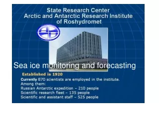
Some History • For over 100 year sea ice has been monitored from stations and ships • Until the 1980’s the main method of keeping track of sea ice was by using Aircraft Surveys • Over the last three decades they have used satellites • International Ice Patrol (IIP) is a branch of the United States Coast Guard, they use flight data and satellite data to warm mariners about icebergs
Ice MonitoringSatellites • Radarsat-1 • Radarsat-2 • ENVISAT • GRACE • The Future… • Crysat • NASA ICE Bridge
Radarsat-1http://www.icebergfinder.com/technology.aspx • Satellite-based synthetic aperture radar (SAR). With SAR the distance ot the target is usually about 800km, but reflections can come from anything. • Icebergs are harder to find because they absorb a lot of the energy being sent out which makes they easier to distinguish from ships from a processed image because they appear duller • Launched in 1995 • Trade off between resolution and area (highest resolution is 8 meters and the smallest image area of 50 km x 50 km)
Radarsat-1 Iceberg detection, confirmed by ships http://www.icebergfinder.com/technology.aspx
Radarsat-2http://www.radarsat2.info/application/ice/index.aspRadarsat-2http://www.radarsat2.info/application/ice/index.asp • Launched Dec. 14, 2007 • Frequencies: C Band SAR Antenna-Transmit & Receive Channel: 5405 MHz (assigned bandwidth 100,540 kHz). X Band Downlink Channel 1-8105 MHz (assigned bandwidth 61,230 kHz). And X Band Downlink Channel 2-8230 MHz (assigned bandwidth 61,230 kHz) • Obrit: polar, sun-synchronous orbit • Period: 101 minutes. • Improved ice edge detection, ice type discrimination and ice topography and structure information due to multi-polarization options • Swath Width increased from Radarsat-1
Radarsat-2http://www.radarsat2.info/application/ice/eoadp2_img.aspRadarsat-2http://www.radarsat2.info/application/ice/eoadp2_img.asp • Useful for sea and river ice • By merging three-channel (HH+VV+HV) they are able to see sea ice, open water, and land • HV:HH ratio provides a relative measure of volume scattering (HV) vs. surface scattering (HH)
ENVISAThttp://envisat.esa.int/category/index.cfm?fcategoryid=87ENVISAThttp://envisat.esa.int/category/index.cfm?fcategoryid=87 • Launched March 2002 by the European Space Agency (ESA) • Maps the extent of ice cover • It is an advanced polar-orbiting satellite that specializes in measurements of the atmosphere, ocean, land, and ice. • Iceberg detection by ASAR (advanced synthetic aperture radar), which uses different polarizations and a form of electromagnetic radiation. ASAR uses C band • Has a resolution of 25 meters and coverage area of 100 km by 100 km • The Polar Platform (PPF) started in 1990. They first started off with The Polar Orbiting Earth Mission (POEM-1) but this was eventually broken up in 1993 into ENVISAT to look at the environment and METOP-1 to monitor the meteorology.
ENVISAThttp://envisat.esa.int/category/index.cfm?fcategoryid=61ENVISAThttp://envisat.esa.int/category/index.cfm?fcategoryid=61 • Sun-synchronous polar orbit, 800km altitude, repeat cycle 35 days, 98.55° inclination • Since it has wide swath instruments it can provide complete coverage of the globe in 1-3 days! • Two X-bands, and Two Ka-bands operating independently so can be used simultaneously.
ENVISAT Alternating Polarization https://bora.uib.no/bitstream/1956/1135/1/MRS_Chapter8-proof.pdf • Like Radarsat-2, it has dual polarization combinations of HH, VV, and HV. The cross-polarization can be limiting for ice with low backscatter (like new thin ice in open water). • The co-polarization ratio (VV/HH) are best for discriminating ice from open water. This is also good for detection of ridges, and to determine level ice from deformed ice.
ICE http://envisat.esa.int/category/index.cfm?fcategoryid=88
GRACE http://www.csr.utexas.edu/grace/mission/flight_config.html
GRACEGravity Recovery and Climate Experiment • Tellus-monitors the change in the mass of hydrologic components (the properties/movement of Earth’s water). Most corrections are already applied and it has user friendly grids • Monitor mass loss of ice sheets such as in Greenland and Antarctica. • Looks at exchange of water between ice sheets, glaciers, and the oceans http://grace.jpl.nasa.gov/
Cryosat-2http://www.esa.int/esaMI/Cryosat/SEMZT6W0EZF_0.html • Also part of ESA’s Earth Observation Program • Cryosat was lost before its initial contact in 2005 • Target launch will be Feb. 28 2010 (it was suppose to be December of this year) • Cryosat-2 will observe ice thickness and how it is changing, which is not something that is currently done. So this research will be a break through in the study of global warming. • Cryosat-2 will help explain the melting of polar ice in correlation with rising sea surface heights. • Ice on land (Ice sheets) can be up to 5km while ice in the ocean could only be a few meters.
Cryosat-2http://www.esa.int/esaMI/Cryosat/SEMFJ4908BE_0.html#subhead1Cryosat-2http://www.esa.int/esaMI/Cryosat/SEMFJ4908BE_0.html#subhead1 • Will have an unusually high polar orbit (2 degrees short of true North). This will maximize its coverage of the poles • One of the main instruments onboard is a Synthetic Aperture Interferometric Radar Altimeter (SIRAL). This is the first sensor of its kind that is specially made for ice.
NASA ICE Bridgehttp://antarcticsun.usap.gov/science/contenthandler.cfm?id=1932 • ICESat stands for Ice, Cloud and Land Elevation Satellite • ICESat-II won’t launch until 2014 at the earliest • Operation Ice bridge is a 6 year mission to make up for lost time and information • NASA outfitted a DC-8 jetliner with various sensors including ones that were not on the original ICESat. The jet flies out of Punta Arenas Chile crossing West Antarctica and the Antarctic Peninsula. It will crisscross ice shelves, sea ice, glaciers and the massive western ice sheet collecting critical data for researchers.http://www.i-cool.org/?cat=21
Questions?Thank You References: Tina Haskins < http://www.i-cool.org/?cat=21> http://technology.jpl.nasa.gov/research/ResearchTopics/topicdetails/?ID=42http://www.flightsafrica.co.uk/blog_images/cruise_ship_iceburg.jpg http://www.icebergfinder.com/technology.aspx http://www.radarsat2.info/application/ice/index http://envisat.esa.int/category/index.cfm?fcategoryid=87 https://bora.uib.no/bitstream/1956/1135/1/MRS_Chapter8-proof.pdf http://www.eurimage.com/products/envisat.html http://envisat.esa.int/category/index.cfm?fcategoryid=88 http://www.csr.utexas.edu/grace/mission/flight_config.html http://grace.jpl.nasa.gov/ http://www.esa.int/esaMI/Cryosat/SEMZT6W0EZF_0.html http://antarcticsun.usap.gov/science/contenthandler.cfm?id=1932