Download
1 / 70
700 likes | 711 Views
Learn about positioning, tracking, and infrastructure establishment in Wireless Sensor Networks (WSN). Explore techniques such as topology control, clustering, and time synchronization.

E N D
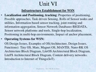
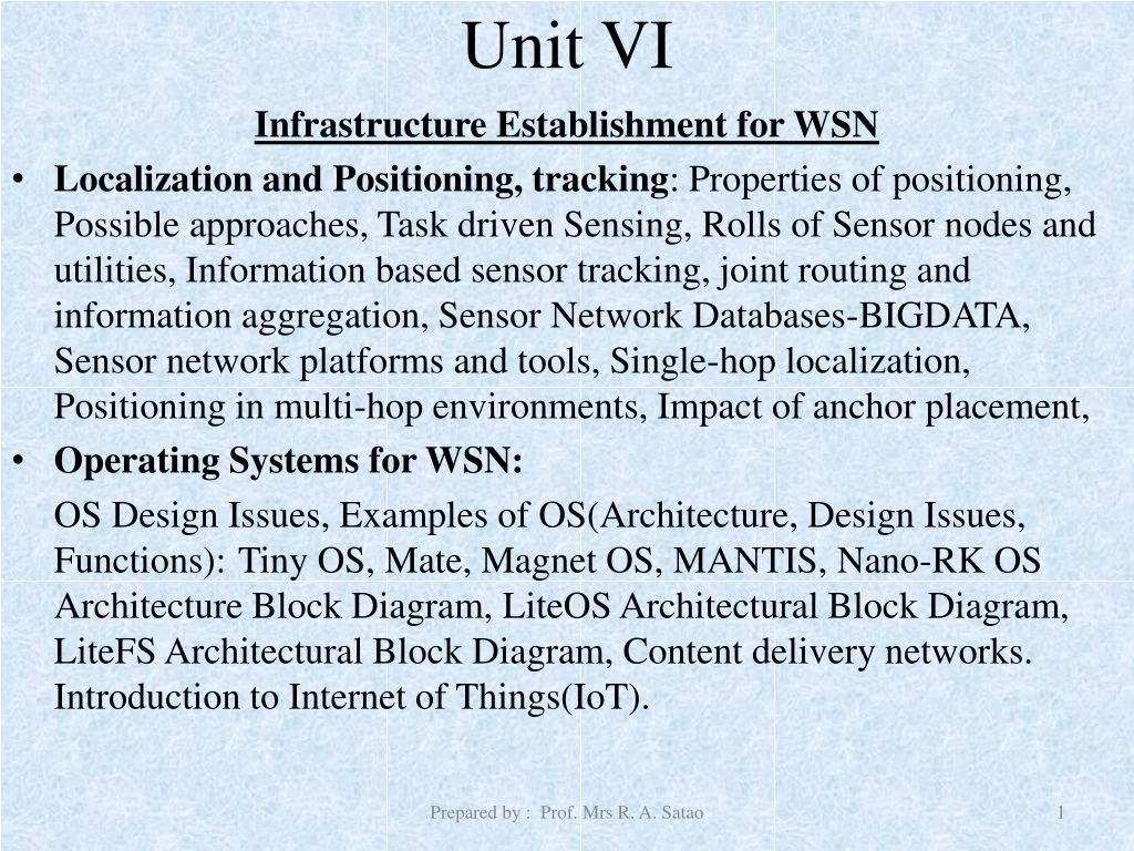
Unit VI Infrastructure Establishment for WSN • Localization and Positioning, tracking: Properties of positioning, Possible approaches, Task driven Sensing, Rolls of Sensor nodes and utilities, Information based sensor tracking, joint routing and information aggregation, Sensor Network Databases-BIGDATA, Sensor network platforms and tools, Single-hop localization, Positioning in multi-hop environments, Impact of anchor placement, • Operating Systems for WSN: OS Design Issues, Examples of OS(Architecture, Design Issues, Functions): Tiny OS, Mate, Magnet OS, MANTIS, Nano-RK OS Architecture Block Diagram, LiteOS Architectural Block Diagram, LiteFS Architectural Block Diagram, Content delivery networks. Introduction to Internet of Things(IoT). Prepared by : Prof. Mrs R. A. Satao
Infrastructure Establishment for WSN Prepared by : Prof. Mrs R. A. Satao
Architecture Prepared by : Prof. Mrs R. A. Satao
Infrastructure Establishment for WSN Definition: The task of initiating collaborative environment for sensor network when that network is activated is called infrastructure establishment. Prepared by : Prof. Mrs R. A. Satao
Infrastructure Establishment for WSN When sensor network is activated various task must be performed to establish necessary infrastructure that will allow useful collaborative work to be performed: Discovering other nodes Radio power adjustment to ensure adequate connectivity. Cluster formation. Node placement in a common temporal and spacial framework. Prepared by : Prof. Mrs R. A. Satao
Infrastructure Establishment for WSN Some common techniques used to establish the network are: Topology control Clustering Time synchronization Localization Prepared by : Prof. Mrs R. A. Satao
1) Topology control : idle node : Active node Prepared by : Prof. Mrs R. A. Satao
1) Topology control • A sensor node that wakes up execute a protocol to discover which other nodes it can communicate with. (bidirectional) • At initial state each node try to connect with neighbors according to the radio link capacity of its own. • The neighbor is determined by the radio power of the node as well as local topology and other conditions that may degrade performance of the radio link. • Sensor node are capable of broadcasting less that their maximum possible radio power. (for energy saving and network lifetime) • Example : Homogeneous topology : all nodes with same transmission range. Prepared by : Prof. Mrs R. A. Satao
Critical Transmission Range Problem Computing minimum common transmitting range “ r ” such that the network is connected. Solution : Depends on physical placement of the node. If node location is known CTR problem has a simple solution. CTR is defined as longest edge of minimum spanning tree Prepared by : Prof. Mrs R. A. Satao
Solution to CTR problem Example : GRG (Geometric Random Graph): N points are distributed into a region according to some distribution and then some aspect of the node placement is investigated with high probability Prepared by : Prof. Mrs R. A. Satao
Base Station Larger Nodes denote Cluster Heads Layer 1 Layer 2 Layer 3 2)Clustering Clustered Architecture Layered Architecture Base Station Prepared by : Prof. Mrs R. A. Satao
2) Clustering • Hierarchical architecture enables more efficient use of sensor resources such as: • Frequency spectrum • Bandwidth • Power • Advantages: • Health monitoring of network is easy. • Identifying misbehaving node is easy. • Some nodes can act as watchdogs for other nodes. • Maintenance of network is easy. Prepared by : Prof. Mrs R. A. Satao
2) Clustering Cluster formation: 1) Initially unique ids (UIDs) are assigned to each node 2) Node with higher ID than its uncovered neighbors declares itself as cluster head. 3) Cluster head nominated nodes then communicate with each other. 4) Node that can communicate with two or more cluster heads may become gateway. Gateway : node that aid in passing traffic from one cluster to other. Uncovered neighbors : node that have not been already claimed by another cluster head. Prepared by : Prof. Mrs R. A. Satao
3) Time Synchronization • Every node is operating independently so their clocks may not be synchronized with each other. • It is important to run network efficiently • to detect events • for localization • estimating internodes distances. • to arrange TDMA schedule Prepared by : Prof. Mrs R. A. Satao
3) Time Synchronization • In wired network NTP is used to achieve coordinated universal time (UTC). • In NTP highly accurate clock is mounted on one of the machine of the network. This is not applicable for WSN : • No master clocks are available. • Inconsistent common delay. • Connections are variable/dynamic and unpredictable. Prepared by : Prof. Mrs R. A. Satao
3) Time Synchronization • Time difference caused by the lack of common time origin is called as clock phase difference or clock bias. • Methods for clock synchronization in WSN : • Clock phase diff estimation using three msg exchanges. • Interval method. • Reference broadcast. Prepared by : Prof. Mrs R. A. Satao
4 ) Localization and Localization Services • What? • To determine the physical coordinates of a group of sensor nodes in a wireless sensor network (WSN) • Due to application context, use of GPS is unrealistic, therefore, sensors need to self-organize a coordinate system • Why? • To report data that is geographically meaningful • Services such as routing rely on location information; geographic routing protocols; context-based routing protocols, location-aware services
Localization in Wireless Sensor Networks In general, almost all the sensor network localization algorithms share three main phases • DISTANCE ESTIMATION • POSITION COMPUTATION • LOCALIZATION ALGHORITHM
Localization in Wireless Sensor Networks • The distance estimation phase involves measurement techniques to estimate the relative distance between the nodes. • The Position computation consists of algorithms to calculate the coordinates of the unknown node with respect to the known anchor nodes or other neighboring nodes. • The localization algorithm, in general, determines how the information concerning distances and positions, is manipulated in order to allow most or all of the nodes of a WSN to estimate their position. Optimally the localization algorithm may involve algorithms to reduce the errors and refine the node positions.
Distance Estimation There are four common methods for measuring in distance estimation technique: • ANGLE OF ARRIVAL (AOA) • TIME OF ARRIVAL (TOA) • TIME DIFFERENT OF ARRIVAL (TDOA) • THE RECEIVED SIGNAL STRENGH INDICATOR (RSSI)
Distance Estimation • ANGLE OF ARRIVAL method allows each sensor to evaluate the relative angles between received radio signals • TIME OF ARRIVAL method tries to estimate distances between two nodes using time based measures • TIME DIFFERENT OF ARRIVAL is a method for determining the distance between a mobile station and nearby synchronized base station • THE RECEIVED SIGNAL STRENGTH INDICATOR techniques are used to translate signal strength into distance.
Position Computation The common methods for position computation techniques are: • LATERATION • ANGULATION
Position Computation • LATERATION techniques based on the precise measurements to three non collinear anchors. Lateration with more than three anchors called multilateration. • ANGULATION or triangulation is based on information about angles instead of distance.
Classifications of Localization Methods According to the ways of Sensors implementation, we classify the current wireless sensor network localization algorithms into several categories such as: • Centralized vs Distributed • Anchor-free vs Anchor-based • Range-free vs Range-based • Mobile vs Stationary
Sensor Tasking and Control • Because of Limited battery power and Limited bandwidth careful tasking and the control id needed. • Information collected from the sensors. • All information aggregation is needed. • Selective information aggregation is needed. • Which sensor nodes to activate and what information to transmit is a critical issue. • Classical algorithms are not suitable for WSN : • Sense values are not known. • Cost of sensing may vary with the data.
Designing strategy for Sensor Tasking and Ctrl: • What are the important object in the environment to be sensed ? • What parameters of these object are relevant? • What relations among these objects are critical to whatever high level information we need to know? • Which is the best sensor to acquire a particular parameter? • How many sensing and the communication operations will be needed to accomplish the task? • How coordinated do the world models of the different sensor need to be ? • At what level do we communicate information in a spectrum from a signal to symbol?
Roles of Sensor nodes and utilities Prepared by : Prof. Mrs R. A. Satao
Roles of Sensor nodes Sensors R SR S SR I S S Prepared by : Prof. Mrs R. A. Satao
Information Driven Sensor Querying Prepared by : Prof. Mrs R. A. Satao
Sensor Network Databases • Sensor Network as Database: Think of a sensor network as a distributed database that store data within the network and allow queries to be injected anywhere in the network. • Research issues • how is data stored and organized after sensing • what’s the user interface to the sensor database • How does an external query find and process the data in an efficient manner? Prepared by : Prof. Mrs R. A. Satao
Challenges • The system is highly volatile. • Relational tables are not static. • New data is continuously sensed. • High communication cost. • In-net processing during query execution. • Arbitrarily long delay and rate of data arrival is variable • Limited storage • Older data has to be discarded • Keep statistics • Long-running, continuous queries. Prepared by : Prof. Mrs R. A. Satao
Querying the physical world • Common user operations in sensor network: • Queries • Actuate & control • Query: user specify the data they want • Simple, SQL-like queries • Using predicates, not specific addresses • Challenge is to provide: • Expressive and easy-to-use interface • High-level operators • Power efficient execution framework • Do sensor networks change query processing? Prepared by : Prof. Mrs R. A. Satao
Type of queries • Historical • What is the average rainfall over past 2 days? • Current • What is the current temperature in Lab_no 3 at building no 5 ? • Long running, continuous • Obtain an ID whenever sensors in region R detects person. 48 Prepared by : Prof. Mrs R. A. Satao
Example Query • High-level query interface such as SQL • For next 3 hours, retrieve every 10 minutes the max rainfall level in each county in California, if it is greater than 3.0 inch. • SELECT max (rainfal_Level) ,county FROM sensors Where STATE = California GROUP BY country HAVING max (rainfal_Level) > 3.0in DURATION [ now, now+180min] SAMPLING PERIOD 10 min 49 Prepared by : Prof. Mrs R. A. Satao
Sensor Database Properties 1. Persistence: Data stored in the system must remain available to queries, despite sensor node failures and changes in the network topology. 2. Consistency: A query must be routed correctly to a node where the data are currently stored. If this node changes, queries and stored data must choose a new node consistently. 3. Controlled access to data: Different update operations must not undo one another’s work, and queries must always see a valid state of the database. Prepared by : Prof. Mrs R. A. Satao
Sensor Database Properties… 4. Scalability in network size: As the number of nodes increases, the system’s total storage capacity should increase, and the communication cost of the system should not grow unduly. 5. Load balancing: Storage should not unduly burden any one node. Nor should any node become a concentration point of communication. 6. Topological generality: The database architecture should work well on a broad range of network topologies. Prepared by : Prof. Mrs R. A. Satao
Issues • How to identify relevant sensors? • Computation vs. communication tradoff Where to process query? • Inside the sensor network (route query) • At centralized location (route data) • Large amount of data transfer not efficiency • How to process? 52 Prepared by : Prof. Mrs R. A. Satao
Cougar Sensor Network Database • SQL type query interface. • Distributed query execution. • Represents each sensor as ADT (applies encapsulation as OOP). • Each measurement is associate with a time stamp. • Whenever a signal processing function returns value a record is inserted into virtual relations (never updated or deleted). Prepared by : Prof. Mrs R. A. Satao