Download
1 / 46
460 likes | 463 Views
Learn about the different layers of the Earth - the crust, mantle, and core - and the evidence of continental drift. Discover how the seafloor geography provides support for the theory of drifting continents.

E N D
Lesson 2- The Center of the Earth • -The Earth is made up of many layers • -The outer layer is the crust and is made of mostly rock • -It includes the oceans, ocean floor, and continents • 2 types of crust- -Oceanic- thinner, 5-10 km thick, made of dense rocks like Basalt -Continental- thicker 30-40 km thick, made mostly of Granite
What do you think? • From where you are now, about how many miles is it to the center of the Earth? • A) 8,000 miles • B) 4,000 miles • C) 10,000 miles • D) 2,000 miles • About how long would it take you to walk to the center of the Earth with no stops? A) 2 years • B) 3 months • C) 1 year • D) 6 months
What do you think? • From where you are now, about how many miles is it to the center of the Earth? • A) 8,000 miles • B) 4,000 miles • C) 10,000 miles • D) 2,000 miles • About how long would it take you to walk to the center of the Earth with no stops? A) 2 years • B) 3 months • C) 1 year • D) 6 months
The Mantle • -Layer below the crust 3,000 km thick, made of • hot rock • -Upper Mantle has the following layers- • -Lithosphere-the rocky outer layer of the solid earth, averaging about 100 km in depth; the lithosphere includes the continents, islands, and the entire ocean floor the • -Asthenosphere-the upper part of the earth´s mantle. Rock here is soft and at it’s melting point. It is capable of being molded (plasticity) • -The Lower Mantle-In this layer, pressure and heat make the rock flow very slowly, like a thick liquid
The Core • Outer Core- Made mostly of metals iron and nickel, and is a liquid • Inner Core- Deepest layer of the Earth, made of solid iron and nickel, hotter than the Outer Core
Lesson 3- Continental Drift • -In the 1500’s, Dutch mapmaker, Abraham Ortelius thought that the continents at one time all fit together like a puzzle to make one “supercontinent”. • -In 1915, Alfred Wegener, a German meteorologist, believed this also and named the supercontinent Pangaea. • -He believed that over 200 million years, the continents drifted apart into 2 supercontinents: • Gondwanaland- made up of modern-day Africa, South America, Australia, Antarctica, and India • Laurasia- made up of North America, Europe, and northern Asia This theory was the Continental Drift!
Alfred Wegener investigated the Continental Drift theory and came up with evidence to convince others. • 1) Fossils- Similar fossils were found on southern continents that are now separated by oceans. • 2) Mountain chains and Rock Layers- mountain layers seemed to match up where they are now separated by bodies of water.
3) Climate- • South America, southern Africa, India, and Australia have very warm climates today. All are far apart from each other. But, landforms in these areas indicate the presence of glaciers and that they were once together under a huge ice sheet in the colder areas of Pangaea. Other places reveal evidence of dramatic climate change. Tropical swamps once existed in areas that are now much colder, such as parts of North America, Europe, and northern Asia.
Did scientists believe Wegener’s theory? • - Many did not believe this theory of Continental Drift • - Scientists wanted to know- how did the continents drift apart? • - Wegener suggested that perhaps they moved across oceanic crust, like a ship breaks through ice • -More data was needed because there was no proof of this movement!
Lesson 4- Seafloor Geography • -Many scientists did not believe Wegener’s theory of the continents drifting apart • -Then, in the 1950s, the simple activity of mapping the ocean floor began providing evidence to support Wegener’s theory. • -Scientists wanted to know what was on the ocean floor so they used sound waves (sonar) • -Sonar waves travel to the bottom of the ocean, and an echo travels back to the ship • -The time the sound takes to travel to the ocean floor and back is used to figure out the distance it traveled • -These depth measurements are combined to create a map of the ocean floor in particular areas, called bathymetric maps.
Under the Sea! Continental Shelf- a shelf of undersea land reaching a depth of about 200 meters (656 feet), extending out from the shoreline • Continental Slope- the relatively steeply sloping undersea land extending from the outer edge of the continental shelf • Submarine Canyon- a deep channel on the ocean floor, in the outer continental shelf, in the continental slope, or in the continental rise • Continental Rise- a region of gentle slope between the continental slope and the main ocean floor • Abyssal Plain- a flat expanse of ocean floor Guyot-a seamount with a flattened top
-Data gathered by ocean surveys showed that a great mountain range on the ocean surrounds the entire earth, running between continents like the seam on a baseball • -This huge, global mountain chain rises an average of 4 kilometers above the sea floor! That’s taller than most mountains!
Lesson 5- Seafloor Spreading • -In 1952, geologist Marie Thorpe was trying to measure the depth of the ocean floor • -She discovered a deep valley running through the mid-oceanic mountain chain which became known as the Mid-Atlantic Ridge. • -The walls along the valley appeared to be slowly spreading apart.
Seafloor Spreading- occurs along mid-ocean ridges, molten material from below earth's surface moves upward, cools, and forms new oceanic crust. The older crust will then move farther away from the rift in either direction, and new crust forms in its place. • How is this happening?
Magnetism! • -Scientists think that currents in the earth’s iron core produce a giant magnetic field all around the planet. • -This effect causes earth to behave like a giant bar magnet, with a north end (the magnetic north pole) and a south end (the magnetic south pole). • -These poles are located near the geographic north and south poles, but not in the exact same spots.
-Many rocks on the ocean floor contain iron • -As these rocks cool, they change from a liquid to a solid • -As a liquid, magnetic particles can float freely and like tiny compasses, they line up with earth’s magnetic field and point north. • -When the rock cools, the mineral grains lock in to place, recording the direction of north at the time the solid rock formed. • -The magnetic minerals in rocks became useful markers for earth’s history, and they showed • - Iron-rich minerals in rock pointed in one direction, and then switched to the exact opposite direction. This seemed to support the idea that magnetic poles have switched theirlocations. • -The record of earth’s magnetic field is called paleomagnetism. This reveals when the earth’s magnetic poles switched and how rocks have moved over time.
-As spreading pulled new oceanic crust apart, a pattern of magnetic “stripes” would have formed. • -They would be about the same size and carried away from ocean ridges on each side. • -the pattern looks a lot like magnetic “stripes” in rock, switching back and forth from normal pole positions to reversed polepositions. • -Stripes occurred in rock extending out on both sides of the ridge • -This showed that seafloor spreading does occur!
How old is the seafloor? • -The age of the seafloor is also important. • -Using rock-dating techniques, geologists can find out the ages of rocks on the ocean floor. • -Then, knowing how far the rocks are from the mid-ocean ridge, they can figure out the rate at which the seafloor is spreading. • -If the seafloor is spreading, the youngest oceanic crust would be found at the ridges and older crust would be found as you move outward. • Is that what is happening in the picture?
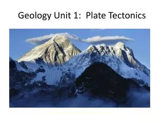
Lesson 6- Plate Tectonics • -Scientists concluded that earth is composed of many different-sized plates. • -This information led to a new theory that explained movement of continents and geologic activity such as earthquakes and volcanoes. • -The population on Earth is increasing, but the land is not!
Earthquakes • -rocks on both sides of the mid-oceanic ridges convinced scientists that earth's lithosphere moves, carrying continents with it. • -Once scientists knew that pieces of earth’s crust could move, they looked to explain how and why. • -Data from earthquake recording instruments, called seismographs, showed scientists where earthquakes were occurring on the ocean floor • -Information from seismographs was used to map out several earthquake zones
-At earthquake zones, scientists could demonstrate where ocean crust was being created and old crust was sinking back into earth’s mantle • -Scientists concluded that the surface of the planet is divided into a number of moving sections, called tectonic plates. • -Where these plates interact, there are numerous earthquakes and volcanoes!
Plate Movement • Earth’s plates move against one another in different ways, producing some interesting results! • 3 kinds of Plate Movement- • 1) Divergent Plate Boundary- a plate boundary where two plates move away from each other • 2) Convergent Plate Boundary-a boundary at which tectonic plates are moving toward one another or colliding • 3) Transform Plate Boundary- a plate boundary where two plates move in opposite directions alongside one another
Plate motion is due to 2 forces- • 1) Gravity • 2) Convection-the transfer of heat by the circulation or movement of the heated parts of a liquid or gas
Lesson 7- Energy of Convection • -The Earth’s surface is in constant movement! • Remember that 2 forces are responsible for plate movement- gravity and convection • -Convection -describes the movement of gases or liquids due to differing temperatures. • -Gravity- is the force of attraction between any two masses such as earth and everything on it, including giant tectonic plates.
-When Pangaea broke apart about 200 million years ago, large pieces of land shifted, eventually forming the arrangement of continents and oceans we have today. • -Scientists call these pieces tectonic plates and have given them names such as Pacific Plate, Cocos Plate, and South American Plate. • -Even today, these plates are always moving!
-Earth’s plates rest on top of the upper mantle, the asthenosphere. • -It is made up of molten rock so hot that it flows • -When convection currents occur here, the plates move around • -Divergentplates move AWAY from each other • -Convergent plates move TOWARDS each other, colliding • -Subduction is when one plate goes under another
-convection is a transfer of heat in a circular motion • -When cool areas are heated up, they rise, then they cool, sink and repeat! • -Gravityalso can affect plate movement • -Heat from rising magma pushes rocks upward from the ridge. As they cool, they become denser and gravity acts on these raised edges, pulling them downward and away from one another. This create
So, what causes the Earth’s crust to move? 1) Convection causes material in the mantle to flow. 2) Plates may move toward, away and under one another or continue to collide, fold and crumple resulting in mountains. 3) Gravity pulls on plate edges creating ridge push and slab pull and making room for new rock to form.
Lesson 8- Plate Boundaries • Lithosphere • -tectonic plates are pieces of the lithosphere; the solid, rigid top layer of the earth • -The lithosphere includes the crust and the uppermost part of the mantle. • -Geologists group the crust and uppermost portion of the mantle together because they behave similarly. • -The lithosphere is solid and rigid but when it is put under stress, it will break. • Asthenosphere • -Tectonic plates float on a weaker layer of the mantle called the asthenosphere • -
Oceanic Crust • -lies in ocean basins • -made of dense rock such as Basalt • -about 35 km thick • Continental Crust • -forms the shallow sea beds near the shores and continents • -about 5-7 km thick
Plate boundary- border around two plates • Divergent plate boundary- a plate boundary where two plates move away from each other • Convergent plate boundary- plates that are moving toward one another • Transform plate boundary- a plate boundary where two plates move in opposite directions alongside one another
Lesson 9- Landforms • -Earthquakes and Volcanoes tend to occur near plate boundaries • -Remember there are 3 types of boundaries- convergent, transform, divergent • -Different landforms occur at each type of boundary
Convergent Plate Boundaries • -plates that are moving toward each other • -Most tectonic plates contain both oceanic crust and continental crust. • -when oceanic and continental crusts come together, the oceanic crust is denser, so it sinks into the asthenosphere • -new magma pushes up through cracks in the crust, creating volcanic activity. • -that’s why the terrain near convergent boundaries is so rugged
Continental Collision • -ocean trenches, volcanoes, and mountains may occur at convergent boundaries between oceanic crust and continental crust • -2 pieces of continental crust can move towards each other also • -when this happens, they crunch up, folding and bending to form tall, rugged mountains. • -The collision of convergent boundaries between continental crusts takes place gradually. • Underwater Collision • -other changes can take place at a convergent boundary between two pieces of oceanic crust • -One plate may sink, slowly sliding beneath the other, creating underwater volcanoes. • - The tops of the volcanoes build up and may extend above the water’s surface to form islands.
Divergent Plate Boundaries • -a plate boundary where two plates move away from each other • -Divergent boundaries are most often found underwater between oceanic plates. • -As the plates separate, they create a space that may fill with magma and create a ridge, or cause underwater volcanoes. • -When divergent boundaries occur in continental crust, they may cause it to split apart.
Transform Plate Boundaries • -a plate boundary where two plates move in opposite directions alongside one another • -Transform boundaries do not change the amount or type of crust, but they can have effects on the landforms near them. • -As the plates slide past one another, the pressure on those pieces increases, and when they separate, energy is suddenly released and earthquakes occur on the surface above the plate boundary.
Hot Spots • -Although most volcanic activity occurs at plate boundaries, volcanoes can appear within a plate. • -Sometimes, hot, molten material rises from the mantle, melting the crust above it to form volcanoes. These areas are called hot spots. • -As a plate moves over a hot spot, a chain of volcanoes may be built up. • - The Hawaiian Islands are an example of how hot spots formed volcanoes within the boundaries of the Pacific plate. The big island of Hawaii, with an active volcano, is now directly over a hot spot.
Did you know….? • -Mount St. Helens volcano formed at a convergent boundary in Washington State where the Pacific Plate and North American plate meet! • -The San Andreas Fault formed at a transform boundary in California! • -The Hawaiian Islands formed as a result of hot spots in the Pacific Ocean! • -Mount Whitney formed at a convergent boundary in California! • -The Mid-Atlantic Ridge formed at divergent boundaries that run along the North and South American plates and the Eurasian and African plates!
Lesson 12- Earthquakes • -there are about 70-80 major earthquakes per year and thousands more that are minor and unfelt • -as tectonic plates move against each other, they build up a lot of pressure and this stress can cause rocks to bend and fold • -Sometimes the stress builds to the point that the rocks break or slip. The sudden release of energy creates waves that can travel far from the break, move the ground, and cause structures to sway and even fall down. • -Forces can change rocks position drastically, causing them to bend or fold • -Stress on rock does not always cause it to fold and bend. Sometimes, the rock breaks, forming a fault-a break along which the surrounding rock moves. However, the rock does not move smoothly.
3 kinds of faults • Normal fault- forms when the pieces of crust move away from each other as they are pulled apart. One piece ends up lower than the other, forming a slope or cliff. • Reverse fault- forms when tectonic plates move toward one another, compressing the crust. One piece pushes over the other. • Strike-Slip fault- forms when two pieces slide alongside one another, in opposite directions. If you look at the rocks of an exposed fault, you can see how much force was needed to move the crust.
Focus- the zone within the earth where rock displacement produces an earthquake • Seismic Waves- compression waves caused by movements in the earth´s crust; seismic waves radiate outward from the source of an earthquake • Epicenter- the location on the surface of the earth directly above the focus of an earthquake
What's the difference between a seismograph and a seismogram? • Seismograph- an instrument used to record earthquake waves • Seismogram- the record of an earthquake tremor, as recorded by a seismograph; by reading a seismogram, we can learn how powerful an earthquake is
Making Waves! • -there are two types of seismic waves, which travel in different ways. • -Pressure or Primary waves (P waves)- They contract and release as they move very quickly. They can move through Earth like they do through a spring or a Slinky • - Secondary waves (S waves)-S waves move more like a rope. That means they move sideways and back and forth compared to the direction the wave is traveling. They do not travel as fast as P waves. • -Scientists find out where the focus and the epicenter of the earthquake are located by comparing the length of time that it takes for the two kinds of waves to travel to seismographs. • -The P waves arrive first, and the S waves follow them • - By timing the arrival of the waves, scientists can tell how far their station is from the earthquake.
-Studying how seismic waves travel to distant places has informed us more about the inner structure of the earth. • -Scientists have found that P waves can travel through solids, liquids, and gases. Using this information, scientists are able to figure out the composition of the earth’s interior. • - Studying these waves also helps scientists figure out the depths and the densities of the layers. • -Seismic waves travel faster through denser material
More Resources! • www.happyscientist.com • User name- LVS • Password- LVS • www.sciencespot.net • Bill Nye, the Science Guy videos- • Earthquakes- • http://www.youtube.com/watch?v=24R_yGDgwA8 Earth’s Crust http://www.youtube.com/watch?v=7NJQKs9-NM0 Volcanoes • http://www.youtube.com/watch?v=oiNWdZuf_D8