Download
1 / 11
110 likes | 121 Views
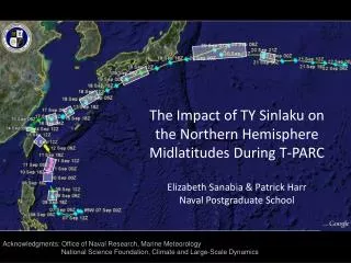
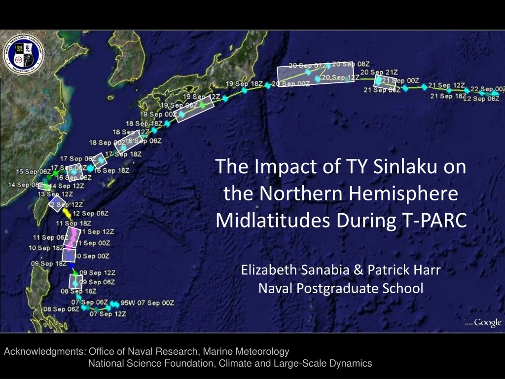
The Impact of TY Sinlaku on the Northern Hemisphere Midlatitudes During T-PARC Elizabeth Sanabia & Patrick Harr Naval Postgraduate School. Acknowledgments: Office of Naval Research, Marine Meteorology National Science Foundation, Climate and Large-Scale Dynamics.

E N D
The Impact of TY Sinlaku on the Northern Hemisphere Midlatitudes During T-PARCElizabeth Sanabia & Patrick HarrNaval Postgraduate School Acknowledgments: Office of Naval Research, Marine Meteorology National Science Foundation, Climate and Large-Scale Dynamics
Predictability Challenges during the ET of TY Sinlaku Compare forecast and analyzed impacts of the ET on NH midlatitudes Identify sources of variability downstream of the ET Examine physical characteristics of the TC relative to reduced predictability ECMWF GFS EPAC WPAC CPAC EPAC WPAC CPAC
Extratropical Transition as part of the TC Lifecycle Extratropical Transition Tropical Transformation Extratropical / Reintensification Figure adapted from Klein et al. (2000); TY Man-yi track courtesy Digital Typhoon: http://agora.ex.nii.ac.jp/digital-typhoon/summary/wnp/s/200704.html.en
Developing center Decaying center Mature center The decaying tropical cyclone increases the EKE that continues to feed the downstream development process. Downstream Development in the context of a local Eddy Kinetic Energy Analysis (after Orlanski and Sheldon 1995)
Diagnosing Downstream Developmentthrough the downstream propagation of EKE following the TC-midlatitude interactionEXAMPLE: GFS Forecast AT: 1200 UTC 16 Sep 08 a b c b a c
GFS Analysisindicates minimal downstream development1200 UTC 16 Sep 08 a b b c a c
Post-recurvature Sinlaku 20 Sep / 0100 UTC 16 Sep / 1800 UTC 18 Sep / 0200 UTC 17 Sep / 0200 UTC X
Data & Forecast Variability FORECAST IMPACTS on the NH midlatitude pattern: DD over-forecast in 16 of 21 cases Reintensification of the TC over-forecast in 15 of 21 cases FORECAST VARIABILITY: The location of the greatest error and the greatest variability in total EKE was the CPAC. Variability in CPAC EKE was a consequence of the variability in the EKE in upstream energy centers associated with the TC and its impacts on other WPAC circulation centers. INVESTIGATE SENSITIVITIES TO VARIOUS TC/ET PROPERTIES AS THEY IMPACT DOWNSTREAM DEVELOPMENT. ECMWF GFS NOGAPS
Error (hPa) in Forecast TY Intensity ECMWF ECMWF GFS GFS NOGAPS NOGAPS
Summary • RESULTS: • REDUCED PREDICTABILITY FOLLOWING THE RECURVATURE OF TYPHOON SINLAKU • TRANSFORMATION STAGE: Weakening of the tropical cyclone; rapid re-intensification in the subtropics. • EXTRATROPICAL STAGE: False alarms in multiple forecasts from 3 global models • REDEVELOPMENT OF TY SINLAKU WAS CRITICAL TO ET: Redevelopment of TY Sinlaku SW of Japan as a warm core tropical system enabled the dissipating system to reach the midlatitudes and begin extratropical transition east of Japan. • GREATEST VARIABILITY/ERRORS IN FORECAST DD IN THE CENTRAL NORTH PACIFIC • Over-forecast TC during the extratropical stage over the western North Pacific • Excess EKE propagation from the western North Pacific • CURRENT WORK: • INVESTIGATE SENSITIVITIES OF THE DD TO THE RE-INTENSIFICATION OF THE TC • Identify mechanisms that were poorly forecast resulting in false reintensification and DD: • Vertical wind shear, upper-level outflow, diabatic influences, upstream trough, etc. • Detailed analysis of aircraft and ELDORA radar data • WRF SIMULATIONS WITH AND WITHOUT SINLAKU