Download
1 / 26
260 likes | 356 Views
Coast Protection Board and Coastal Management Branch Involvement in coastal recreational access. 1946. 2008. Recreational Coastal Access. Coast Protection Board Policies for Coastal Access. The Coast Protection Board: encourages and supports environmentally sustainable access to the coast,

E N D
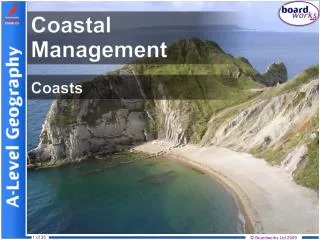
Coast Protection Board and Coastal Management BranchInvolvement in coastal recreational access
1946 2008 Recreational Coastal Access
Coast Protection Board Policies for Coastal Access • The Coast Protection Board: • encourages and supports environmentally sustainable access to the coast, (while recognising that some coastal landforms are not suitable for access, and public safety must be maintained) • encourages and supports the rationalisation of roads / tracks to the coast, • does not support roads that run parallel to the coast, • opposes vehicular access to beaches, (recognising that there is a need to balance public uses to ensure they are managed wisely, safely and in a manner that minimises environmental impacts to the beaches.) • opposes new development that restricts or limits access to the coast, • provides grants to Local Councils towards approved access projects that comply with these policies and the Coast Protection Act 1972. (Subject to state wide priorities and the availability of funds.)
Coast Protection Board Role and Legislation for Managing Access • Coast Protection Act 1972 • Declaration of Restricted Area’s eg. Telowie Beach, Beachport breakwater, Semaphore breakwater. • Development Act 1993 • Development referrals (roads, associated infrastructure etc) • Coast Protection Board grants • Council grants and Community Participation Grants • Advice, information and support for managing access and coastal land • S. (34) Restricted areas • Any part of a coast protection district may be declared a restricted area (but not private land or land constituting a public road). • Can contain such prohibitions and restrictions upon access to the area as the Minister thinks fit (eg. pedestrian and/or vehicular, etc.) • Penalties for contravention of restriction.
Telowie Beach • Coastal reserve is Crown land dedicated to the District Council of Mount Remarkable for care, control and management. • Being damaged by uncontrolled access of 4WD vehicles and motorbikes. • In 2006 the area was declared a restricted area under the Coast Protection Act to prohibit motor vehicles from the area. • The area was fenced, signage installed and a revegetation program was undertaken.
Telowie Beach • The work was done in partnership between the District Council of Mount Remarkable, Northern and Yorke NRM,, Coast Protection Board, DEH - Coastal Management and Crown lands, SAPOL, BHP Billiton (private sponsor) and Conservation Volunteers Australia. • Key Factors to success • Partnership between key stakeholders • Community awareness and engagement • Police support • Ongoing presence of CVA undertaking revegetation program
Fishery Beach / Lands End • The Coast Protection Board purchased coastal land in the Fishery Beach / Lands End area of Fleurieu Peninsula in the 1980s to conserve the natural and heritage values of the area. • This area was used heavily by off-road vehicles, leading to damage of vegetation, erosion and damage to heritage (European and Aboriginal) sites. SAFETY ISSUES • Carpark constructed, fencing and gates were installed from 2004/05, the gates were locked to the public in 2006 • Planning and works undertaken in partnership between the District Council of Yankalilla, AMLR NRM, CPB, DEH, Greening Australia, SAPOL, local community and landowners
Fishery Beach / Lands End • Initially a lot of vandalism • A consistent approach taken to repair damage as soon as possible. Media releases promoting the area. Badging of the area as a Conservation Reserve. • Key factors to success • Planning, works, and ongoing management undertaken in partnership • Consistent approach to management and maintenance • Presence on site
1979 2007 Far West Coast Access Management
Far West example - Location Focus Area • 300km west of Ceduna • Nullarbor NP, south of the Eyre Highway.
Far West example - mapping • NP boundary • Topographic tracks • Cadastral boundaries • Existing tracks • (134 km) • Existing tracks • (134 km) • Formal car parks • and lookouts (4) • Existing tracks • (134 km) • Formal car parks • and lookouts (4) • Informal cliff top • lookouts (24) • Existing tracks • (134 km) • Formal car parks • and lookouts (4) • Informal cliff top • lookouts (24) • Sea lion sites (1) • Starling cages (0)
Statistics – Access Management • TRACKS • Topographic maps – 205km • Actual Existing Tracks – 535km (330km or 160% increase) • Take off points from Hwy to coast – 193 (in 185km of highway) • FAUNA • Starling cages – 19 • Sealion sites – 26 • CAR PARKS AND LOOKOUTS • Cliff top lookout car parks – 7 • Unofficial cliff top lookouts – 72
Safety – Cave access Accelerated erosion Damage to vegetation, habitat and landscape, weed introduction and spread Safety – Informal cliff top lookouts Safety - Cracks Damage to cultural sites Network of tracks Safety – Undercutting of cliffs Safety – Tracks close to cliff edge Uncontrolled Access - Impacts
Land Tenure • Department for Environment and Heritage (DEH) – own and manage the National Park. • Department for Transport, Energy and Infrastructure (DTEI) – own road reserves, highway car parks, cliff top lookouts, borrow pits, etc. • SATC – provide publications, promotional materials etc for the area • Management of the area needs to be undertaken in partnership.
Access Management Logistics • Management of uncontrolled • Close and rehabilitate unnecessary and/or unsafe tracks • Barricade / sign accordingly • Regulate & Police Access • Update topographic maps to ensure removal of unnecessary tracks • Management of uncontrolled access – Far West example • Map all existing tracks • Management of uncontrolled • Map all existing tracks • Identify tracks to remain open to public, tracks that may be required as service ONLY roads (eg. gated and locked), and tracks to be closed. • KEY REQUIREMENT FOR MANAGEMENT - Capacity Building • Community involvement and education • Developing partnerships with relevant parties eg. State Government agencies – DEH, DTEI, NRM, SATC, stakeholders – starling shooters and researchers, and community groups
Access Management • Key Requirements • Good planning • Partnership involvement at all stages • Community engagement and education • Consistent and ongoing management and maintenance
Local Government Access Forum • Tuesday 28 July 2009 • Access over Crown Land
What is Crown Land? • Crown Lands Act 1929 – “Crown land” • All land of State except • Freehold, leased, dedicated • Crown Land Management Act 2009 – “unalienated Crown land” • All land of State except • Freehold, leased, dedicated and land owned or controlled by Minister or agency
What is not Crown land? • Roads (made and unmade) • Vested in fee simple under Local Government Act • Parklands and dedicated reserves • Dedicated under Crown Lands Act or freehold under Development Act • National Parks & Forests Reserves • Proclaimed under own legislation • Schools & hospitals • Dedicated or owned by Minister • Beaches • Below HWM vested freehold with Minister for Transport with care and control to Councils outside harbours
Waterfront Crown Land • Waterfront reserve • “150 link reserve” most of coast and River Murray waterfront • unalienated Crown land • often dedicated to Councils in urban areas • sometimes licensed to adjoining owners in rural areas • sometimes expanded by PLAF project
Access and the law • Freehold • Registered proprietor enforces proprietary rights - trespass • Parklands and dedicated reserves • Custodian applies own policies/bylaws • National Parks & Forests Reserves • Restrictions in legislation • Beaches • Council bylaws
Access and the law • Crown Lands Act 1929 • Offence to occupy Crown land without authority, except • Merely traversing or temporarily camping is not occupying • Other offences – erect buildings or structures, deposit materials, etc • Penalty $100 plus cost of removal • More offences • Depasture cattle, remove timber, remove land marks, leave gates open • Crown Land Management Act 2009 • Occupy unalienated Crown land more than three weeks • Drive vehicle off established road or track on unalienated Crown land • Deposit litter or abandon property on unalienated Crown land • Maximum penalty $20,000 • Expiation fee $315 • Custodian can request Minister to apply division to dedicated land
Unalienated Crown Land Compliance • Crown Land Management Act 2009 • Use existing DEH compliance regime • Likely to be operational rather than “scattergun” approach • Minister can appoint authorised officers • By regulation prohibit, restrict or regulate access to Crown land