Download
1 / 45
450 likes | 455 Views
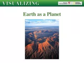
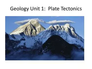
Geology 1 Review. What are the layers of the Earth ? Crust, mantle (upper & lower), core (inner & outer 2. Identify the thinnest layer of the Earth. Crust 3. Explain the differences between continental crust and oceanic crust. Continental crust is thicker than oceanic crust.

E N D
What are the layers of the Earth? • Crust, mantle (upper & lower), core (inner & outer 2. Identify the thinnest layer of the Earth. • Crust 3. Explain the differences between continental crust and oceanic crust. • Continental crust is thicker than oceanic crust. • Oceanic crust is more dense than continental crust.
4. Describe the structure of the mantle. • Upper mantle is solid (makes up part of the lithosphere) • Lower mantle is liquid-like. Convection current found here move crustal plates. 5. How does density change as you move towards the center of the Earth? • As you move from the crust towards the center of the Earth, density increases.
6. 4
7. 1
4 8. 2 9.
10. 2 11. 1
12. Identify the largest ocean on Earth. Pacific 13. Identify the ocean that the east coast of the United States meets. Atlantic 14. What ocean is found by Antarctica? Southern
15. 4 16. 4 17. 4
18. Explain where warm and cold currents form. Warm currents form near the equators, while cold currents form near the poles. 19. How does salinity affect ocean currents? Water with greater salinity (more salt) sinks while water with less salt rises. 20. What causes surface currents to form? Winds 21. Which way do surface currents move in the Northern Hemisphere? clockwise
22. Identify the Features A = Continental slope E = Volcano B = Seamount F = Continental shelf C = Plains D = Mid ocean ride (rift valley)
a 23. What are the deepest parts of the ocean called?a. Deep-sea trenchesb. Abyssal plainsc. Continentsd. Seamounts 24. What is a seamount? a. A scientist who studies the ocean floorb. Deep-sea trenchc. A fancy seagulld. A volcano that formed on the ocean floor. d
25. 3
26. Explain how to continents have changed over millions of years. • They have separated over time. 27. Explain how sea floor spreading occurs. • Magma rises and cools at the rift valley of a mid-ocean ridge forming new crust, while the older crust is pushed away 28. What happens to the older crust that is pushed away from ocean ridges? • It is pushed down into a subduction zone and melted.
29. 2
30. a. They slide past each other, or collide (converge), or separate (diverge) b. Formation of a volcano, volcanic eruption
31. 1
32. a. Sea-floor spreading OR continental drift b. They fit together like puzzle pieces OR have matching fossils
33. 2 34. 2
35. 2
36. a. They fit together like puzzle pieces b. Earthquakes, volcano, formation of a trench or subduction zone, formation of mountains, sea-floor spreading
37. a. What type of boundary is shown below? b. What forms or can occur as a result? a. convergent boundary (oceanic-continental ) b. trenches, volcanoes, deep earthquakes
38. 3 39. 2
40. a. Plate Tectonics b. Formation of a volcano, formation of a subduction zone
a. What type of boundary is shown below? b. What is occurring at this boundary? 41. a. divergent plate boundary b. new crust is made
42. a. What type of boundary is shown below? b. What forms or can occur as a result? a. Transform b. earthquakes
43. What are the three types of boundaries? • Convergent, divergent, transform 44. What direction do plates go for each? • Convergent = collide • Divergent = separate • Transform = slide past each other 45. Which boundary has a subduction zone? • Convergent (when continental crust collides with oceanic OR 2 oceanic crusts collide more dense crust sinks and melts
46. a. Earth’s crust has a lower temp than its interior. b. Earthquake, volcano, formation of a trench or subduction zone, mountain building c. Oceanic crust is thinner than continental crust.
47. a. Movement of crustal plates b. Living things and habitats are destroyed, volcanic dust and ash enters the atmosphere changing climate.
48. 1 49. 4
50. 3
51. 4 52. 4
53. 4
54. a. San Francisco b. Building earthquake proof homes and buildings, create an evacuation plan, create food supplies
55. 4
56. Built up energy is released along a fault during a(n) • Earthquake 57. Intense vibrations felt throughout Earth’s crust during an earthquake are called • Seismic waves 58. Melted rock found beneath Earth’s surface is called • Magma 59. The location where an earthquakes belongs is called the • Focus
60. Where do most of Earth’s volcanoes and earthquakes occur? • Along the Ring of Fire (around Pacific Ocean) 61. Which type of seismic wave is the slowest? • L-waves (surface waves) 62. Which type of seismic wave is the fastest? • P-waves (primary waves)
63. a. They are located at the edges of plates, or on the Ring of Fire. b. Locate shelters, create an evacuation plan, store food reserves
64. 1 65. 2
66. a. What is the elevation of point X? 640 feet b. Where is the steepest part of the hill located? On the west side of the hill, where the lines are closer together.
67. The contour map below shows a hill. Two elevations are labeled. a. What is the contour interval? 500 – 400 = 100 100/5 spaces = 20 X b. Place an X on the map where an elevation of 430 feet could be located.
68. a. What is the contour interval? 20m 40/2 = 100-60 = 40 b. 0 m c. The steepest slope can be found where the contour lines are closer together.
70. a. Contour Interval 100m b. Elevation of Black Bear Camp= 540m c. Elevation at Eagle Peak= 1499m
a. Identify the landform shown at point A. 71. Hill or mountain b. What is the contour interval? 2000-1500 = 500 500/5 = 100 ft c. What is the elevation at point B? 1550 ft