Download
1 / 18
180 likes | 186 Views
This presentation discusses the history, configuration, and current status of the Japanese Satellite-Based Augmentation System (SBAS), known as MSAS. It also highlights the dual-frequency trial and the MSAS evolution plan.

E N D
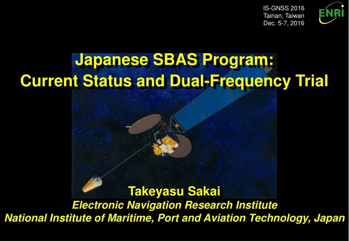
IS-GNSS 2016 Tainan, Taiwan Dec. 5-7, 2016 Japanese SBAS Program: Current Status and Dual-Frequency Trial Takeyasu Sakai Electronic Navigation Research Institute National Institute of Maritime, Port and Aviation Technology, Japan
Contents • History • Configuration • Current Status • Continuous Operation • MSAS Evolution Plan
MSAS History (1) • ICAO FANS Concept in 1988: • In 1983, ICAO (International Civil Aviation Organization) organized the special committee for FANS (Future Air Navigation Systems). • Recommendation: CNS should be modernized in a global manner. • AMSS (aeronautical mobile satellite service); • GNSS (global navigation satellite system); and • ADS (automatic dependent surveillance); all based on satellites. • GNSS Core Constellations: • US and Russia: GPS and GLONASS available for free of direct user charges. • Remaining problem: ‘Integrity’ • Capability to generate timely alert in case that the navigation system does not operate with the intended performance. • In ICAO, 'GNSS' means global satellite navigation service with accuracy and integrity available for civil aviation.
MSAS History (2) • Augmentation Systems: • A realization of integrity: GIC (GPS integrity channel). • Monitoring GPS signals at the ground stations and transmitting integrity information to the airplane. • ICAO standard of augmentation system providing ‘integrity’ as a GIC: • SBAS (Satellite-Based Augmentation System) using geostationary satellites for wide area service; and • GBAS (Ground-Based Augmentation System) with VHF datalink serving near an airport. • Finally documentation of SBAS and GBAS was made effective in 2002. • MSAS Program in Japan: • JCAB (Japan Civil Aviation Bureau) of Ministry of Transport (Reorganized in 2001 to Ministry of Land, Infrastructure, Transport and Tourism) decided the development of its own SBAS in 1993. • The system named MSAS, or MTSAT Satellite-based Augmentation System, was originally planned to be operational in 2000.
MSAS History (3) • MSAS GEO Satellites: • MTSAT (Multi-functional Transport Satellite): Aviation and weather missions. • MTSAT works for AMSS and SBAS services for aviation. • Launch of the MTSAT-1 was unfortunately failed in 1999. • Spare satellites: MTSAT-1R was launched in February 2005. • 2nd GEO: MTSAT-2 on the orbit in February 2006. • Ground facilities: • Consists of 2 MCS (KASC and HASC), 4 GMS, and 2 MRS. • MSAS-96 system completed by 1999. • Beginning Operation: • Broadcast test signal since summer 2005. • Certification activities for 2 years. • Finally, MSAS began its operation in September 27, 2007. • Available for Enroute to NPA (non precision approach) flight modes.
MTSAT-1R MTSAT-2 GPS Satellites Ranging Signals Augmentation Signals 6 GMS in Japan Hawaii MRS Sapporo GMS Users Kobe MCS (and GMS) Fukuoka GMS Canberra MRS Hitachi-Ota MCS (and GMS) Tokyo GMS Ground Network Hawaii MRS Naha GMS Australia MRS Original Configuration PRN137 PRN129 MSAS Monitor Stations • 2 GEO, 2 MCS (Master Control Station), 4 GMS (Ground Monitor Station), and 2 MRS; • MCS also has GMS function; MSAS has 6 domestic monitor stations. • 2 MRS (Monitor and Ranging Station) for accurate GEO positioning for ranging function.
MSAS GEO (MTSAT) MTSAT-1R Spacecraft • 3-axis stabilized spacecraft with the standard bus system. • Solar panel at the single side. • Due to installation of equipment for the weather mission. • L-band transponder with the bandwidth of 2.2MHz. • Uplink: Ku-band (13GHz) due to results of frequency coordination. • Also has downlink channel in Ku-band. • For power control of uplink signal because of rain attenuation in Ku-band.
MCS Facilities KASC (Kobe Aeronautical Satellite Center) HASC (Hitachi-Ota Aeronautical Satellite Center) • Western part of Japan • MCS nominal for MTSAT-1R (PRN129) • Backup for MTSAT-2 (PRN137) • Dishes for 2 GEO and emergency • Eastern part of Japan • MCS nominal for MTSAT-2 (PRN137) • Backup for MTSAT-1R (PRN129) • Dishes for 2 GEO
MTSAT Coverage (Fukuoka FIR) MTSAT-1R @140E MTSAT-2 @145E FIR: Flight Information Region
Current Status • MSAS: Japanese SBAS in operation. • MTSAT Satellite-based Augmentation System. • Operational since Sept. 27, 2007. • Continue operation with 2 signals via 1 GEO. • MTSAT-1R decommissioned in Dec. 2015. • Hawaii and Australia MRS sites are decommissioned in Feb. 2015. • Service for Air Navigation • GPS Augmentation Information for RNAV, from En-route through NPA (RNP 0.3). • Within Fukuoka FIR. • Only horizontal navigation due to ionosphere activities. • NOTAM is available to MSAS users. • Alert for Service Interruption. • Alert for Predicted Service Outage.
Current Configuration MTSAT-2 GPS Satellites Ranging Signals Augmentation Signals 6 GMS in Japan PRN137 Sapporo GMS PRN129 Users Kobe MCS (and GMS) Fukuoka GMS Hitachi-Ota MCS (and GMS) Tokyo GMS Ground Network MSAS Monitor Stations Naha GMS • 1 GEO, 2 MCS (Master Control Station) and 4 GMS (Ground Monitor Station); • MCS also has GMS function; MSAS has 6 domestic monitor stations. • MTSAT-2 is broadcasting 2 signals from 2 MCS (PRN129 and PRN137).
Performance of MSAS GPS only GPS only Horizontal 0.722m RMS Horizontal 0.717m RMS MSAS PRN129 MSAS PRN137 GEONET 940058 (Takayama) 16/8/8-12 (5 days) PRN129 and PRN137 Broadcast Signal
Integrity Performance Loss of Availability Loss of Availability & Integrity HAL=556m Horizontal Protection Level (HPL), m Loss of Integrity Normal Operation Loss of Integrity Actual Error, m
Southwestern Islands Asahikawa Tokunoshima ● ◆ Amami Okierabu ● ● New Chitose ● ● ● ◆ ● ● Ishigaki ● ◆ Hakodate Miyako ◆ Yoron ● ● ● Naha ● ● ● ◆ ◆ Oodate-noshiro Tarama ● Akita ● ● Toyama Shonai ● Niigata ● ● ● ◆ ● Oki Izumo Sendai ● Komatsu Hiroshima Miho ● ● Tottori Yamaguchi-Ube ◆ ● Iwakuni ● ◆ ● ● ● Fukui Kita Kyushu As of August 2014 (RNAV / RNP Approach 50 airports) Okayama Nagoya ◆ Osaka Narita ● ● ◆ Chofu ● Fukuoka ● ● ● ◆ ◆ ◆ ● ◆ ◆ ● ◆ ● ● ◆ ◆ ◆ ◆ ●RNAV Approach 17airports ● Chubu ◆ ● ◆ Haneda Nagasaki ● ◆ ● ◆ ◆ ● ● Oita ◆ Niijima Kobe ●RNP AR Approach 12airports ● Kumamoto ● Kochi Kozushima ◆ RNP Approach 15airports Matsuyama ◆ ● Kansai ● ● Kagoshima Miyazaki Basic RNP 1 16airports Tokushima Takamatsu Tanegashima ◆RNAV1 30 airports ● Yakushima ● ◆ Implementation of RNP/RNAV
Continuous Operation • Current status: • MTSAT-1R decommissioned in 2015. MTSAT-2 will be in 2020. • 2 MRS sites decommissioned in 2015. • The ground facilities need to be upgraded: It is difficult to maintain 20-year old equipment. • Replacement in 2020: • MSAS continues operation with 1 GEO (MTSAT-2) and 6 GMS by 2020. • In 2020, MSAS will continue operation with a GEO of the QZSS. • QZSS (Quasi-Zenith Satellite System): Japanese regional satellite navigation system with IGSO and GEO satellites. • The L1Sb signal of QZS-3 (GEO) will be used for MSAS service. • MCS equipment will also be fully replaced at the same time. • 7 GMS will be added: Totally 13 GMS domestic. • Performance will be similar with the current MSAS: Horizontal only.
Improvement Plan • Supporting vertical guidance: • Vertical guidance: LPV and LPV-200 operation. • Need software upgrade: • Adding GMS cannot overcome ionospheric effects. • ENRI has been developed the improved algorithms for ionospheric correction. • Will be supported in accordance with introduction of the 2nd GEO in 2023. • Dual-Frequency operation: • Eliminates ionospheric effects dramatically. • Robust vertical guidance (LPV and LPV-200) in the whole Japanese airspace. • QZSS GEO will have the L5S signal useable for L5 SBAS. • ENRI will begin L5 SBAS experiment in 2018 with QZSS satellites. • The first opportunity of the L5 SBAS signal from the space. • Expects participation to this experiments from Asian countries.
MSAS Evolution Plan • L5 SBAS trial since 2018. • Replacement to the new QZSS-based system in 2020. • LPV/LPV-200 upgrade in 2023 and L5 SBAS implementation after that.
Conclusion • MSAS has been operational since Sept. 2007. • An operational SBAS in accordance with ICAO standards. • Service: Horizontal navigation (Enroute to NPA performance). • Continues operation with MTSAT-2 GEO. • MSAS evolution plan: • Replacement to the fully new system and new GEO in 2020. • Upgrade for vertical guidance in 2023 with the 2nd GEO. • Dual frequency L5 SBAS trial since 2018 with real signals. • Contact for more information: Dr. Takeyasu Sakai <sakai@mpat.go.jp> Electronic Navigation Research Institute National Institute of Maritime, Port and Aviation Technology, Japan