Download

1 / 96
970 likes | 1.12k Views
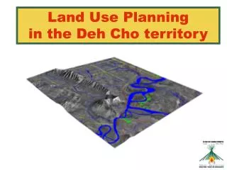
Land Use Planning in the Deh Cho territory. Agenda. WHAT IS LAND USE PLANNING? UPDATE ON DCLUPC ACTIVITIES & PROGRESS INPUT DATA FOR LAND USE OPTIONS LAND USE OPTIONS + ECONOMIC MODEL CUMULATIVE EFFECTS RESEARCH QUESTIONS AND DISCUSSION 7:00 – 9:00 P.M. OPEN HOUSE.

E N D
Agenda • WHAT IS LAND USE PLANNING? • UPDATE ON DCLUPC ACTIVITIES & PROGRESS • INPUT DATA FOR LAND USE OPTIONS • LAND USE OPTIONS + ECONOMIC MODEL • CUMULATIVE EFFECTS RESEARCH • QUESTIONS AND DISCUSSION 7:00 – 9:00 P.M. OPEN HOUSE
Committee & Staff • Committee Members • 2 DCFN reps (Tim Lennie and Petr Cizek) • 1 GNWT rep (Bea Lepine) • 1 Federal Government rep (Adrian Boyd) • Chairman selected by the 4 members (Herb Norwegian) • 5 Staff Members • Executive Director (Heidi Wiebe) • Office Manager (Sophie Bonnetrouge) • GIS Analyst (Monika Templin) • Land Use Planner (Paul Wilson) • Land Use Planner Trainee (Priscilla A. Canadien)
What is Land Use Planning? Potential Land Uses Decisions (Planning Partners) (Staff & Committee) ? ? ? ? • DevelopmentConservation • Forestry - Green TLUO – Red • Tourism – Orange Wildlife – Blue • Oil and Gas – Purple Archaeology - Black • Minerals – Brown • Agriculture – Yellow Zones (Planning & Management)
Land Use Planning in the Deh Cho • Land Use Planning means determining what types of land use activities should occur and where they should take place • “The purpose of the plan is to promote the social, cultural and economic well-being of residents and communities in the Deh Cho territory, having regard to the interests of all Canadians.” • Our planning area extends to the whole Deh Cho territory, excluding municipal areas and Nahanni National Park Reserve
Land Use Planning and the Deh Cho Process • Land Use Planning is only one part of the larger Deh Cho Process of negotiations looking at land, resource management and governance issues • Draft Land Use Plan (2005) • Final Land Use Plan (March 2006) • Land Use Plan used by three parties to negotiate in the Deh Cho Process • Complete Deh Cho Process (~ 2008)
Planning Partners + + 2nd Priority Businesses, Associations, non- governmental organizations 1st Priority Residents Approve Plan
Planning vs. Management • Our mandate is to plan for future resource development – map potential, identify issues, write final plan to show “what” and “where” • We are not involved in past or current resource applications – current government structures do that (DCFN, GNWT and Gov of Canada) • May change with Deh Cho Process – Future Deh Cho Resource Management Authority
Update on DCLUPC Activities & Progress • Staff Recruitment • Round 1 Consultation Feedback • Q & A Report • Further Research: • Wildlife Workshop, • Dene Nahodhe Workshop • Economic Development Model Completed • Reviewing Various Land Use Options
Wildlife • Traditional Knowledge & Expert Research • Regional Wildlife Workshop - Held: November 2003 • 308 species in the Deh Cho territory (3 amphibians, 36 fish, 213 birds and 56 mammals) • Key species include: • Caribou, Moose, Bison, Fish and Waterfowl for consumption • Trumpeter Swan, Whooping Crane, Peregrine Falcon (Endangered) • Black Bear, Grizzly Bear, Furbearers, Dall’s Sheep, and Mountain Goat (Trapping & Hunting species) • Critical wildlife areas include: • Nahanni National Park Reserve • Mackenzie Bison Sanctuary (denning, staging and calving, etc.) • Edehzhie • Central area between Fort Liard & Wrigley • Important consideration for Cumulative Effects Management
Traditional Use Density • Important to Traditional Dene Lifestyles • Information gathered by DCFN • Consulted over 386 harvesters and mapped information • Harvest areas, kill sites, sacred sites, berry patches • DCFN approved publication and use at Kakisa Assembly 2004
Archeology, Cabins, Historic Sites & Rare features • Evidence of past human use • Important small sites i.e. fire rings, cabins, trails • Buffer required for protection • Development must avoid these areas • Rare Features: • i.e. Hot Springs and Karst Formations Conservation Value is determined by distance from these important sites
Forestry Potential • Timber stands: • Fort Liard, Nahanni Region, Jean Marie River and the Cameron Hills • NWT 137,000 km2 Timber Productive Land • Northern Portion of Boreal Forest • 4 Major Tree Species: • White Spruce, Black Spruce, Trembling Aspen and Balsam Poplar + Jack pine and Lodgepole Pine • Fringe of Economic Timber Zone • Current < Sustainable Harvest Levels • Low Prices $ • Access • Community Use Commercial Viability
Sawlog Potential • RWED Sawlog Utilization Standards • 17.5 cm dbh, 10 cm top, 5.0 m log length Minimum Attributes • White Spruce Stands • Class 3 (medium) sites that are 15 m tall and 80 years old. • Lodgepole or Jack Pine Stands • Class 3 (medium) sites that are 19 m in height. • Aspen Stands • Medium sites, in the Liard Valley and Cameron Hills only, that are 15m in height (Pers. Comm. RWED-FMD).
Timber Potential Analysis • PACTeam Canada - Timber Potential • Inventory (Deh Cho Productive Areas) 1961-1997 • Spatial Forest Management Inventories RWED • Non-Spatial Forest Management Inventories RWED • Digital Compilation of Vegetation Types of the Mackenzie Valley Transportation Corridor (Wright et al.2003) • NWT RWED Vegetation Classification Project • National Forest Inventory (Productive Forest Inventory) 100 km 1 km Distance to Linear Feature Species, Size, Access, Fire History 1 km 100 km
Minerals • Assessed 9 mineral types thought to have the most potential in the region • The highest potential is in the western tip of the territory, moderate in the west-central portions and low in the remaining areas • The most significant minerals types are Copper, Lead-Zinc & Tungsten (existing mines) • The western portion has high to very high potential for Skarn (Lead-Zinc, Gold and Tungsten)
Oil & Gas • 20 hydrocarbon plays in the Deh Cho • 9 confirmed • 11 unconfirmed • 419 hydrocarbon wells drilled, most are wildcat wells (exploratory) but 127 (25%) found hydrocarbons • Current producing regions are Fort Liard and Cameron Hills; other significant discoveries found but not yet developed • Greatest potential is in the Liard Plateau and the Great Slave Plain (northern extension of the western sedimentary basin)
Tourism • The greatest potential is along the Mackenzie and Liard River valleys and radiates out from communities (the “hub and spoke” effect.) • Exceptionally scenic, offer various types of tourism experiences and have good access • Key tourism destinations include Nahanni National Park Reserve, the Ram Plateau and North Nahanni River, Little Doctor Lake, Cli Lake, Trout Lake and some lodges • Deh Cho tourism is not well developed but has lots of potential - it can still offer tourists pristine wilderness free from commercial interruption
Agricultural Potential • Agriculture is small scale generally within community boundaries • Potential not developed – minor land use • Limitations include; climate, soil type, difficulties with access and power requirements • South have competitive advantage • Cost of food - opportunities and potential for community use
Land Use Options • Land Use Options represent different visions for the final land use map • Represent 5 different levels of development • Based on information (mostly scientific) gathered to date – no community or planning partner input yet • Will be revised based on feedback and presented at the next round of meetings
Preliminary Land Use Options • Change Priority of Conservation and Development • Create 5 Land Use Options • Shows a range of possibilities available • Compare to Current Land Withdrawals • Use Economic model to compare effects on economy Low Development High Conservation High Development Low Conservation Options 1 2 3 4 5
Zones • Multiple Use Zones: all development uses permitted subject to general regulations • Conservation Zones: no development permitted • Uncertain Zones: conservation and development hold equal priority, no decision possible • Traditional Use Allowed Everywhere
Land Use Option # 1 • Priority given to development sectors (Multiple Use Zones) • Some Uncertain Zones • Few conservation areas outside Nahanni and Edehzhie • Employment: 51,339 new person-years of employment (~3000 per year) • In-Migration: 3041 people need to move here to fill jobs • Tax Revenues: $3 billion over 20 years ($150 million/yr) • GDP: $11.6 billion over 20 years ($580 million/yr) • Move to wage employment and modern lifestyle • Education, training and management a priority to secure benefits for communities • Fragmented wildlife habitat and population declines • Loss of traditional knowledge culture and language • Other factors determine if development occurs
Land Use Option # 2 • Development focus although more weight to conservation than Option 1 • Conservation Zones protect key wildlife habitats and traditional areas i.e. Nahanni National Park • No Uncertain Zones – clear what is permitted development • Employment: 41,000 new person-years of employment (~2044 per year) • In-Migration: 1941 people need to move here to fill jobs • Tax Revenues: $2.0 billion over 20 years ($100 million/yr) • GDP: $8.8 billion over 20 years ($440 million/yr) • Strong Economy – lots of opportunities, especially in the South Deh Cho • Habitat fragmentation - may impact traditional harvesting • Lifestyle changes may result in loss of traditional knowledge culture and language • May increase social problems
Land Use Option # 3 • Balance of Development and Conservation Priorities • Uncertain Zones cover 40% of the Deh Cho - special conditions for development may apply • Conservation Zones better able to sustain wildlife populations, traditional harvesting and seasonal employment • Employment: 25,128 new person-years of employment (~1250 per year) • In-Migration: 1000 people need to move here to fill jobs • Tax Revenues: $1.25 billion over 20 years ($62.5 million/yr) • GDP: $5.4 billion over 20 years ($270 million/yr) • Economic benefits available from development including employment given sufficient education and training • High disposable income for some, immigration and pressure on housing and social and medical services • Opportunity to balance traditional lifestyle and development
Land Use Option # 4 • Focus on Conservation layers, Wildlife and TLUO promotes subsistence harvesting and traditional activities • Some Multiple Use Zones for Development - no Uncertain Zones • Employment: 24,951 new person-years of employment (~1248 per year) • In-Migration: 1057 people need to move here to fill jobs • Tax Revenues: $1.2 billion over 20 years ($60 million/yr) • GDP: $5.4 billion over 20 years ($270 million/yr) • Some benefits from development i.e. employment and tax revenue • Young people may leave communities or Deh Cho for employment or education • Local and regional governments are a major employer and have a lead role in skills development
Land Use Option # 5 • Conservation Zones a Priority to promote traditional use and culture • Development restricted to areas away from communities with high potential • A few Uncertain Zones where decisions have to be made • Employment: 14,514 new person-years of employment (~726 per year) • In-Migration: 700 people need to move here to fill jobs • Tax Revenues: $628 million over 20 years ($31.4 million/yr) • GDP: $2.5 billion over 20 years ($125 million/yr) • Lack of revenue and income may limit services and opportunities • Lack of opportunities may create social problems • Young people may leave communities or even the Deh Cho for employment or education • Key role for government in employment, training and controlling development