Download
1 / 25
250 likes | 443 Views
Governor’s Advisory Commission on Coastal Protection, Restoration and Conservation Mark R. Wingate, PE Chief – Projects and Restorations Branch April 4, 2012. Louisiana Coastal Area Modification of Davis Pond Study Overview . Purpose.

E N D
Governor’s Advisory Commission on Coastal Protection, Restoration and Conservation Mark R. Wingate, PE Chief – Projects and Restorations Branch April 4, 2012 Louisiana Coastal AreaModification of Davis PondStudy Overview
Purpose • To update the Governor’s Advisory Commission on progress of the LCA Modification of Davis Pond feasibility study: • Planning Objectives and Constraints • Alternatives under consideration • Other factors to be considered • Timeline to completion
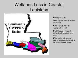
Background • One of 15 critical projects authorized in WRDA 2007 “to sustain a larger coastal ecosystem that supports and protects the environment, economy, and culture of southern Louisiana” • WRDA language provided sequencing insight • Modification of Davis Pond (MDP) - Title VII, Sect 7006(e) – LCA “4” • LCA “4” FCSA Signed 5 June 2009 (includes MDP) • Next Step – TSP selection (13 April 2012) • Chief’s Report to be signed - 1 Nov 2013
Planning Goals and Objectives Goal: Identify operational change that maximizes restoration outputs in the Barataria Basin Objectives: Over the 50 yr period of analysis: Objective 1: Decrease the rate of land loss, and where possible, increase wetland acreage Objective 2: Increase the geographic extent and distribution of Davis Pond freshwater, sediment, and nutrients throughout the study area
Planning Constraints • Avoid or minimize negative impacts to T&E (Pallid Sturgeon) • Avoid or minimize adverse impacts to habitat • Maintain level of flood protection/no induced flooding • Avoid or minimize impacts to navigation • Avoid or minimize low dissolved oxygen and/or algal blooms • Assess only operational changes • Other factors to be considered
Analytical Tools • H&H Modeling (TABS) – detailed history and forecast of hydrology • SAND Model - estimates sediment deposition rates • WVA - estimates restoration outputs • IWR - economic analysis on cost effectiveness • Trade-off Analysis - Socioeconomic Impacts, EFH
Modeled Area DIVERSION STRUCTURE MYRTLE GROVE GRAND ISLE
Plan Formulation • Developed an initial array of 42 alternatives • Screened based on criteria • Final Array • 8 alternatives ranging from “no-action” to operating at maximum capacity throughout year
Future Without Project:No Action MYRTLE GROVE -Maintain current operation of structure X X
River Stage Dependent/Open Continuous:Alternative 18 • Maximum possible flow throughout year • -No Salinity target • -No Time constraints MYRTLE GROVE X X X X
Maximize Sediment Load and Maximize Footprint:Alternative 41 • Maximum capacity operation during sediment peaks • Establish new salinity target during non-sediment peaks MYRTLE GROVE X X
Major Flow Event (3 Year Cycle): Alternative 17 -Capture maximum sediment for year 1 during sediment peaks -For years 2 and 3, focus on establishing new salinity target -Repeat 3 year cycle MYRTLE GROVE X X
Major Flow Event (5 Year Cycle):Alternative 40 -Capture maximum sediment from the river for year 1 during sediment peaks -For years 2, 3, 4, and 5, focus on establishing new salinity target -Repeat 5 year cycle MYRTLE GROVE X X
Maximize Sediment Load With Time Constraint (Jan – Apr):Alternative 42a MYRTLE GROVE • -Maximize flow during high river conditions • Establish new salinity target for remainder of year X X
Maximize Sediment Load With Time Constraint (Jan-Apr):Alternative 42b MYRTLE GROVE • -Maximize flow during high river conditions • Maintain existing salinity target for remainder of year X X
Maintain New 5ppt Isohaline:Alternative 39 MYRTLE GROVE -Establish new annual salinity target X X
Projected Wetlands in Acres • No Action: 45% reduction in landmass over 50 years • Alt 18: 43% reduction in landmass over 50 years • Approximately 10 square miles difference between Alt 18 and No Action • Only assesses operational changes of DP structure *Values Assume Intermediate Sea-Level Rise
Wetland Value Assessment Results (Year 50) - AAHU (Average Annual Habitat Unit) – Increased Habitat Quality
Other Factors to be Considered • Planning Aid Letter • Environmental effects (adverse and beneficial) • Social effects (adverse and beneficial) • Risks and uncertainties
IWR Analysis Alt 39 Alt 40 Alt 41 In thousands Alt 42a Alt 42b Alt 17 Alt 18