Download
1 / 64
650 likes | 785 Views
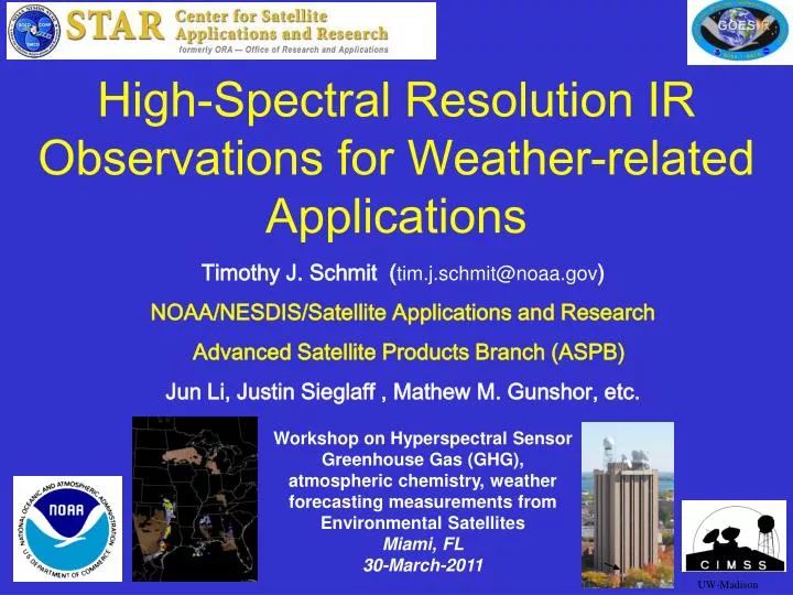
High-Spectral Resolution IR Observations for Weather-related Applications. Timothy J. Schmit ( tim.j.schmit@noaa.gov ) NOAA/NESDIS/Satellite Applications and Research Advanced Satellite Products Branch (ASPB) Jun Li, Justin Sieglaff , Mathew M. Gunshor , etc .

E N D
High-Spectral Resolution IR Observations for Weather-related Applications • Timothy J. Schmit (tim.j.schmit@noaa.gov) • NOAA/NESDIS/Satellite Applications and Research • Advanced Satellite Products Branch (ASPB) • Jun Li, Justin Sieglaff, Mathew M. Gunshor, etc. Workshop on Hyperspectral Sensor Greenhouse Gas (GHG), atmospheric chemistry, weather forecasting measurements from Environmental Satellites Miami, FL 30-March-2011 UW-Madison
Overview • GOES-R Overview • No dedicated Sounder • Synergy with ABI • Current GOES Sounder • Select products • Sample applications • Summary • More information • References Lockheed Martin
ABI – Advanced Baseline Imager Space Weather/Solar ABI covers the earth approximately five times faster than the current Imager. Geostationary Lightning Mapper Images courtesy of SOHO EIT, a joint NASA/ESA program GOES-R main instruments
GOES-R Series Overview • No dedicated Sounder • Advanced Baseline Imager (ABI) • Geostationary Lightning Mapper (GLM) • Space Weather • Space Environmental In-Situ Suite (SEISS) • Solar Ultra Violet Imager (SUVI) • Extreme Ultra Violet/X-Ray Irradiance Sensor (EXIS) • Magnetometer • Communications • GOES Rebroadcast (GRB) • Low Rate Information Transmissions (LRIT) • Emergency Managers Weather Information Network (EMWIN) • Search and Rescue (SAR) • Data Collection System (DCS)
Advanced Sounders Timothy J. Schmit NOAA/NESDIS/ORA Advanced Satellite Products Team (ASPT) in collaboration with Cooperative Institute for Meteorological Satellite Studies (CIMSS) Madison, Wisconsin [2001] UW-Madison
Sounders, circa 2010 More than 5 years of high spectral measurements from polar orbits: - AIRS (Atmospheric InfraRed Sounder) - IASI (Infrared Atmospheric Sounding Interferometer) - CrIS(Crosstrack Infrared Sounder) Approximately 5 years of high spectral, spatial and temporal measurements from geostationary orbit: - GIFTS (Geostationary Imaging Fourier Transform Spectrometer) 30 years of filter wheel technology in geostationary orbit: - VAS and GOES Sounder 40 years since the first interferometer flown in space to study the weather: IRIS (Infrared Radiation Interferometer Spectrometer) Forecast from 2001… with 67% accuracy! The time is right to update the GOES sounder! The technology is mature. The need is documented.
Spatial Temporal resolution resolution Cloud clearing Improved products could be realized from combinations of ABI and HES (Hyperspectral Environmental Suite) data ABI HES Spectral coverage Surface emissivity Spectral resolution cira 2004
GOES-12 Sounder Bands Smooth over required absorption lines Why do we need a high spectral resolution sounder? Analysis courtesy of Justin Sieglaff, CIMSS. Compared to broadband sounders, observing absorption lines is mandatory to meeting requirements for temperature and moisture structure needed to improve weather forecasting Many papers document science value of high spectral resolution sounder that support weather forecast needs. (Sieglaff et al.)
High-Spectral, combined with High-Temporal Resolution is the key • Water Vapor and Carbon Dioxide absorption lines within the infrared window are sensitive to changes in the lower tropospheric thermodynamic state • Current GOES sounders are spectrally too broad to resolve these lines • High-time information obtained from a high spectral resolution IR GEO sounder would be very useful for monitoring pre-convective clear sky regions
Allen Huang, CIMSS On-line/off-line “signal” Longwave window region
Allen Huang, CIMSS “AIRS or IASI-like” Longwave window region
Allen Huang, CIMSS Longwave window region
Allen Huang, CIMSS Longwave window region
Allen Huang, CIMSS Longwave window region
Allen Huang, CIMSS Longwave window region
Allen Huang, CIMSS “Current GOES-like” Longwave window region
The relative vertical number of independent pieces of information is shown. Note that the moisture content is similar between the ABI and the current GOES Sounder. The Sounder does show more temperature information than the ABI. Caveat: Even if two systems have the same number of pieces of information, they may represent different vertical levels. This information content analysis does not account for any spatial or temporal differences.
GOES-R ABI Weighting Functions ABI has only 1 CO2 band, so upper-level temperature will be degraded compared to the current sounder. Hence short-term NWP temperature information will be needed.
GOES-13 Sounder Weighting Functions The current GOES sounders have 5 CO2 bands, and more SW bands than ABI
Overview • GOES-R Overview • No dedicated Sounder • Synergy with ABI • Current GOES Sounder • Select products • Sample applications • Summary • More information • References http://cimss.ssec.wisc.edu/goes/rt/sounder-dpi.php
Current Sounder Operational Uses Courtesy of J. Daniels, STAR While there are limitations, the current GOES sounder is used today!
AWIPS Display Lifted Index Total Precipitable Water Courtesy of J. Daniels, STAR Surface Skin Temperature Cloud-Top Height
Forecasters value the current sounder NWS Forecaster responses (Summer of 1999) to: "Rate the usefulness of LI, CAPE & CINH (changes in time/axes/gradients in the hourly product) for location/timing of thunderstorms." There were 248 valid weather cases. - Significant Positive Impact (30%) - Slight Positive Impact (49%) - No Discernible Impact (19%) - Slight Negative Impact (2%) - Significant Negative Impact (0) National Weather Service, Office of Services
Forecasters need a better GEO sounder • Forecasters value the current GOES sounder products; however, the same forecasters also noted several limitations of the current sounder: • retrievals limited to clear skies; • the scanning rate is relatively slow, which limits coverage; • the vertical resolution from the current generation GOES radiometers is limited. • Each of these limitations can be mitigated with an advanced sounder in the geostationary perspective.
Impact Study of RAOB, GOES, and POES data on Eta Data Assimilation System RAOBs, GOES and POES all contribute unique information! Zapotocny, T. H., W. P. Menzel, J. A. Jung, and J. P. Nelson III, 2005: A four season impact study of rawinsonde, GOES and POES data in the Eta Data Assimilation System. Part I: The total contribution. Wea. Forecasting, 20, 161-177. Zapotocny, T. H., W. P. Menzel, J. A. Jung, and J. P. Nelson III, 2005: A four season impact study of rawinsonde, GOES and POES data in the Eta Data Assimilation System. Part II: Contribution of the components. Wea. Forecasting, 20, 178-198. Zapotocny, T. H., W. P. Menzel, J. P. Nelson III, and J. A. Jung, 2002: Impact Study of Five Satellite Data Types in the Eta Data Assimilation System in Three Seasons. Weather and Forecasting, 17, 263-285.
Oct 2001 forecast impact (%) for T, u, v, RH fields after 24-hrs of Eta model integration Zapotocny, 2005
Overview • GOES-R Overview • No dedicated Sounder • Synergy with ABI • Current GOES Sounder • Select products • Sample applications • Summary • More information • References
Product Impacts and Requirements With data from an advanced high-spectral sounder in the geostationary orbit, the following NOAA validated product requirements can be reinstated, improving now, short and long term forecasts : • Advanced Atmospheric vertical moisture profile; • Advanced Atmospheric vertical temperature profile; • Capping inversion information (height & strength); • Moisture flux; • Surface emissivity; • Cloud Base altitude; • Carbon monoxide concentration. Plus, high spectral resolution IR data will help at least 17 other products.
Spectral coverage of the ABS, GIFTS, IASI and the current GOES radiometer sounder
Evolution of the Vertical Moisture is the Key!Simulated Relative humidity cross-section at 20 UTC 12 June 2002 “Truth” “GEO advanced IR sounder ” “ABI” “RUC” Li et. al.
Time series of low-level vertical moisture structure during 9 hours prior to Oklahoma/Kansas tornadoes on 3 May 1999 Truth> Geo-Adv. IR> Note Geo-AI retains strong vertical gradients for monitoring convective instability Current GOES> GEO-AI Analysis courtesy of W. Feltz, CIMSS. Geo-Advanced IR traces moisture peaks & gradients with greatly reduced errors
3 May 1999 – Oklahoma/Kansas tornado outbreak GIFTS/GOES Retrieved-Moisture (g/kg) Errors Truth> Geo-Adv IR Errors> Standard Dev. = 0.9 g/kg Note Geo-I reduces errors and captures low-level moisture peaks and vertical gradients GOES Errors> Standard Dev. = 2.4 g/kg Analysis courtesy of W. Feltz, CIMSS. Geo-Advanced IR correctly captures important vertical moisture variations
Better Observation of Cloud Properties • High spectral data allow a more accurate determination of high, thin clouds.
Overview • GOES-R Overview • No dedicated Sounder • Synergy with ABI • Current GOES Sounder • Select products • Sample applications • Summary • More information • References
Example of Advantage of GOES over POES data for small-scale convection, An un-forecast mesoscale Derecho which moved from MN across south-central WI, decayed and then re-intensified south of Chicago Figure courtesy of R. Petersen, CIMSS. Comparison of GOES (left) and AIRS (right) data coverage around 0700 UTC 20 July 2006. Times and lateral limits of AIRS overpasses shown. For GOES: Details of moisture maximum (warm colors) which was initially over Iowa and subsequently moved eastward to support convection over WI and IL are clearly identified in spatially continuous data. For POES: No AIRS data were available over IA (indicated by white areas), due to combination of: 1) cloud obscurations (e.g., over MN and western IA in later 0900 UTC data), and 2) data gaps between successive orbital paths (e.g., central and eastern IA). Note: Neither radiosonde nor aircraft moisture data would have been available around 0700 UTC for this area.
Benefits of high-spectral over broad-band measurements! Root Mean Square Error Forecast: 0.40 ABI like + fcst: 0.35 GOES 12 + fcst: 0.34 HES + fcst: 0.16 Experiments show that retrievals of Total Precipitable Water (TPW) from high-spectral (HES) data are much improved over current broadband (GOES-12+forecast).
Benefits of high-spectral resolution over narrowband measurements! Root Mean Square Error Forecast: 2.27 ABI like + fcst: 2.20 GOES 12 + fcst: 2.18 HES + fcst: 1.79 Experiments show that retrievals of atmospheric instability from high-spectral (HES) data are much improved over current broadband (GOES-12+forecast).
Current GOES Sounder showed a stable atmosphere. No profiling via thin clouds. Sample of AIRS (high-spectral IR) showed un-stable regions. Retrievals generated through thin clouds. Derived Product Images of LiftedIndex: GOES and AIRS Analysis courtesy of Jun Li, CIMSS.
Sample AIRS (LI) in AWIPS • Might a polar Proving Ground reformat AIRS products in near realtime for AWIPS?
Atmospheric Motion Vectors from Sounder data • Imager WV cloud tracked AMVs (yellow), Imager WV clear sky AMVs (red) and clear sky GOES Sounder AMVs (blue) Much improved height-resolved winds from tracking features in retrieval fields from high spectral/temporal resolution rather than spectral images using broad band sounder IlianaGenkova, Chris Velden, Steve Wanzong, Paul Menzel, CIMSS
ABI – Advanced Baseline Imager Continuity of GOES Legacy Sounder Products from ABI SEISS – Space Env. In-Situ Suite EXIS – EUV and X-Ray Irradiance Sensors GLM – Geostationary Lightning Mapper Magnetometer Geomagnetic Field Aerosol Detection (including Smoke and Dust) Surface Albedo Surface Emissivity * Probability of Rainfall Aerosol Particle Size Rainfall Potential Vegetation Fraction: Green Suspended Matter / Optical Depth Vegetation Index Rainfall Rate/QPE Volcanic Ash * Legacy Atm. Vertical Moisture Profile * Aircraft Icing Threat Currents Legacy Atm. Vertical Temperature Profile * Sea & Lake Ice / Age Cloud Imagery: Coastal Derived Stability Indices * Sea & Lake Ice / Concentration Cloud & Moisture Imagery Cloud Layers / Heights & Thickness * Total Precipitable Water * Sea & Lake Ice / Extent & Edge Cloud Ice Water Path * Sea & Lake Ice / Motion Total Water Content * Cloud Liquid Water Clear Sky Masks Ice Cover / Landlocked Radiances * Cloud Optical Depth Snow Cover Absorbed Shortwave Radiation: Surface Cloud Particle Size Distribution Snow Depth Downward Longwave Radiation: Surface Cloud Top Phase Sea Surface Temps Downward Solar Insolation: Surface Energetic Heavy Ions Cloud Top Height * Reflected Solar Insolation: TOA Mag Electrons & Protons: Low Energy Cloud Top Pressure * Upward Longwave Radiation *: Surface & TOA Mag Electrons & Protons: Med & High Energy Cloud Top Temperature * Ozone Total * Solar & Galactic Protons Cloud Type Solar Flux: EUV SO2 Detection * Convection Initiation Solar Flux: X-Ray Enhanced "V"/Overshooting Top Detection Derived Motion Winds * Solar Imagery: extreme UV/X-Ray Fire / Hot Spot Characterization Hurricane Intensity Flood / Standing Water Low Cloud & Fog Lightning Detection Land Surface (Skin) Temperature * Turbulence Visibility *= Products degraded from original GOES-R (e.g.; now no HES) SUVI – Solar extreme UltraViolet Imager GOES-R Observational Requirements: High spectral (HS) resolution IR data will help at least 17 other ABI-based products Improved with HS
Overview • GOES-R Overview • No dedicated Sounder • Synergy with ABI • Current GOES Sounder • Select products • Sample applications • Summary • More information • References
Current Sounder Data Volume Current GOES Sounder Horizontal
Advanced High-Spectral IR Sounder (GIFTS example) Horizontal
Summary An advanced geostationary sounder overcomes existing instrument limitations. High-spectral IR observations needed for trace gas monitoring could also be used for a number of weather-related applications. High-spectral resolution IR observations will resolve high temporal and vertical fluctuations of moisture that are not resolved by current in-situ or satellite measurements. High temporal resolution is unique aspect of GEO measurements. Critical meteorological parameters (temperature, moisture, clouds, winds) with necessary temporal, spatial and vertical resolutions will improve monitoring of atmospheric conditions. An advanced high-spectral sounder on GOES will fulfill requirements of several validated products. Studies have estimated the economic and societal benefits of a high-spectral resolution sounder to be at least $4.2 B (Centrec study).
Conclusions on the need for advanced geostationary IR observations wrt weather applications • As stated in 2001… • Technology is mature • Meteorological need is documented. • Time is right to update geostationary sounding instruments to provide required high spectral resolution measurements with high temporal refresh rates.
Select References Schmit, T. J., J. Li, S. A. Ackerman, and J. J. Gurka, 2009: High spectral and temporal resolution infrared measurements from geostationary orbit, Journal of Atmospheric and Oceanic Technology, 26, 2273 - 2292. (a.k.a., why we need an advanced geo-sounder) Sieglaff, J., M., T. J. Schmit, W. P. Menzel, S. A. Ackerman, 2009: Inferring Convective Weather Characteristics with Geostationary High Spectral Resolution IR Window Measurements: A Look into the Future. J. Atmos. Oceanic Technol., 26, 1527–1541. (a.k.a., potential now-casting applications) Schmit, T. J., J. Li, J. J. Gurka, M. D. Goldberg, K. Schrab, J. Li, W. Feltz, 2008: The GOES-R ABI (Advanced Baseline Imager) and the continuation of current sounder products. J. of Appl. Meteor., 47, 2696–2711. (a.k.a., the ABI isn’t an advanced sounder)
Back-up • No dedicated Sounder on GOES-R/S/T/U • Legacy products can be produced from the ABI. • ABI+forecastand GOES Sounder+forecasthave similar precisions on temperature, moisture profiles, TPW, LI • Both GOES Sounder and ABI has significantly less temperature and moisture information than a hyper-spectral resolution IR sounder