Download
1 / 34
340 likes | 477 Views
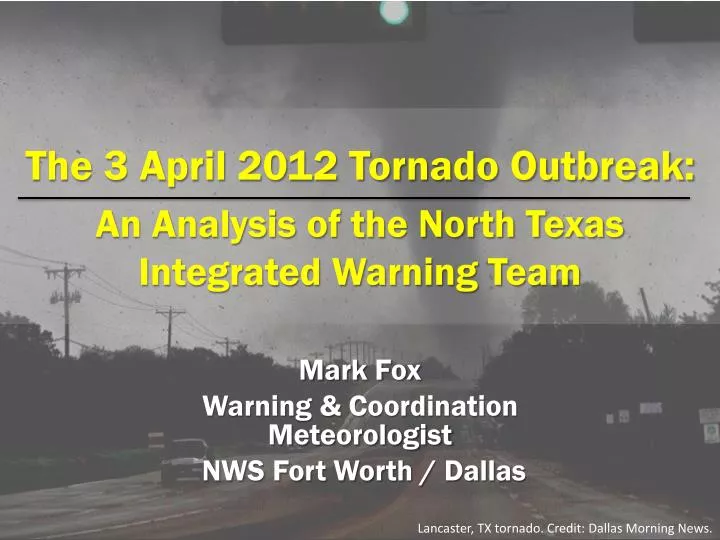
The 3 April 2012 Tornado Outbreak: An Analysis of the North Texas Integrated Warning Team. Mark Fox Warning & Coordination Meteorologist NWS Fort Worth / Dallas. Lancaster, TX tornado. Credit: Dallas Morning News. Outline. Public Response April 3 Overview Timeline Findings. Dallas.

E N D
The 3 April 2012 Tornado Outbreak:An Analysis of the North Texas Integrated Warning Team Mark Fox Warning & Coordination Meteorologist NWS Fort Worth / Dallas Lancaster, TX tornado. Credit: Dallas Morning News.
Outline • Public Response • April 3 Overview • Timeline • Findings
Dallas Fort Worth Forney Arlington Joshua 20 Tornadoes 1 EF – 3 2 EF – 2 0 Fatalities 29 injuries $ 800 Million in Damages
Why? • 4 significant tornadoes in a highly populated area • The Integrated Warning Team Saved Lives • Use this as an opportunity to find why and how • No Deaths!!!!! • No Assessment
Wish it was… More Like… • Around 1 in 4 people require confirmation • Just under half (47%) would take cover immediately
Public Response • 115 people across Dallas/Fort Worth Metroplex surveyed • 79 recalled events of 3 April 2012 • Random digit dial method • 50% land line numbers, 50% cell phone
High Traffic area. I-45 and I-20 intersection City center of Lancaster Dense residential and commercial Open farmland few homes I-35E
Kennedale & Arlington Dense residential area. US. 287 & I-20 Open farmland quickly gives way to residential
Subdivision quickly gives way to farmland City center of Forney
Spotters report increasing west of Forney Tornado Warning: Kaufman County (Forney) 3:25 PM Tornado Emergency: Dallas County (Lancaster)1:26 PM Tornado Emergency:Tarrant County (Arlington/Pantego) 1:26 PM Photo: Dallas Examiner Tractor trailer footage replayed 2:29 PM Tornado Warning: Johnson County (Joshua) 12:45 PM Tornado Emergency: Dallas County (Mesquite/Garland) 2:02 PM Tornado Emergency: Hunt County (Greenville) 4:27 PM 4:30 PM CDT 2:30 PM CDT 12:30 PM CDT 1:30 PM CDT 3:30 PM CDT Tornado Emergency: Dallas County (Lancaster) 1:17 PM Tornado Emergency: Dallas County (Lancaster) 1:34 PM Broadcast media relays reports of increasing tornado threat for Kaufman County (Forney) 3:27 PM Tornado Emergency: Dallas County (Lancaster) 1:34 PM Tornado confirmed in Forney (Kaufman County) 3:33 PM Photo: WFAA-TV Live footage of tractor trailers being damaged 1:33 PM Tractor trailer footage replayed 3:02 PM
Tornado Emergency – IWT Communications • Storm spotters and media coverage drive the decision to issue a tornado emergencyby the NWS • Tornado Emergency language used to raise awareness of the threat of a large, damaging tornado in a populated area • The use of “tornado emergency in text products is difficult to notice, chatting about it elicited a much faster response from local area media • Emergency were largely unaffected by “tornado emergency” language • Most important outcome: Everyone was delivering the same message at the same time… “this is a significant threat, and you need to take action now”
Search and Rescue 2:00 PM <nws-jason.dunn> with new line of storms moving into western Tarrant County, there will be a threat of frequent lightning and gusty winds. This may hamper search and rescue efforts in Tarrant County 2:03 PM Station 3 coverage: NWS states approaching line of storms will complicate search and rescue efforts 2:17 PM Station 3 coverage: The squall line will hamper search and rescue efforts 2:46 PM Station 1 coverage: Possible tornado in Arlington… may impact damage efforts 3:29 PM Station 3 coverage: NWS concerned about storms impacting search and rescue operations Photo: Tony Gutierrez, Associated Press
Forney Damage Reports 3:46 PM 3:41 PM 3:40 PM 3:39 PM 3:42 PM 3:44 PM 3:48 PM 3:47 PM 3:45 PM 3:38 PM 3:43 PM
Forney Damage Reports 3:46 PM 3:41 PM 3:40 PM 3:39 PM 3:42 PM 3:44 PM 3:48 PM 3:47 PM 3:45 PM 3:38 PM 3:43 PM • FWD continues Tornado Warning for Dallas, Kaufman, Rockwall [TX] till 4:00 PM CDT • Station 1 provides report of tornado in Forney • Station 2 concerned about a tornado in Forney • Station 3 identifies “debris cloud" seen on radar over Forney • Spotter reports tornado went through center of Forney • Station 4: "I don't think we have a tornado on the ground (near Forney), because we've had no confirmation in chat from the NWS at this time” • Forney PD/FD: Officer advises that there is a tornado down town • <nws-nick.hampshire> Tornado reported in Forney! • <media-national1> What county is FORNEY in? • <nws-nick.hampshire> Kaufman
Forney Damage Reports 3:46 PM 3:41 PM 3:40 PM 3:39 PM 3:42 PM 3:44 PM 3:48 PM 3:47 PM 3:45 PM 3:38 PM 3:43 PM • Station 1 spotter shows video of "well-defined stovepipe tornado" in Forney • Says Forney High School has been hit • Meteorologist reports Forney is a tornado emergency • Station 2 shows text on screen: “Tornado on ground in Forney” • Schools are in tornado’s path • Station 3 reports tornado north of Forney doing damage • Station 4 asks for chat updates • Meteorologist says NWS is becoming very concerned about a tornado in Forney • Forney PD/FD: Officer advises that there is a lot of tree damage • Forney PD/FD: Tornado over Fire Station at Elm and 80
Forney Damage Reports 3:46 PM 3:41 PM 3:40 PM 3:39 PM 3:42 PM 3:44 PM 3:48 PM 3:47 PM 3:45 PM 3:38 PM 3:43 PM • Local Storm Report: Tornado on ground just west of Wal Mart in Forney • Station 3 Coverage: Debris ball has gotten bigger; funnel getting larger- “fairly good size”
Forney Damage Reports 3:46 PM 3:41 PM 3:40 PM 3:39 PM 3:42 PM 3:44 PM 3:48 PM 3:47 PM 3:45 PM 3:38 PM 3:43 PM • NWS updates Rockwall EM on Forney tornado • Station 3 Coverage: Spotter confirms power flashes, tornado is still on ground • Forney PD/FD: Officer advises Ridgecrest on the ground • <ham-spotter1> cone tor near forney stand by for more.. i have visual
Forney Damage Reports 3:46 PM 3:41 PM 3:40 PM 3:39 PM 3:42 PM 3:44 PM 3:48 PM 3:47 PM 3:45 PM 3:38 PM 3:43 PM • Station 1 spotter corrects himself, tornado "hasn't hit high school yet", but “is going to” • Station 2 covers debris in the Forney area. • Station 4 reports of a confirmed tornado in Forney • <nwsbot> FWD: Unverified/Non-NWS Report -- Large cone tornado 5 to SWof Forney • Forney PD/FD: Tornado still in the Diamond Creek area
Forney Damage Reports 3:46 PM 3:41 PM 3:40 PM 3:39 PM 3:42 PM 3:44 PM 3:48 PM 3:47 PM 3:45 PM 3:38 PM 3:43 PM • FWD continues Tornado Warning for Kaufman, Rockwall [TX] till 4:00 PM CDT • Forney PD/FD: County EMC notified of tornado down and damage • Station 1 reports Forney High School has not been hit, storm appears to be moving farther north • Station 2 reports damage at Forney HS per spotter • Station 3 covers "tornado on the ground near Forney“ • Station 4 spotter on FM 548 says he is viewing a tornado near Forney High School • <media-Station1> Chaser on 548, tornado near Forney High School • <nws-nick.hampshire> Thanks Station 1 • Forney PD/FD: Heading toward Crosby Elementary
Forney Damage Reports 3:46 PM 3:41 PM 3:40 PM 3:39 PM 3:42 PM 3:44 PM 3:48 PM 3:47 PM 3:45 PM 3:38 PM 3:43 PM • Station 3 Coverage: spotter reports tornado went through Diamond Creek subdivision; new wall cloud… storm may be cycling • Forney PD/FD: Officer asks to call in everyone off duty • Forney PD/FD: Officer advises Major Damage
Forney Damage Reports 3:46 PM 3:41 PM 3:40 PM 3:39 PM 3:42 PM 3:44 PM 3:48 PM 3:47 PM 3:45 PM 3:38 PM 3:43 PM • Station 1 reports Crosby Elementary has been hit (Diamond Creek subdivision) • Station 2 states damage is near FHS, but does not have confirmation • Station 3 spotter states tornado did roof damage to Crosby Elementary • <ham-Spotter1> TOR has lifted ATTM • <nws-nick.hampshire> Thanks • Forney PD/FD: Injured Baby • Forney PD/FD: Officer advises that N. Elm & Dalbac building & trees across Elm and minor damage to house on Elm
Forney Damage Reports 3:46 PM 3:41 PM 3:40 PM 3:39 PM 3:42 PM 3:44 PM 3:48 PM 3:47 PM 3:45 PM 3:38 PM 3:43 PM • Station 3 spotter reports cars overturned at Crosby Elementary • <nws-nick.hampshire> Do we have confirmation the high school was hit/ • <nws-nick.hampshire> ? • Forney PD/FD: Terrell FD has been notified to respond on mutual aid • Forney PD/FD: Officer checking on Crosby Elementary • Forney PD/FD: Damage reports continue to come in and logged
Forney Damage Reports 3:46 PM 3:41 PM 3:40 PM 3:39 PM 3:42 PM 3:44 PM 3:48 PM 3:47 PM 3:45 PM 3:38 PM 3:43 PM • Station 2 talking about storm, mentions the storm that did hit Forney, and did hit FHS. • Station 4 shows live spotter video of tornado damage in a subdivision in Forney • <media-Station1> Storm Chaser reports Crosby Elementry in Forney hit • <nws-nick.hampshire> Your spotter? any damage?
Forney Damage Reports 3:46 PM 3:41 PM 3:40 PM 3:39 PM 3:42 PM 3:44 PM 3:48 PM 3:47 PM 3:45 PM 3:38 PM 3:43 PM • Station 2 states off camera Crosby elementary school reportedly hit • Station 3 has no new reports from NWSChat(Station 3 believes NWS is watching their coverage)… tornado actively moving northward • <media-national2> high school or elementary? • <nws-nick.hampshire> Going to extend the tornado warning from Kaufamn/Rockwall into Collin/Hunt. • <media-Station1> Damage homes seen live on TV in Forney • <media-Station1> elementary
Information Needs - Media • Have access to radar data and usually their own storm spotters (in DFW market) • Rely on FREQUENT chat updates from the NWS regarding: • Warning decision updates • Spotter reports that come into NWS • Radar observations (what is the most dangerous storm or part of the storm now) • Short term forecast updates (expected changes in storm behavior, hazards • Why? • Broadcast meteorologists are on the air constantly, they need the latest information to avoid repetition • If the NWS can be relied upon to provide useful, frequent updates, it gives the NWS a chance to influence which storms are being covered by the media and when… consistency of message!
Information Needs – Emergency Managers • Have access to radar data and usually their own storm spotters • Primarily concerned about IMPACTS of hazardous weather in their individual jurisdiction • What is the worst case scenario? • If damage has occurred, could additional storms/weather hamper response efforts?
Information Needs – NWS • Have access to radar data and other real-time remote sensing technologies • Needs ground truth reports to issue effective warnings: • Can monitor local media visually, but too much noise for audio monitoring during a severe weather event • Amateur radio operators communicate with organized county spotter groups • Direct contact with city and county officials
Best Practices by the NWS 1. Maintaining a consistent, reliable presence in chat drives a consistent warning message.
Findings • Zero Deaths • Good Warnings • Daytime • Video • Integrated Warning Team Worked • One Voice to all* • Multiple jurisdictions saying the same thing • NWSChat • Glue that held it all together • FWD Watched Media…but can’t hear media
Mark Fox NWS Fort Worth / Dallas mark.fox@noaa.gov 817.831.1157 x 223 Thanks